Category Archives: Background

Pikaboost and Camera Reviews

Many, many people have asked me in person or via messages over the past few weeks when I will be posting my Pikaboost eBike and Dekco Security Camera (used as a trail cam) Reviews. The answer is soon.

In terms of Dekco, my cameras arrived a few days ago. My evaluation starts in earnest when I get home from a family wedding tomorrow. I had become dissatisfied with trailcams for monitoring what was visiting my feeders. Cold outdoor temperatures in the Northwoods (my home area) meant I was constantly changing out batteries. When I altered my searches from trailcams to security cameras I was able to find products that run off standard electrical cords, and connected to my home wifi while being outdoor resilient.


In terms of PikaBoost, I am a Kickstarter Booster of the simple eBike conversion kit project. My conversion kit should arrive in October, and assuming the snows don’t come too early this fall, I will perform my evaluation in November.

Planning Your Migration Birding: BirdCast and HaikuBox

The southern migration has started. The bug eating birds are exiting the Northwoods. No matter where you live in North America, it is possible to discover / learn what to expect in terms of the migration. For my purposes I am focusing upon northern Minnesota which equates to the Duluth area and St. Louis County. However, you can use the same approach for wherever you call home or are located.

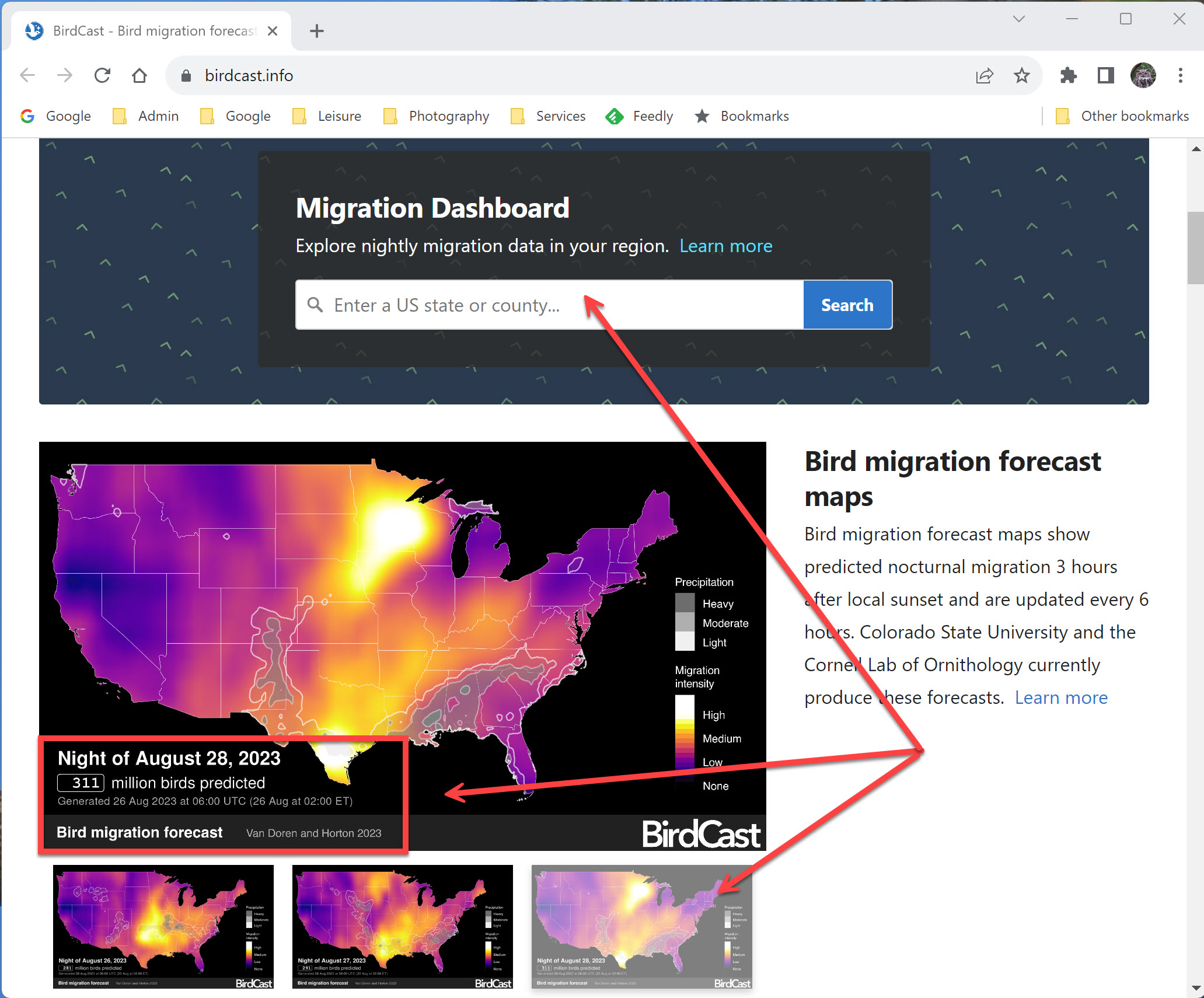
BirdCast: Use this tool from the Cornell School of Ornithology (and others) on your computer or mobile device to learn what is happening in terms of migration over the next few days. Remember, a wind pushing birds in their desired direction, just like a tailwind on a bicycle, means more birds will be moving. We all like to use less energy to move the same distance. See my full review of BirdCast with annotated screenshots.

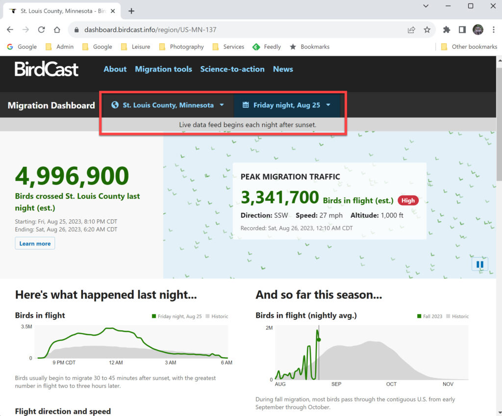
Here are two screenshots from BirdCast taken this Saturday morning, August 26th for the migration that occurred last night, and for two days hence when the winds will once again be out of the North for Duluth … located in St. Louis County, Minnesota.


I also mention HaikuBox may be used to figure out what is migrating. Read my full review of HaikuBox, but remember this small box identifies the birds singing in your yard in real time and saves that data. As I mentioned in my full review, anyone may obtain a free HaikuBox account for use on a computer or mobile device and view the data from public HaikuBoxes across the United States and Canada. (Link to my own HaikuBox Data Stream)

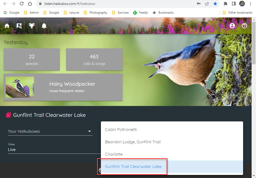
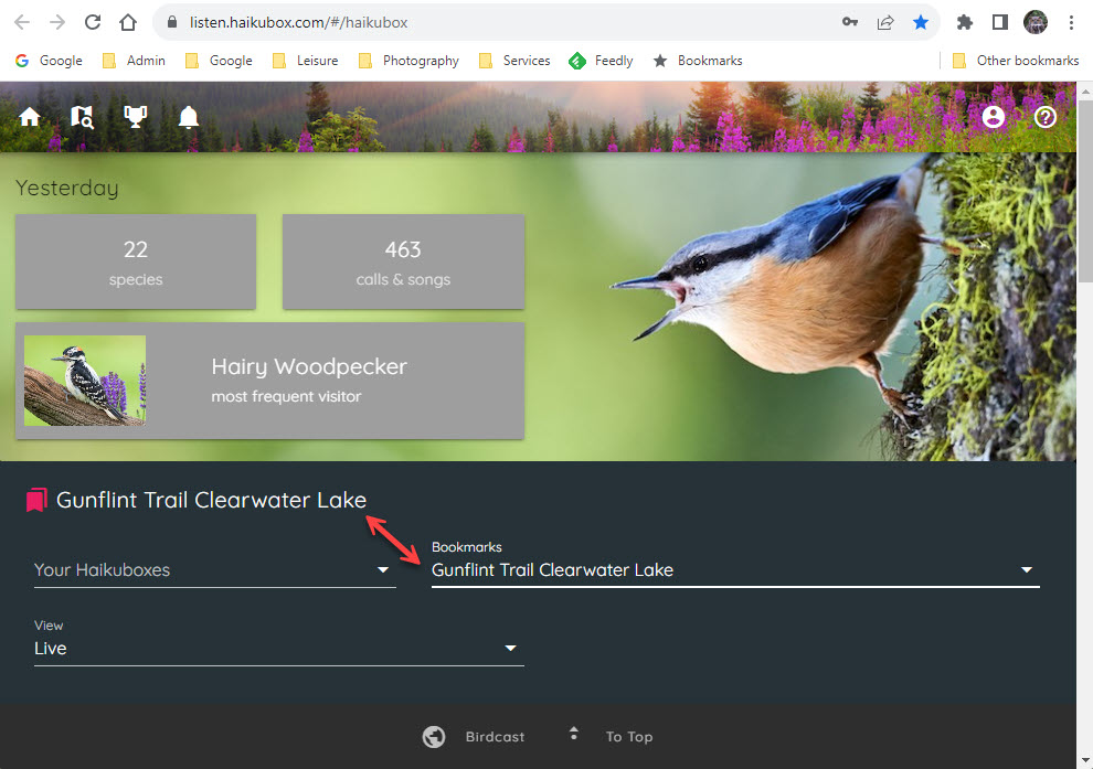
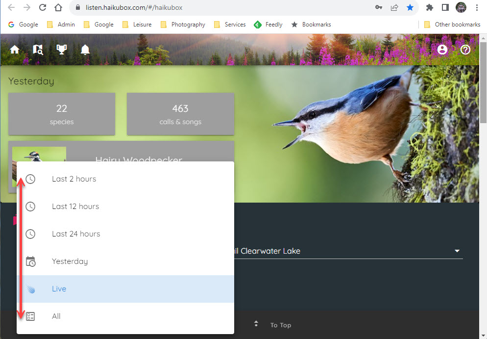
The way to use HaikuBox for migration information is easy. Use the map on their website (Listen.Haikubox.Com) and pick Haikuboxes north of your own location and bookmark them. At any time, you may then visit those Haikuboxes and discover what ACTUAL birds are visiting the geographic locations in question.

Thus, I have chosen and bookmarked for my purposes and account four Haikuboxes … one in Grand Marais, Minnesota … two on the Gunflint Trail … and one box on Lake Winnipeg.

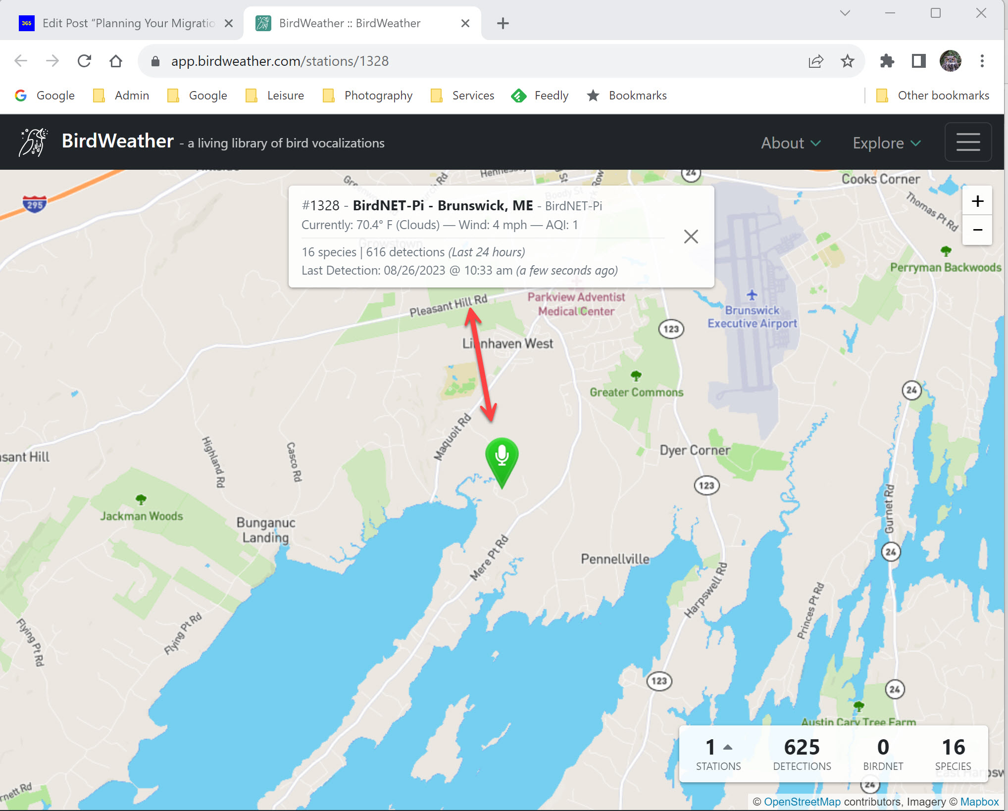
A Screenshot of the HaikuBox Map for my Region


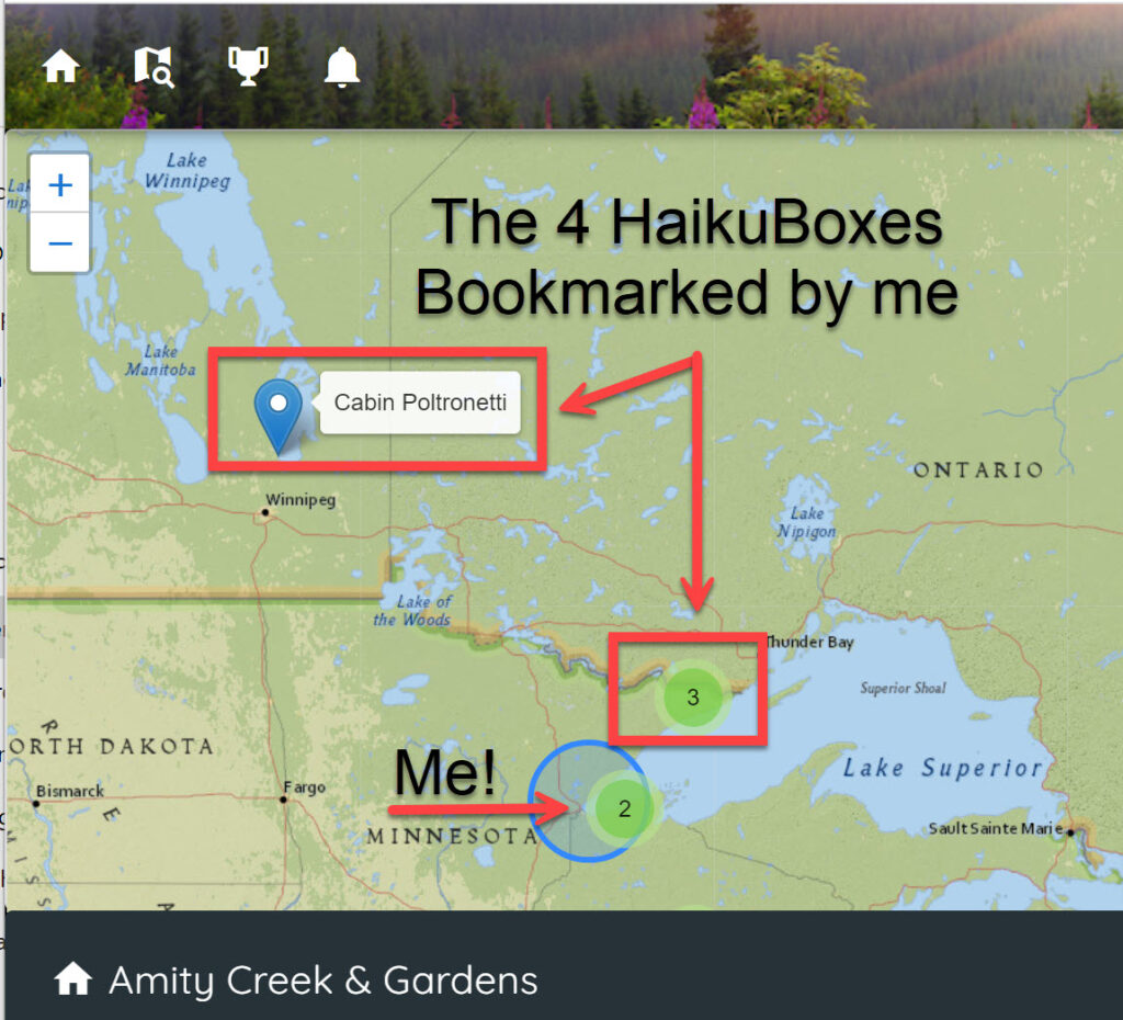
Using one’s free Haikubox Account … on a PC or Mobile Device … check what’s happening for a given period


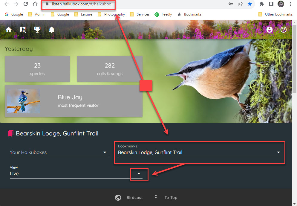
One final item in closing out this post. In my full review I talk about how I had purchased my own HaikuBox. However, a college classmate of mine, Jim Ancona, who is also a techie and a retired software engineer built the equivalent of his own Haikubox … a Do It Yourself (DIY) project. The cost is less that what I spent, and the result is similar! Read how Jim built his own bird listening device:

Here is a screenshot from Jim’s area and his Birdsong Device.


Finally a special callout to another one of my buddies, and I am throwing the gauntlet down. Paul with your amazing Wood Duck Drop monitoring tech, I totally expect you to follow in Jim’s footsteps!

Tracking the Sun for Your Bird Outing: SunCalc

I am enjoying a morning at home, as the rains finally arrived overnight and the weather is ugly outside, but such was not the case yesterday. The day dawned crystal clear and with the first hint of autumn. It was 39F on Admiral Road in Sax-Zim Bog at 6 am, and did not rise to 40F till after 7 am. I had an excellent morning, and enjoyed my route.

One very important aspect of any birding outing (or even just a longer hike in a local park) is knowing in advance where the sun will be located relative to your current or planned position. If you are visiting a new area, and slowly driving down a remote dirt road scanning for birds, if that road ends up tracking into the morning sun, your birding success will be poor. It is no fun on a birding hike or slow drive in your car to be staring directly into the sun. It makes it darn hard to see anything.

While I use an advanced app on my phone and tablet called PlanIt for Photographers, which allows me to not only know the sun’s and moon’s location on any given day (and time), or additional items like planning milky way photographs for a given time of night and learning where truly dark night time skies are located (and much more) … for most people an app of this nature is overkill. Thus in this post I am reviewing a free service you may use on computer (not phone) that easily allows you to plan your own outings, and is free! The service is named SunCalc.Org.

SunCalc allows the user to accomplish the basics, but arguably the most important task … where will the sun be located relative to a given (or expected) location at some time in the future.

SunCalc.Org (basic or entry screen upon loading web page)

The Red Arrows and White Numbering & Text are my Annotations!


Map Layers


Zoom In and Out & Location


Time of Day Slider


Select Date


Selected Menu Options


Once again, SunCalc provides only the basics, but it does a good job and has an easy to learn interface. Happy birding.