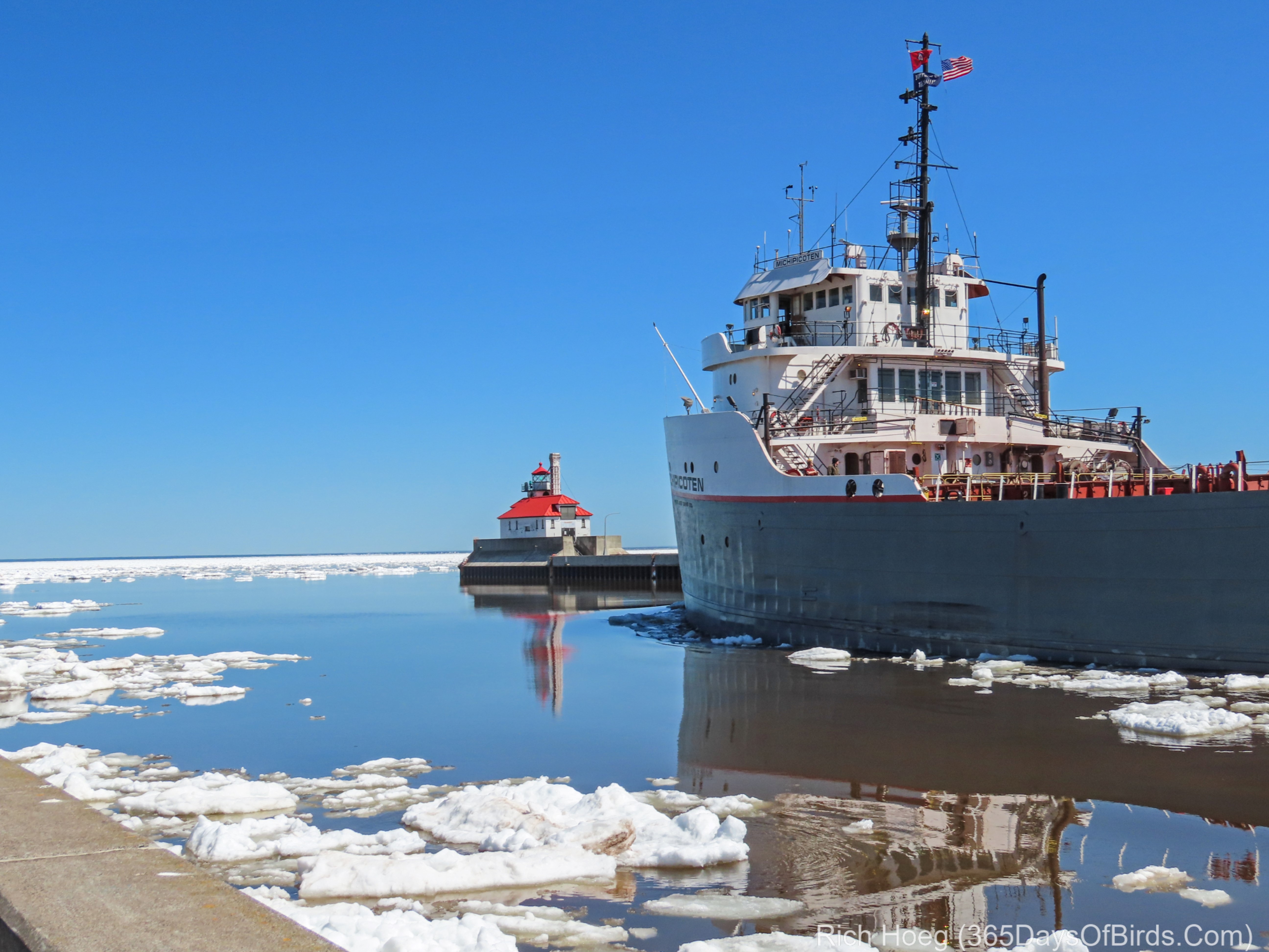
By good fortune I happened to catch the Michipicoten steaming out into the Lake Superior Ice Fields this Easter Weekend 2019. Hopefully it did not hit an iceberg after dark! 🙂
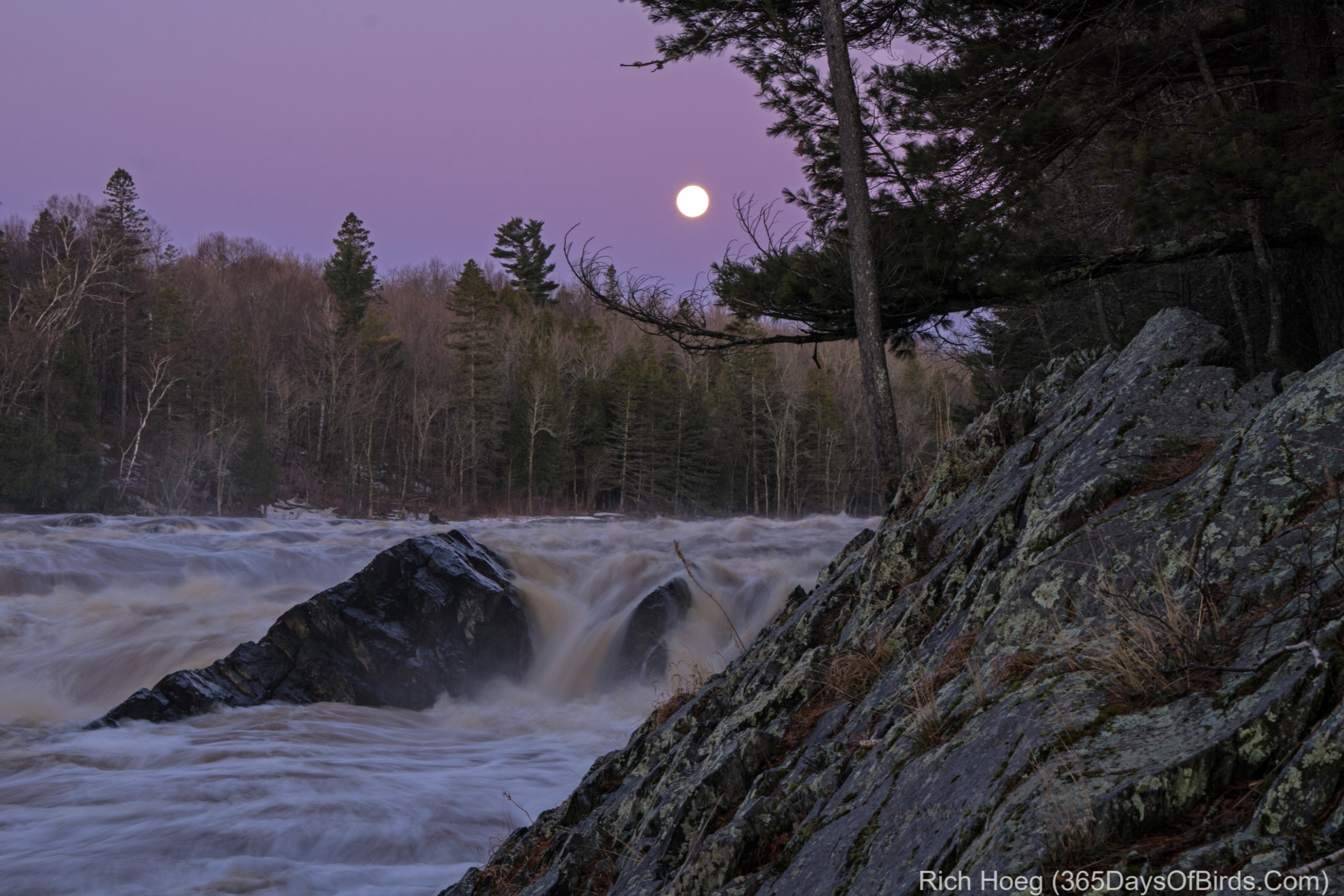
The day had actually started before 5 am yesterday when I drove over to Jay Cooke Park for a pre-dawn hike under the setting full moon. The St. Louis River rapids at the Swinging Bridge were in full force. After watching the moonset I headed over to some nearby wetlands for my first local birding of the Spring. The results were fantastic … pictures coming soon but family Easter celebrations come first. Happy Easter and Passover!
Molly and I are back in Minnesota. My hope was to go birding this morning and explore local haunts, but Mother Nature thought differently. After five weeks in the dry Texas Hill Country and then the Desert Southwest, it is pouring in Minnesota. It’s kind of nice to see rain, but taking a birding hike is out of the question.
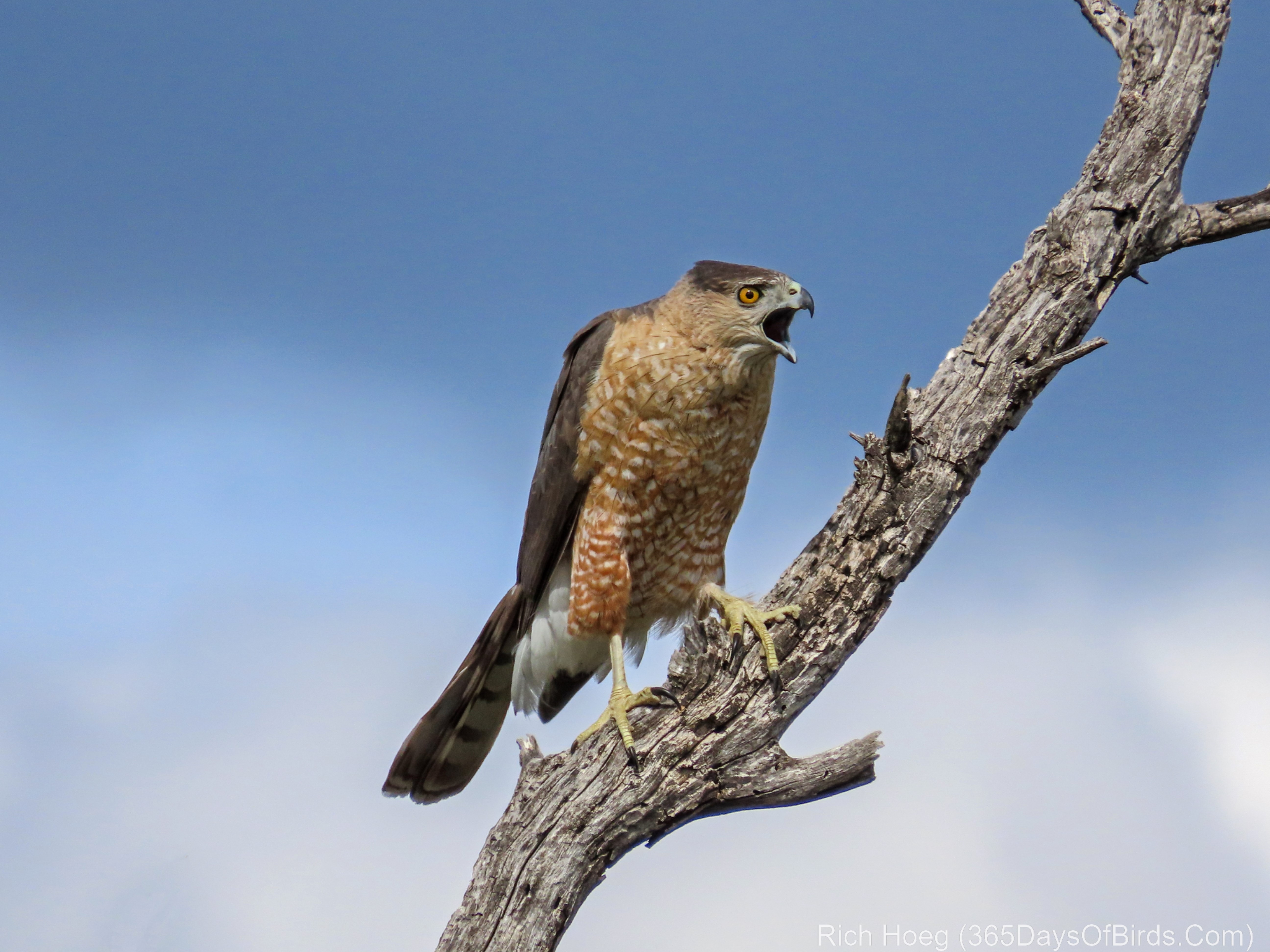
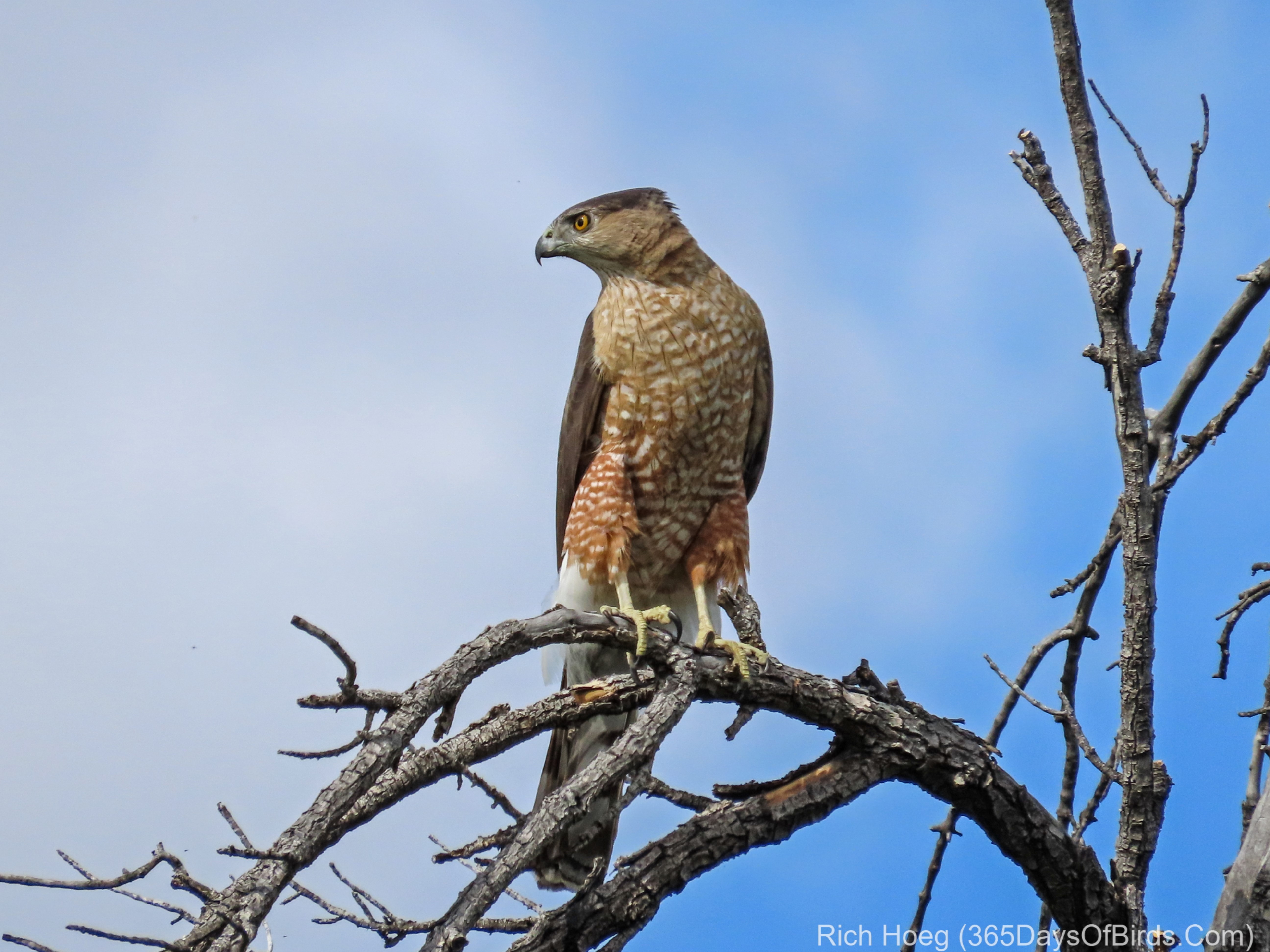
For my own benefit as much as anyone’s, here are my final images from Tucson. This Coopers Hawk is lucky to be alive and proves love is dangerous. While hiking and visiting the area in Catalina State Park where my Barn Owl would hang out, I discovered three Coopers Hawks having a disagreement over a nesting site. Both guys were trying to impress the lady. Note to self: when presented with a great opportunity, a Barn Owl will strike during the middle of the afternoon. Said owl suddenly appeared out of nowhere (at least it seemed to me) and struck at this Coopers Hawk. The hawk escaped by a matter of inches.
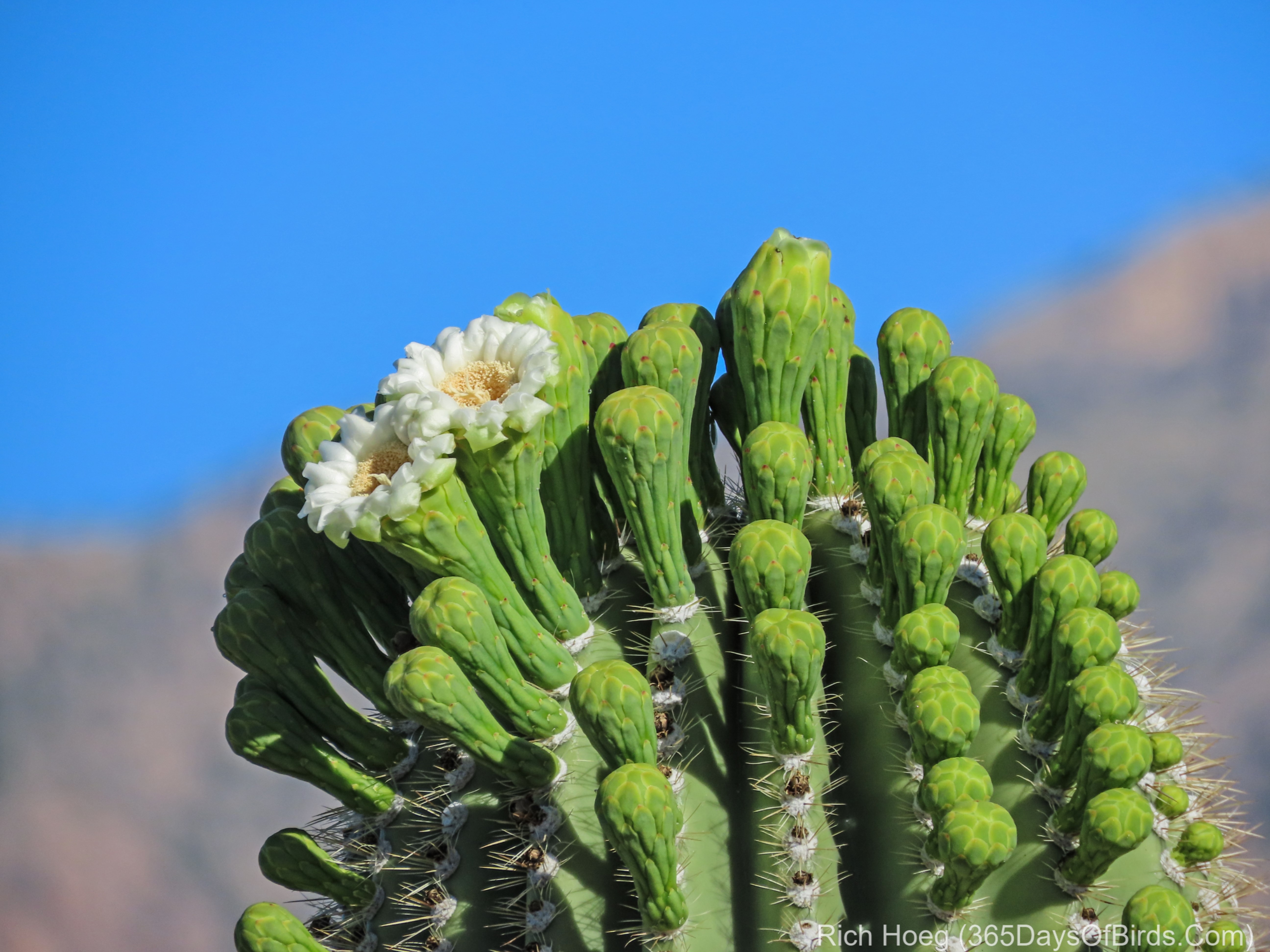
For my final southwest post, here is another blooming Saguaro Cactus! If you ever get the opportunity to visit the desert southwest, a trip in late March or early April will often yield a desert in bloom!
One final comment, my favorite English teacher at Phillips Exeter Academy might not approve of my blogging style. I often capitalize the names of birds and other items which are not proper nouns. I understanding I am breaking grammar rules, but it helps the name stand out better in the blog text. This is not an apology … just an explanation! In addition the use of dot, dot, dot as in “…” is also not proper punctuation … sorry Professor Heath!
Long time readers know I hate interstate highways. These boring roads prevent one from seeing America. Yesterday my policy of driving the backroads of our country paid off in spades, but first you need to know the back story …
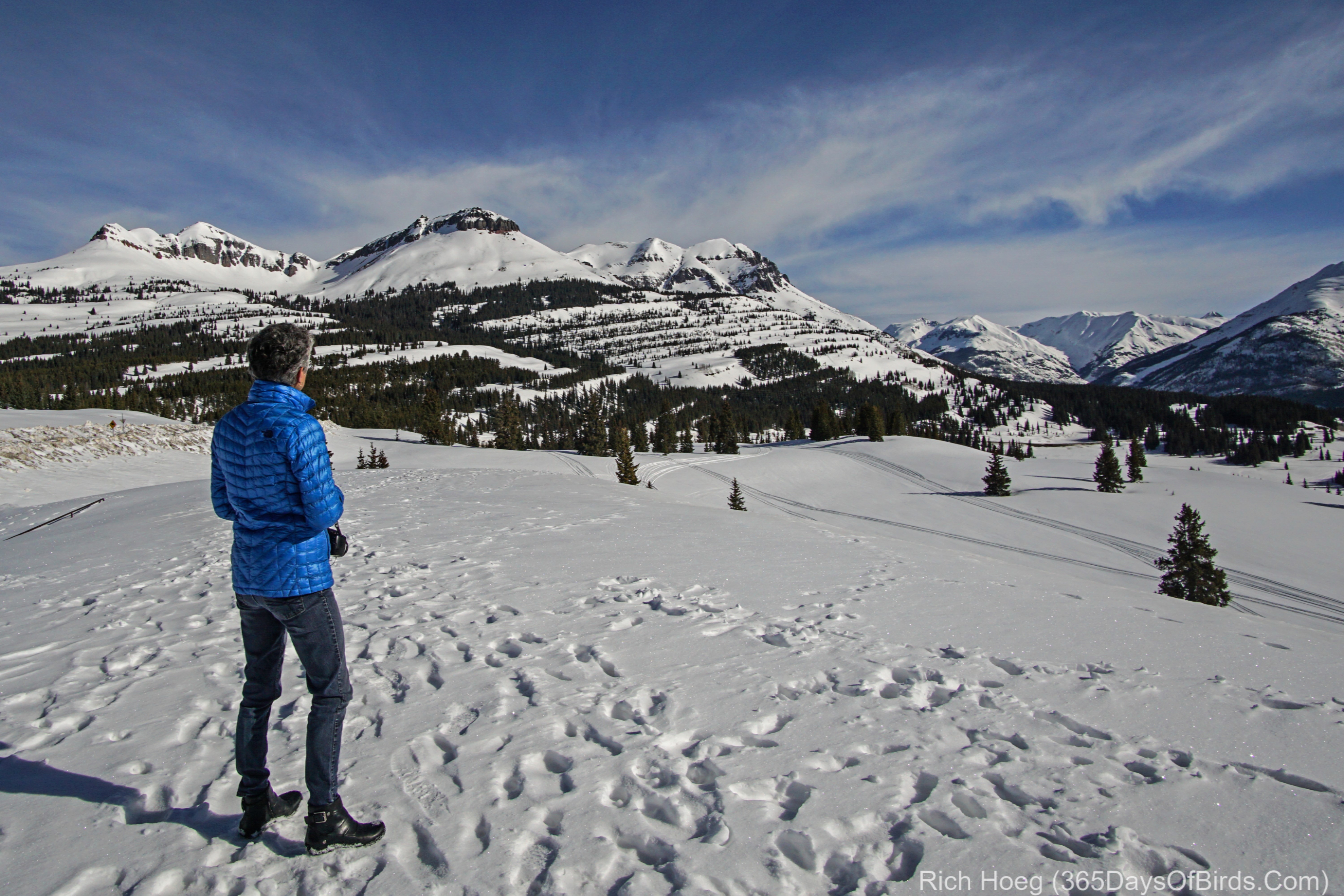
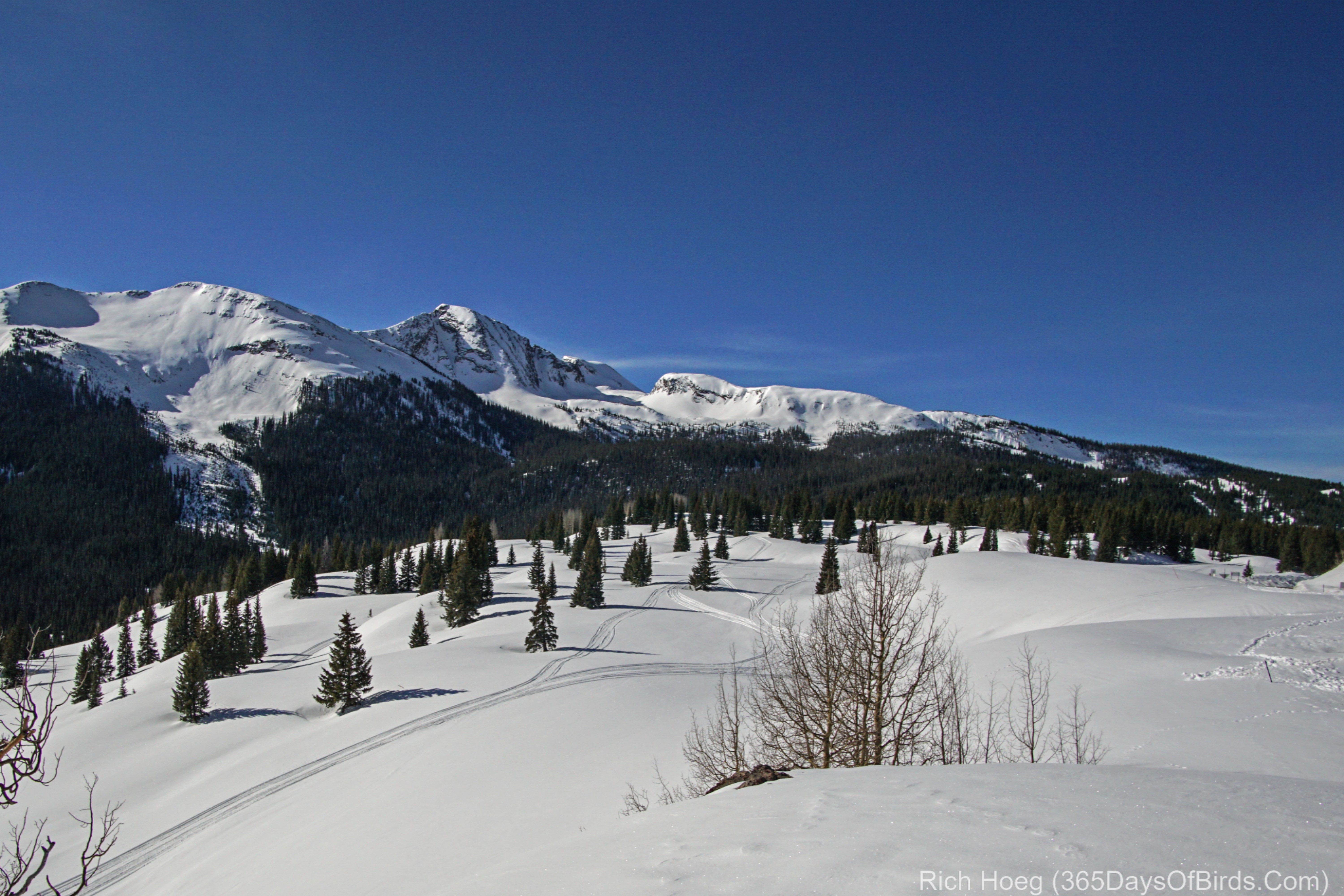
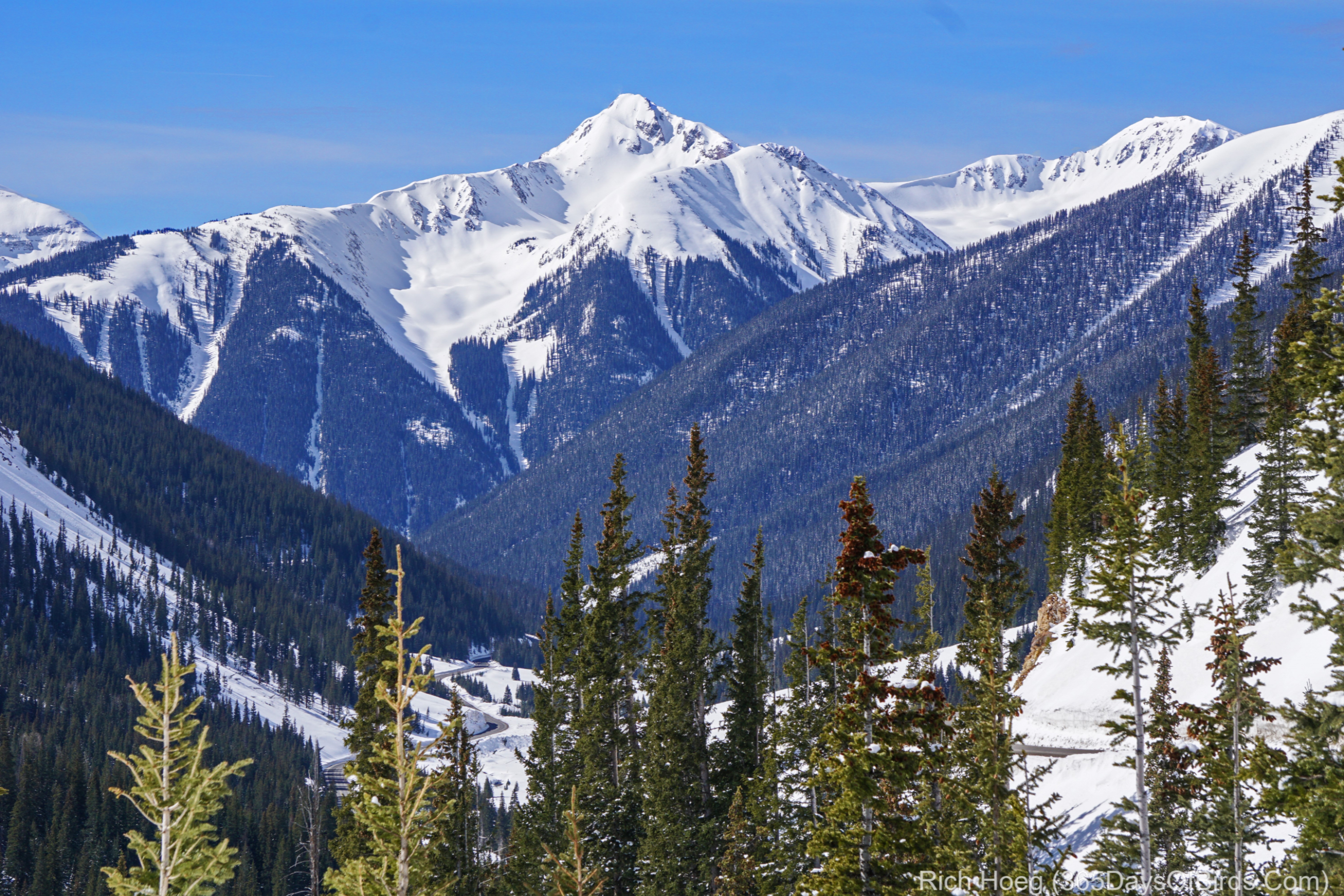
Two years ago while driving home from the Grand Canyon to northern Minnesota, I decided to cut through the mountains from Arizona to SW Colorado. I had no idea what the scenery was like, and advance research had not yielded any “must sees”. By chance we ended up in Durango, Colorado and that is how this story begins. In Durango we learned of the Million Dollar Highway. On our first trip we only were able to drive a small portion of the road, and then vowed we would be back. Yesterday we fulfilled that promise.
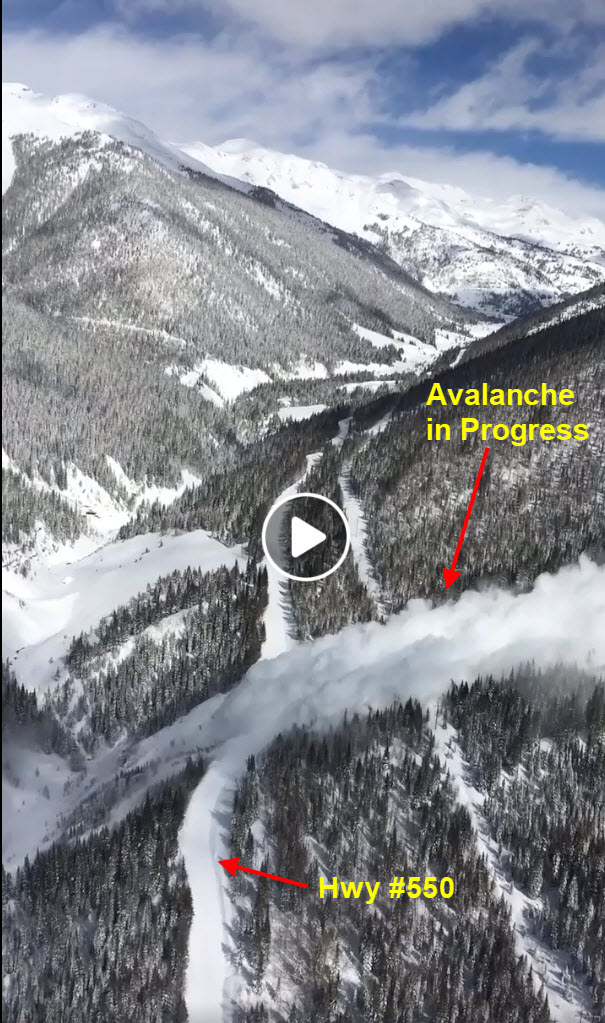
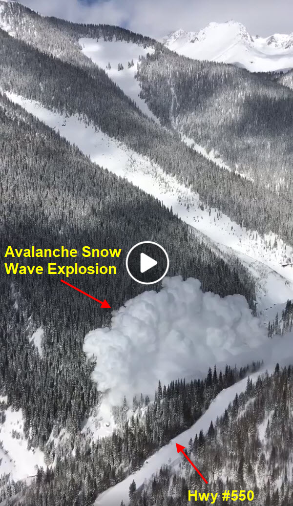
The Million Dollar Highway (US Hwy #550) takes one up and over the summit of Red Mountain, but in-between there are enough hairpin turns and exhilarating downhills to last a life time. The Million Dollar name comes from the time period when the road was built. Huge money was spent getting a road through the mountains. During our stay in Tucson we kept monitoring the weather in Durango, hoping we would get a clear sun / low wind forecast. We struck pay dirt! Arriving in Durango we learned from our waiter at dinner that we were very lucky. A huge avalanche had closed the road four weeks earlier, and only a few days prior after 20 days of clean-up had the Colorado Department of Transportation (CODOT) been able to clear all the snow, broken trees and boulders from the highway. Apparently somewhat down the mountain this winter there had been over 350 inches of snow, but more on the summit. Spring melt means avalanches. During our drive on the highway we often passed CODOT trucks which were monitoring current avalanche conditions. Hwy #550 had many gates which could have been closed to prevent access. Thankfully all traffic was were allowed to proceed!!!
Here are two video screenshots courtesy of the Arizona Department of Transportation (annotations are mine). This is the highway we drove and was closed for 20 days resulting from the numerous avalanches.
Follow this link to watch a video taken by CODOT. The passenger in the heleocopter actually captured the two biggest avalanches on video … the second triggered by the first. The most amazing footage starts at the video’s 1 minute mark. Maximize the video for the best effect!
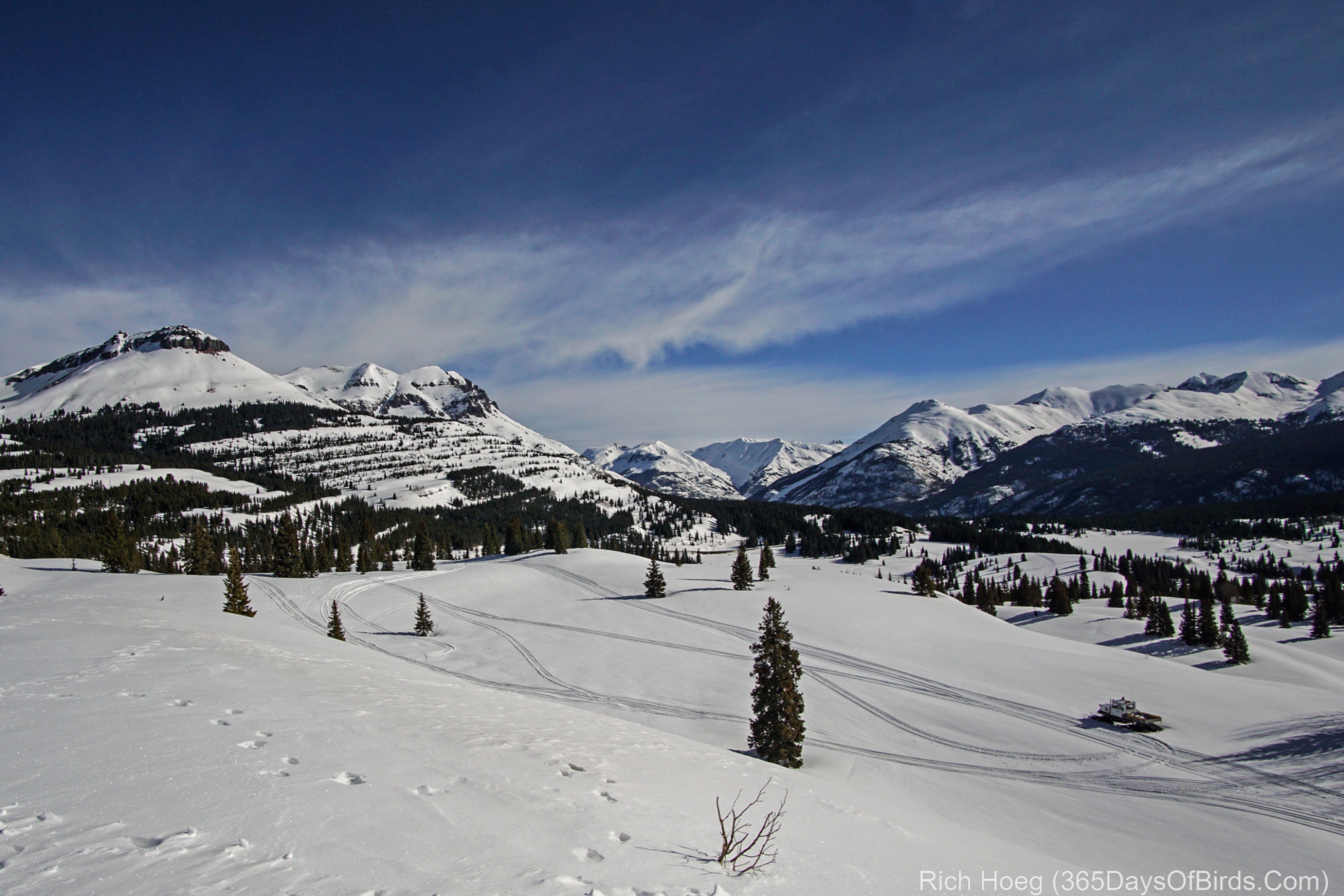
My pictures and video from atop one of the mountain passes. The three images combine to show the vista we could see from the mountain pass. In the video I scan the same in real time.
Looking back at Red Mountain … site of the huge avalanches (and a video of our descent into the canyon)