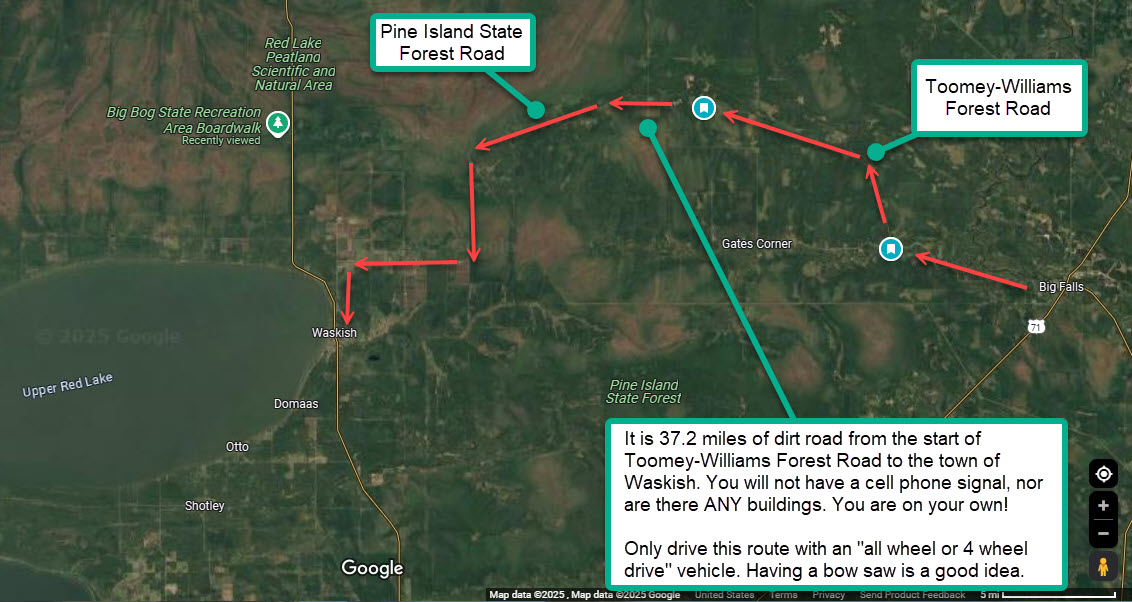
This post documents one of my favorite wilderness tours … from the town of Big Falls, Minnesota (a bit south of International Falls & the Canadian Border) to the town of Waskish, Minnesota (on the shores of Upper Red Lake). Your route will take you through amazing wilderness, and your drive will be on dirt roads for 37.2 miles from the start of Toomey-Williams Forest Road to Waskish.
Please note eBird spells Toomey-Williams in this manner … “Twomey-Williams Forest Road.” I am using the Google Maps spelling. You will find other spellings, even on the sign as you turn onto this forest road.
I have 8 videos which document this route. The videos were taken on the final day of June 2025. The route takes you along Toomey-Williams Forest Road, Pine Island State Forest Road (past Fiero Truck Trail) and finally to Waskish Road. Most of the habitat is boreal forest and bog. Immediately next to Toomey Williams Forest Road there will be lots of bogs, and there is a huge stretch of bog about seven miles past the intersection of Pine Island State Forest Road and the Fiero Truck Trail. Your drive will end driving through rice farms as you approach Waskish. The topography is very flat … thus the bogs.
I have a small Northwoods cabin on North Star Lake near Marcell which gives me easy access to this region. For everyone else, there is a humble, but clean motel named the TimberWolf Inn just north of Marcell (has a restaurant) which would give anyone easy access to the Pine Island State Forest.
This post assumes you will be driving this route in the early morning, and thus will have the sun behind you for most of your birding expedition (easier to see and find birds / wildlife). Upon reaching Waskish you will find gas stations in both Waskish and Kelliher (sixteen miles to the south). If you are returning to the Marcell area (Timberwolf Inn) use Google Maps, and you will be routed back with your first turn taking place off Mn #72 at Kelliher. I do NOT suggest doing this wilderness route in reverse unless you wait till well into the afternoon and get the sun behind you.
Pay attention to these warnings!
- You will not have cell phone coverage
- The road can be soft. Only drive this route with an “all wheel or 4 wheel drive” vehicle. After heavy rains the roads may be difficult driving for any vehicle.
- There is no civilization … no buildings … no cabins … no help if you break down or get stuck (no cell phone coverage over most of the route). I carry a bow saw in my car to cut through trees that may have fallen across the road.
- This route is not plowed in the winter
- The bogs and forest are fantastic. Wildlife abounds!
A basic map of the route … click to expand
Here are interesting links and web content: (click or press upon to maximize images)
- My blog posts for this region (extensive)
- GPS Waypoints (Google Maps)

- End Toomey-Williams … Turn Right onto Pine Island State Forest Road
- Pine Island State Forest Road / Fiero Truck Trail Intersection

- End at Waskish, Minnesota
- eBird Reports for Toomey-Williams Forest Road
- There are a number of different spellings for Toomey Williams
- I am using the Google Maps web spelling
- eBird uses this spelling: Twomey-Williams Forest Road
- Just north of Waskish … great birding spots during fall migration
- Shoreline Drive NE (5.1 miles north of Waskish … do NOT drive past Upper Red Lake public boat launch … the start of Blanchard Trail NE)
- Big Bog State Recreation Area Boardwalk (10.1 miles north of Waskish)
Videos of your drive … 8 parts (direct video links for email subscribers)
- Part 1 (South of Big Falls on Mn Hwy 6)
- Part 2 (Entrance to Toomey-Williams Forest Road)
- Part 3 (On Toomey-Williams Forest Road)
- Part 4 (Bogs and forest on Pine Island State Forest Road)
- Part 5 (Deciduous forest on Pine Island State Forest Road
- Part 6 (Leaving the Boreal Forest and entering Farmland)
- Part 7 (Rice farms about 5 miles before Waskish Road)
- Part 8 (Turning onto Waskish Road … 2 miles out of town)
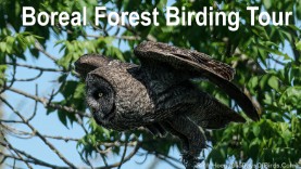
Mn Boreal Forest Birding Tour – Pine Island State Forest
Part 1: South of Big Falls on Mn Hwy 6
Part 2: Entrance to Toomey-Williams Forest Road (Twomey-Williams Forest Road)
Part 3: On Toomey-Williams Forest Road (Twomey-Williams Forest Road)
Part 4: Bogs and forest on Pine Island State Forest Road
Part 5: Deciduous forest on Pine Island State Forest Road
Part 6: Leaving the Boreal Forest and entering Farmland
Part 7: Rice farms about 5 miles before Waskish Road
Part 8: Turning onto Waskish Road … 2 miles out of town
Post last updated on July 4, 2025. I may choose to expand this post in the future.
Discover more from 365 Days of Birds
Subscribe to get the latest posts sent to your email.