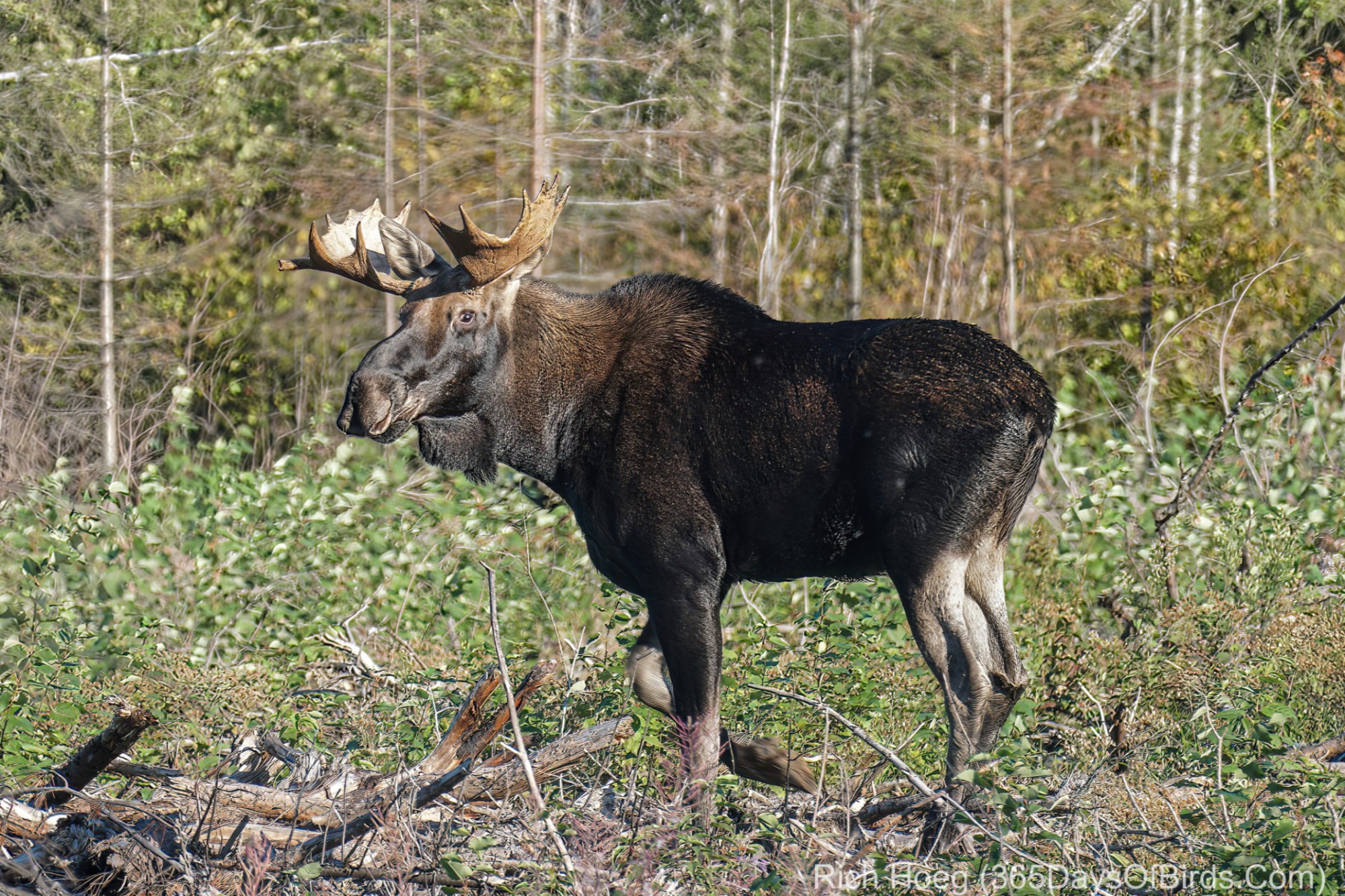
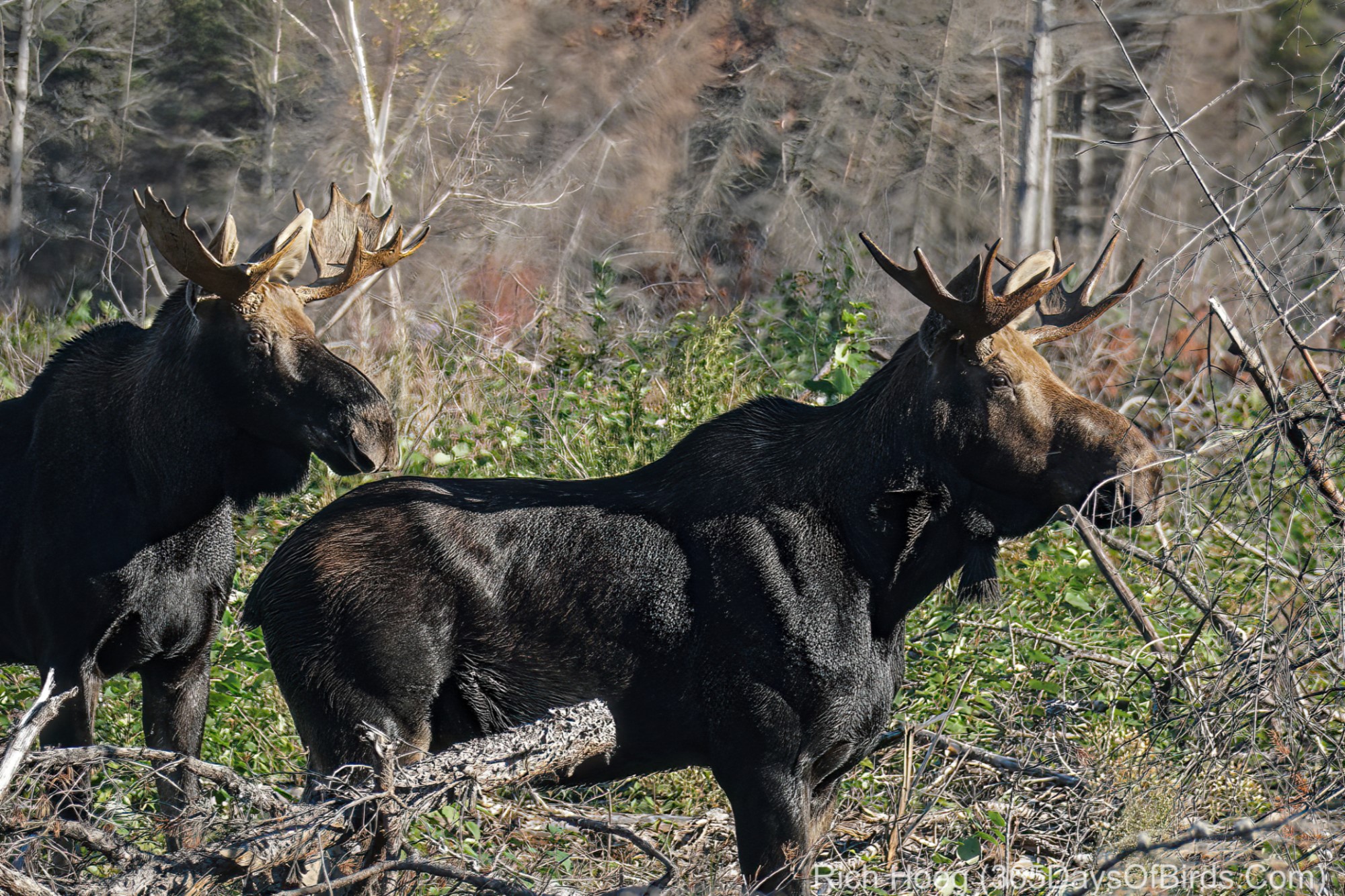
Bull Moose Times 2! While forest fires are tragic, a fire brings rebirth to the forest. These two bull moose were enjoying fresh greens this morning in the Greenwood Forest Fire Burn Area, or were they looking for Lady Moose?! We men … eat first and then love, or vice versa?! LOL! (as a fyi … late September through October are when Moose are interested in love)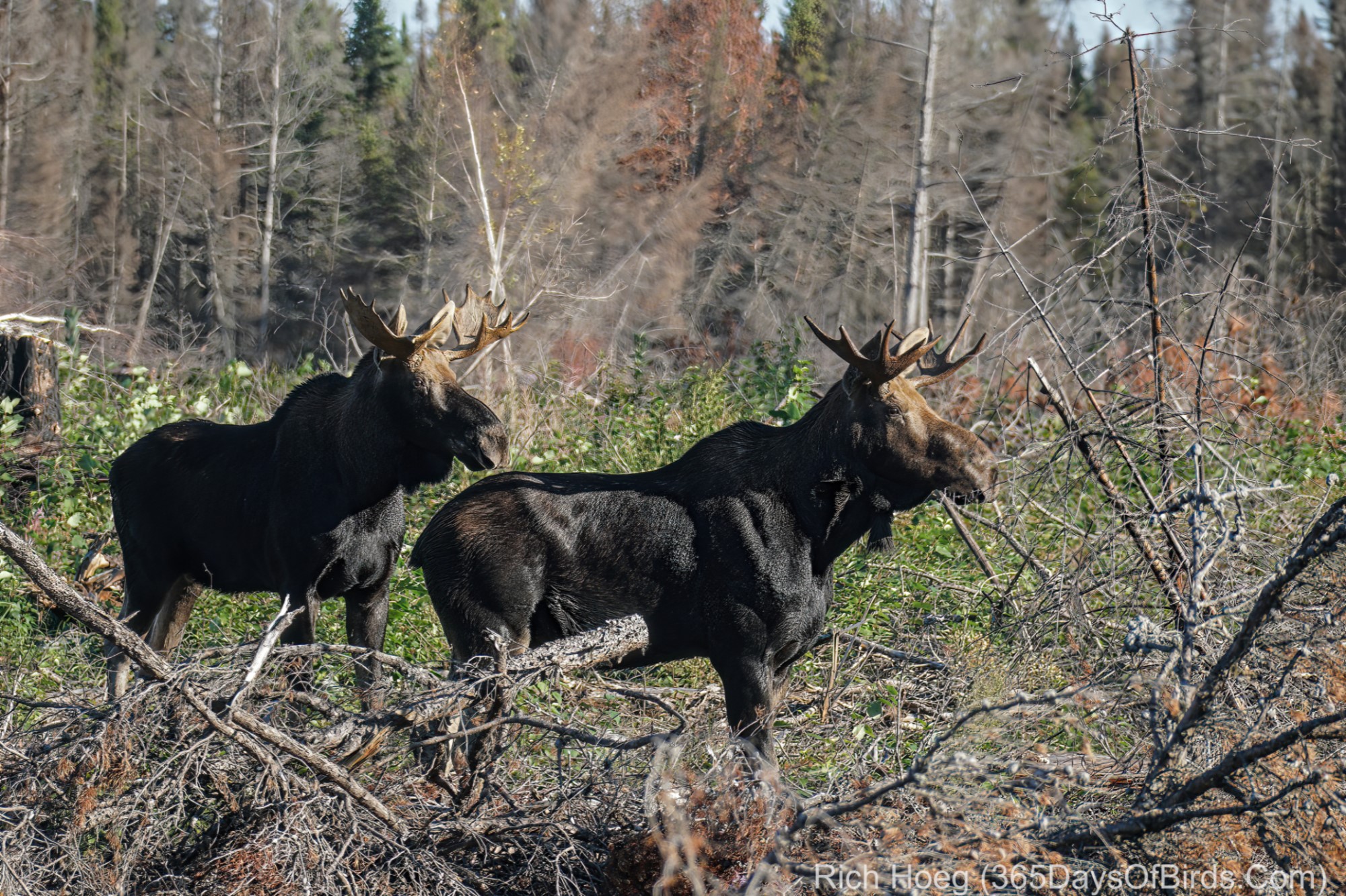
Tag Archives: MN North: Greenwood Forest Fire Area
Stony River Forest Road – Spruce Grouse
I wanted to bird Stony River Forest Road this morning north of Two Harbors. I had not been on the road since last Fall’s Greenwood Forest Fire. While the fire never reached Stony River Forest Road, it got mighty close and most of the route was used as a fire block. Given the land cleared for the fire block, it is now rare that the forest ever gets tight on the western edge of the road. Normally there was always 100 to 125 yards of open space / land on that side.
Unlike many areas that have been recently logged, the fire block clearings were not torn up and barren. Active meadows, brush and bog were almost always present. By having all this open space next to the forest’s edge, in the years ahead this road will become an ever better wildlife magnet! There were frequent log piles.
As sunrise was at 6:55 am this morning, and I wanted light in the woods, I timed my arrival for shortly after sunrise. Thus at 7:15 am I started driving from the southern end of Stony River Forest Road where it begins at Lake Cty. 15 / Forest Rd. #11. The road was still fully shaded and the sun was not yet peaking over the trees. Stoney River Forest Road tracks slightly northeast. In total my trip on the forest road with birding stops took 1 hour and 45 minutes finishing the 41 miles at 9:00 am (20.5 miles up to Mn. Hwy #1, and 20.5 miles back).
You will NOT find Stony River Forest Road on Google Maps, but there is a wooden sign showing the road’s name where it begins at Lake Cty. #15. Thus, if you use Google Maps, ignore ALL directions for this road. At any subsequent intersection just stay straight and you will reach Mn. Hwy. #1 (as noted … distance of 20.5 miles). Google Maps links to Stony River Forest Road’s endpoints are found later in this post.
Stony River Forest Road may easily be driven by two wheel drive vehicles assuming NO snow. During my 1 hour and 45 minutes roundtrip, I saw the following:
• 7 Spruce Grouse
• 2 Whitetail Deer
• 2 Timber Wolves
• 2 Logging Trucks
• Various Hawks
Road Notes: Stony River Forest Road was easily wide enough to allow me to pull over and let the trucks pass me. I did not see any trucks on the first half of my drive. I believe loggers do not work on Sundays, but the truckers were very courteous. Given the logging operations, if you park do NOT block the road! Move well over to the side.
Here are two Google Maps links to the southern and northern ends of Stony River Forest Road:
- Southern End of Road (at Lake Cty. #15 / Forest Rd. #11)
- Northern End of Road (at Mn. Hwy. #1)
Pictures of a few Spruce Grouse from this morning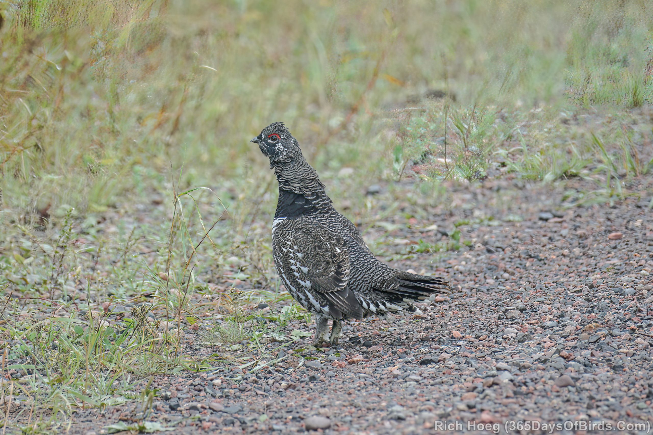
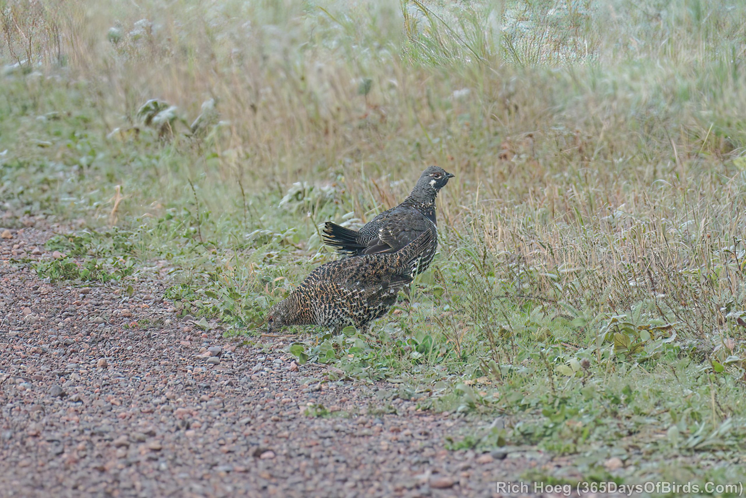
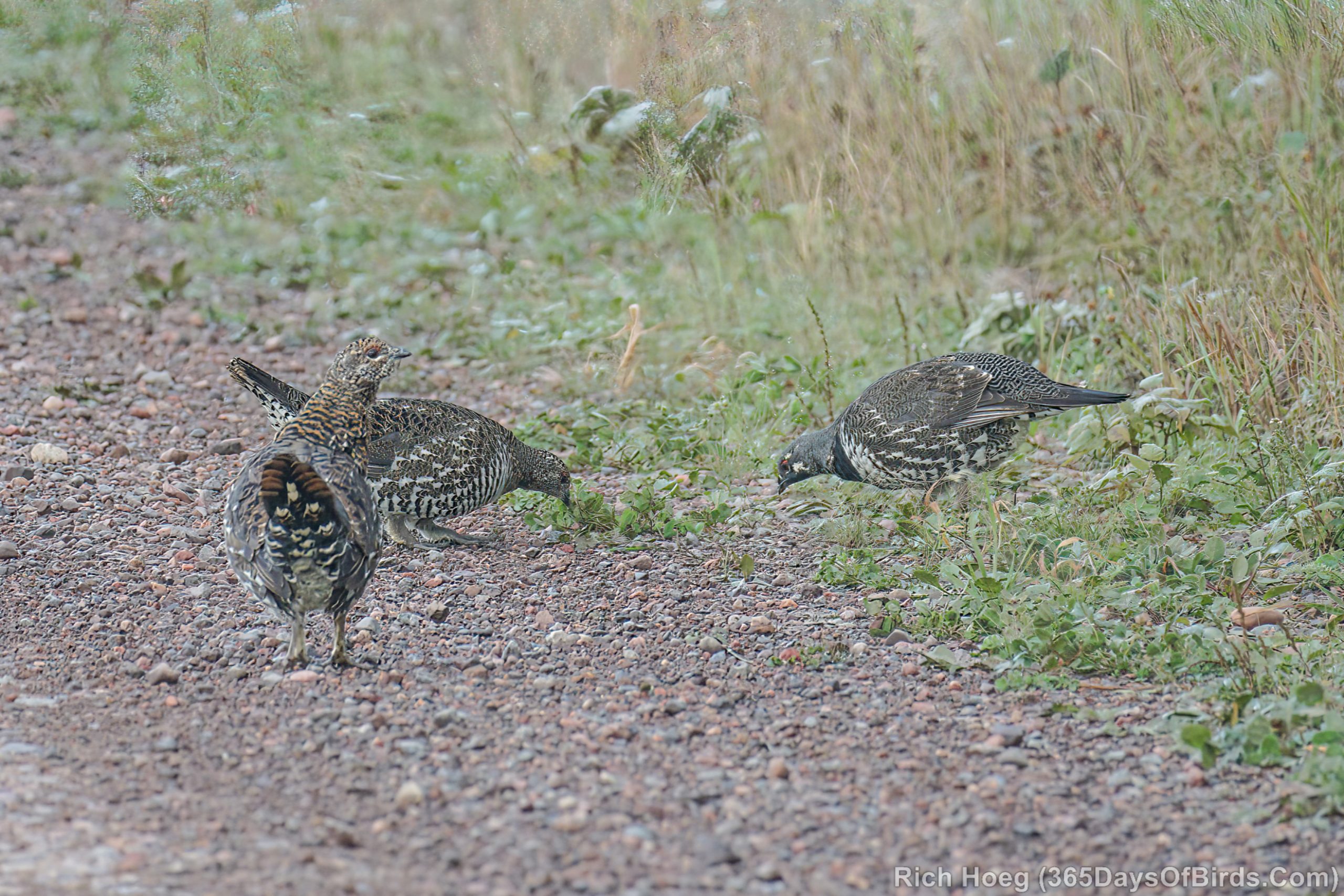
Given some years I do not see even a single Spruce Grouse, it is rather amazing and fun to have seen ten individuals just this week via two different birding excursions!
Forest Fire Burnout Aurora Borealis
Ever wonder what an Aurora looks like against a forest fire burned out background?! I wondered also and drove up to the Greenwood Forest Fire Burn Area last night (27,000 acres). This is actually the Sand River (45 miles north of Two Harbors). At this specific location as one looks up the river, lots of the smaller trees burned out, and some of the pines. Amazingly right next to burned out pines there will be sections of untouched trees. One other interesting fact on the night of November 3rd, the backwaters of the river were iced over and there was about one inch of snow on the ground (temperature was 19F).
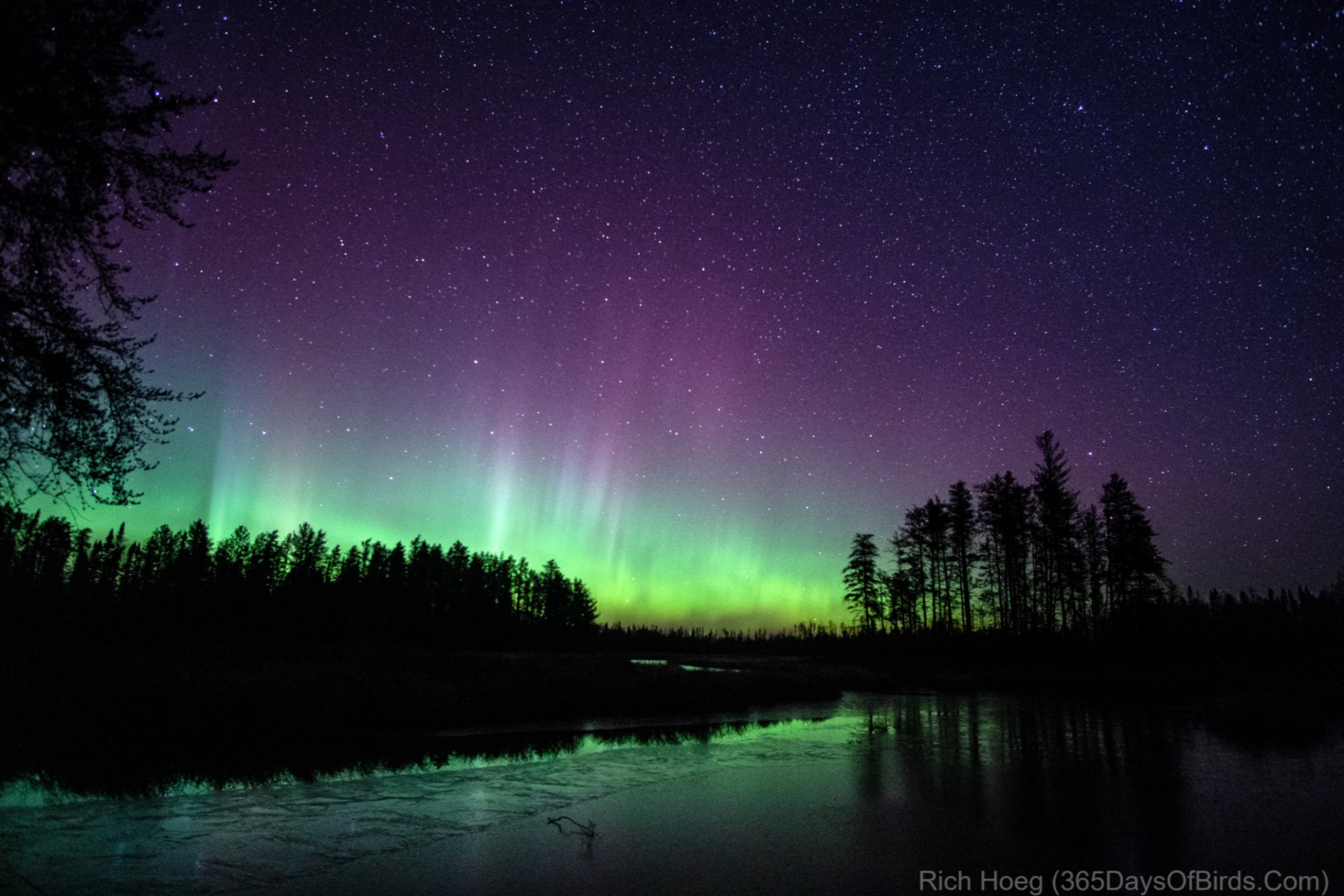
Camera settings: ISO 3200, Aperture 2.2, Exposure 6 seconds (Sony a6300)
.
This second image is what the sky looked like as I waited and hoped Lady Aurora would come out and dance. Notice the Big Dipper waiting to get filled (it did). You may need to maximize these images to get the full effect.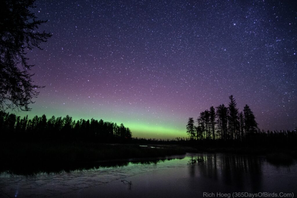

This final photograph was taken about 11:15 pm at Greenwood Lake (40 miles north of Two Harbors … just out of the burn area). Although my drive between locations was only 8 minutes, I about had a cow when I pulled into the public access.
Sub-Storm! This is what I actually was seeing with my naked eye. The Aurora filled the sky up to the zenith.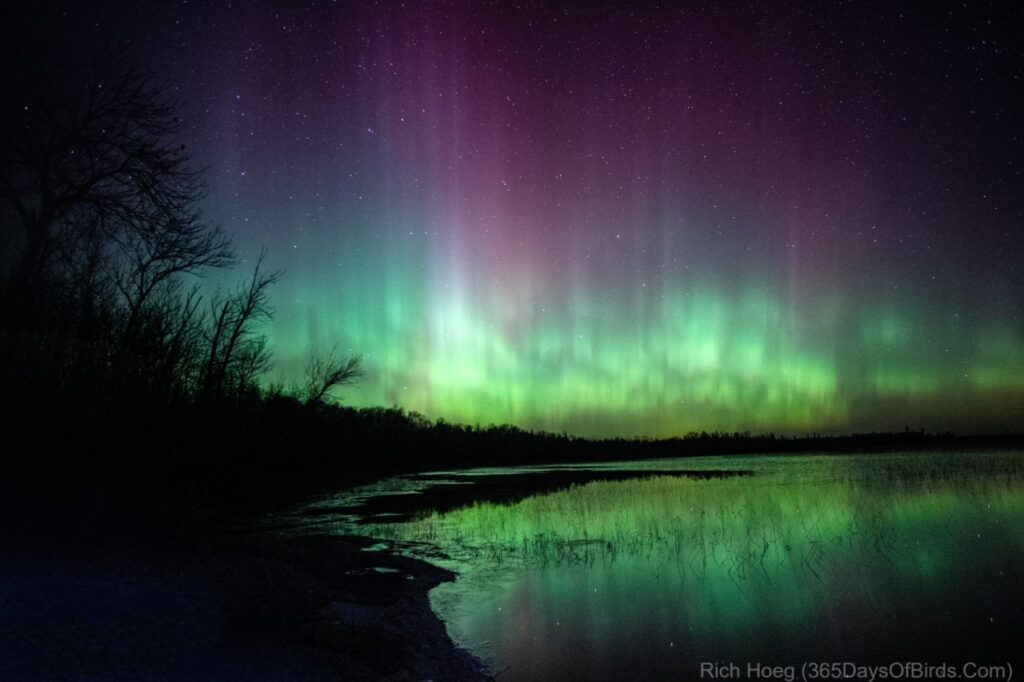

Camera settings: ISO 3200; Aperture 2.2; Exposure 4 seconds (Sony a6300)