This blog post completes my information about birding The Big Bog and nearby areas. It is worth reading my other posts to help with your research. Unlike Sax-Zim Bog which is near Duluth and may have large crowds, you will be alone as you bird this region. In fact, on many back roads you will NEVER see another car. As there are zero services, or often buildings / homes of any sort, you must be prepared. This is truly a wilderness area. Do not expect to utilize eBird or other social media services as you bird the Upper Red Lake Boreal Forest. You will be 100% on your own, which is actually quite enjoyable!
Other Posts in this Series:
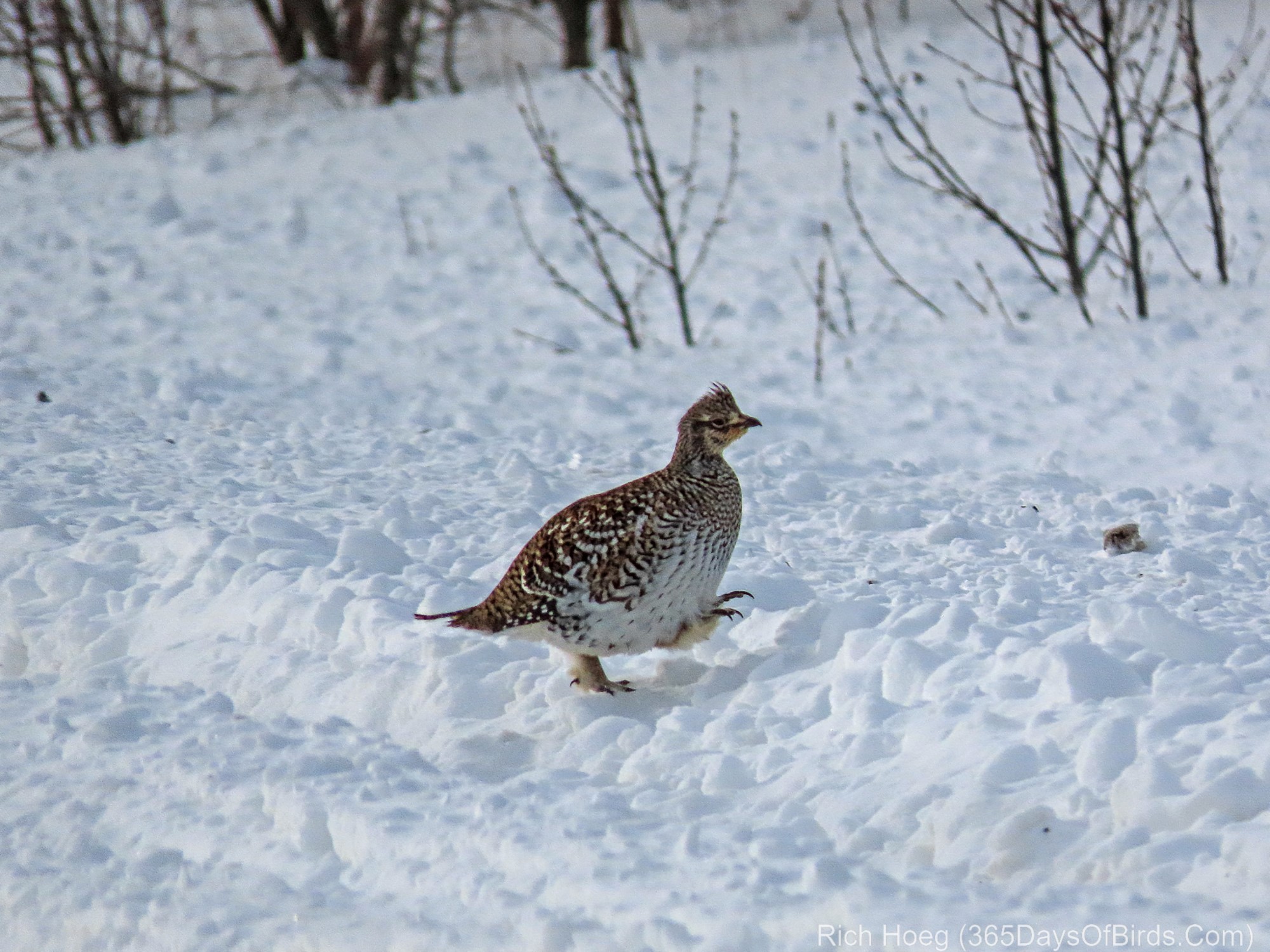
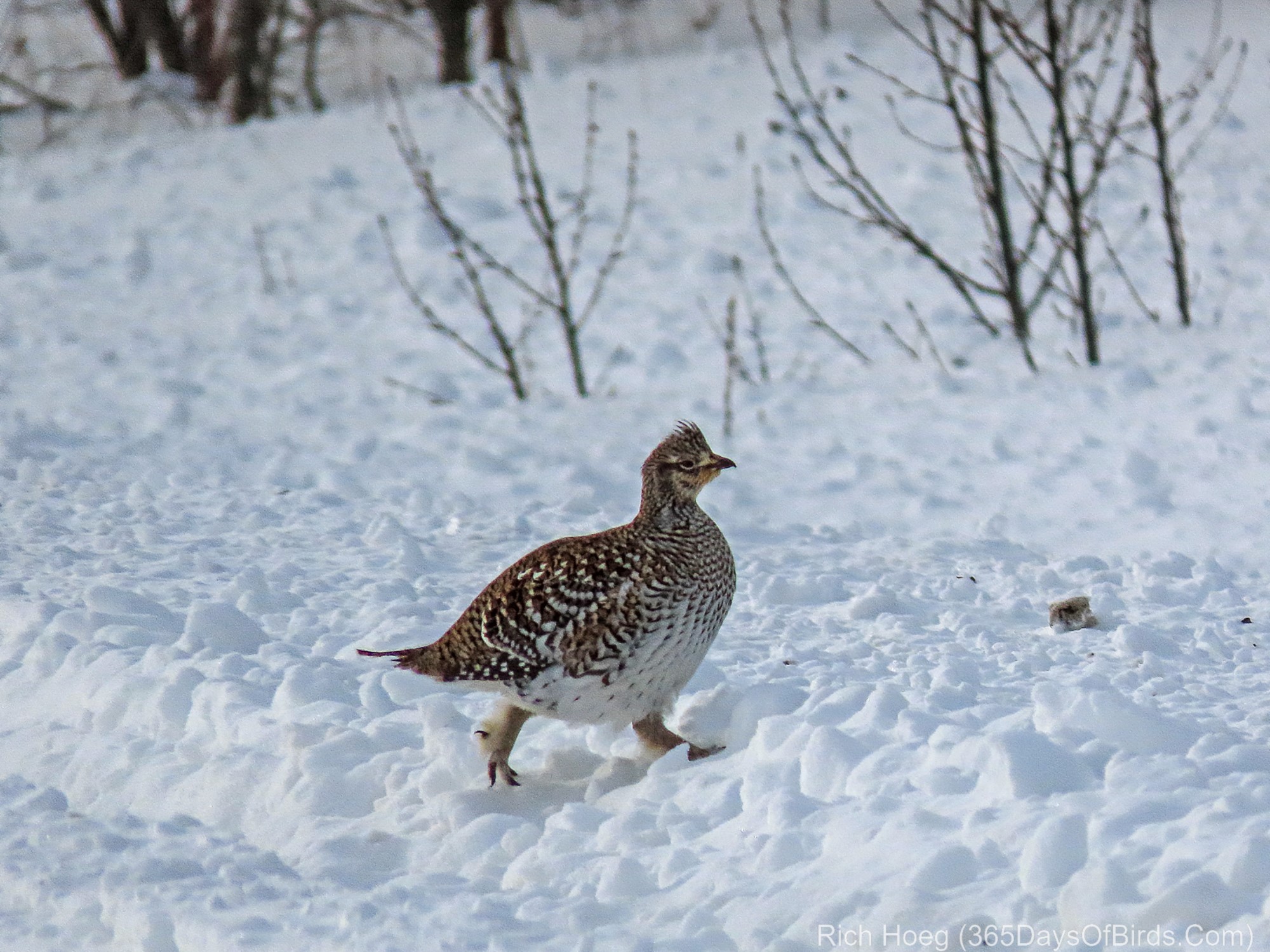
My final bird which I very much enjoyed was found just before the land switched over from grasslands to the Boreal Forest on Fourtown Road NW, was a Sharp-Tailed Grouse. See my maps and explanations starting beneath the grouse images.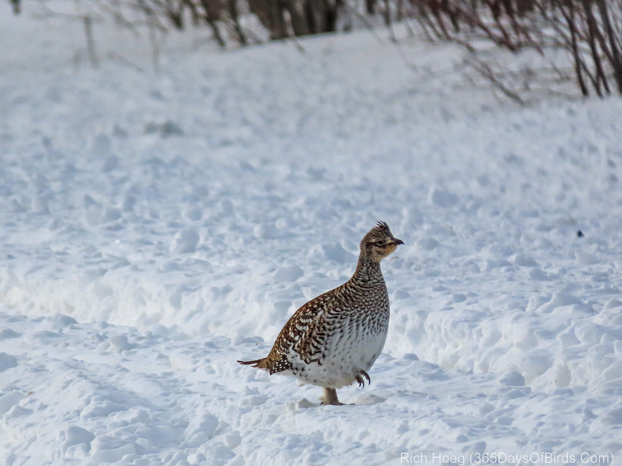
And now the maps. Understand these Google Maps screenshots do not cover the “Lost River State Forest / Lake Bottoms” or “Shoreline Drive NE” areas discussed in the “Minus 32F Birding Success” post. The true area of The Big Bog makes Sax-Zim Book look puny.
Map #1: A dirt road that runs basically due north 47 miles to Warroad. Think of Admiral or McDavitt Road in Sax-Zim Bog (Boreal Forest) but that goes on and on and on. Zero services.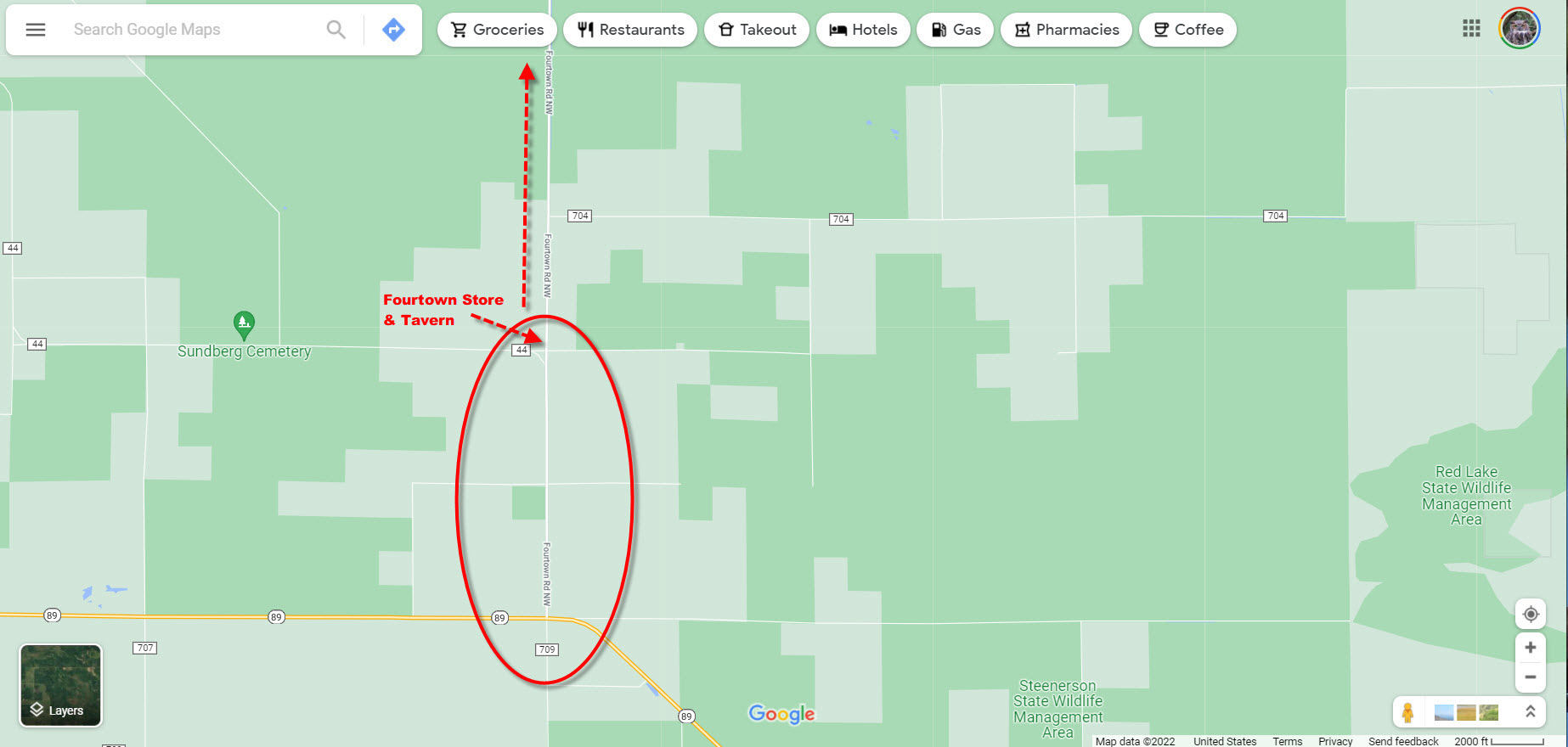
Map #2: Zoomed out to both show other birding areas, and provide road names for Map #1. Download Google Maps for Offline Usage (see my post). Much of the time you will NOT have cell coverage. The Grasslands area would be good birding in the summer. 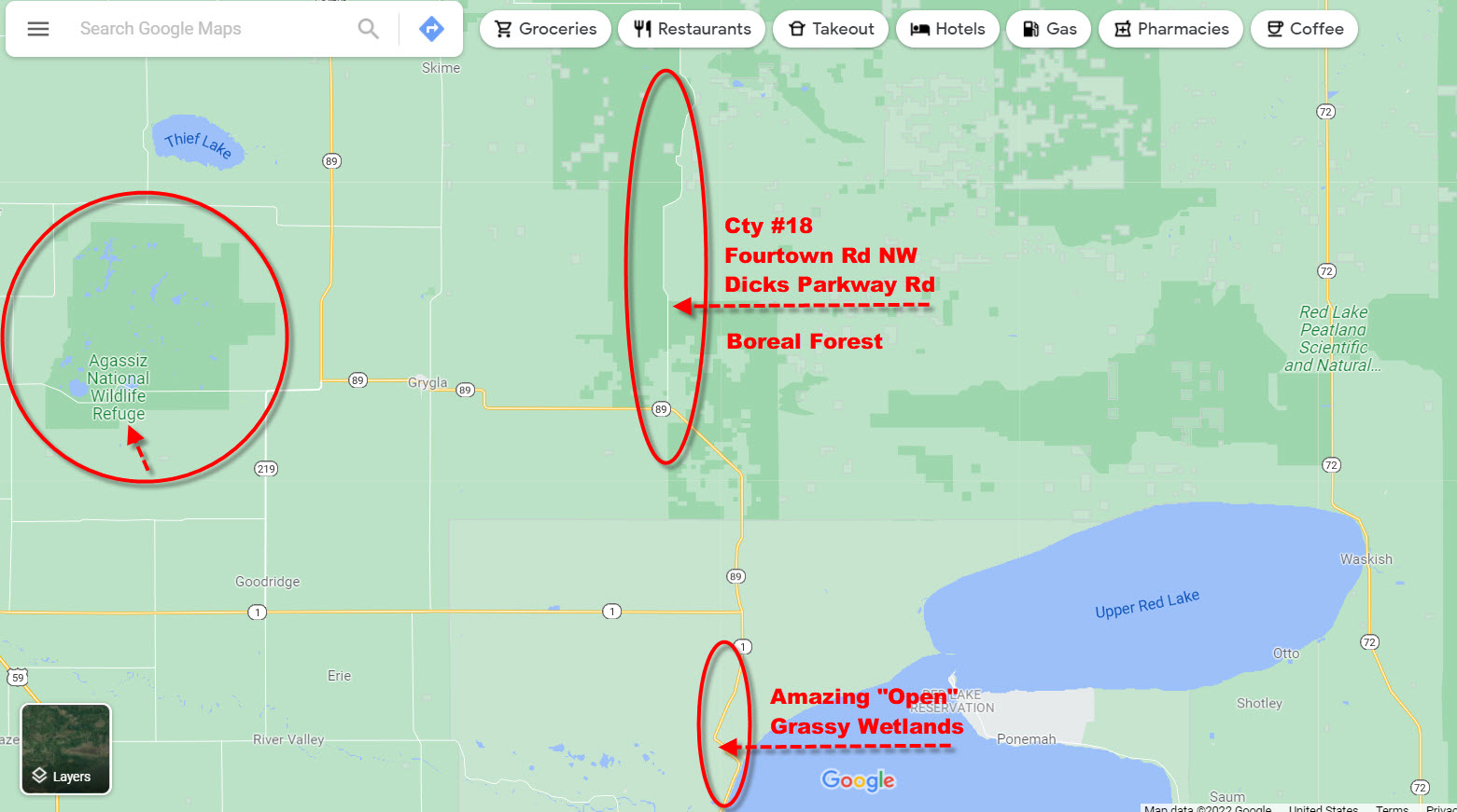
Map #3: Region-wide satellite mode perspective. Click / Press upon any image to view at full size.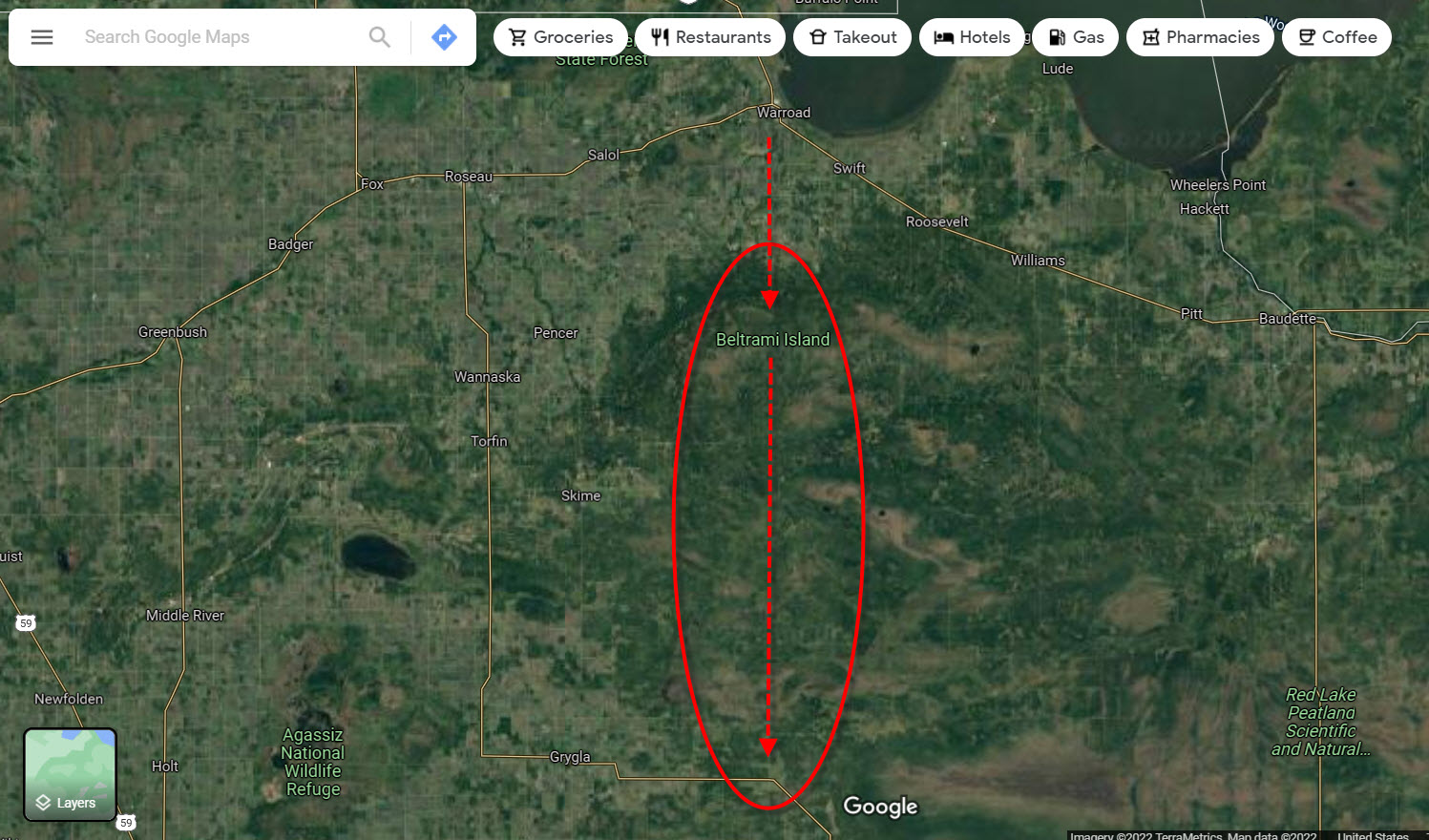
Discover more from 365 Days of Birds
Subscribe to get the latest posts sent to your email.