Category Archives: Background

The Wonder of Woodpeckers!

While we have many year round woodpeckers that grace northern Minnesota’s presence year round, late June and July are the time of Woodpecker Wonder! These neat birds which drill holes in trees are finishing up their nesting and fledging their young. It is fun to watch the young woodpeckers stick their heads out nesting holes as their parents load them up with food. However, this sight requires one to find woodpecker holes which is no easy task.

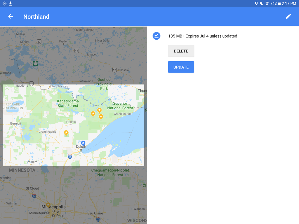
Yesterday I made a trip over to the Wisconsin Grasslands (Cloverland, Wisconsin) and the Johnson Mitigation Wetlands. This neat habitat area is dramatically different from my Boreal Forest in NE Minnesota, and only a 35 minute drive! As a added bonus, for the past few years I have always been able to find Red Headed Woodpeckers in this area. A review of the range map from Cornell demonstrates my region is at the extreme northern edge of this woodpecker’s range.

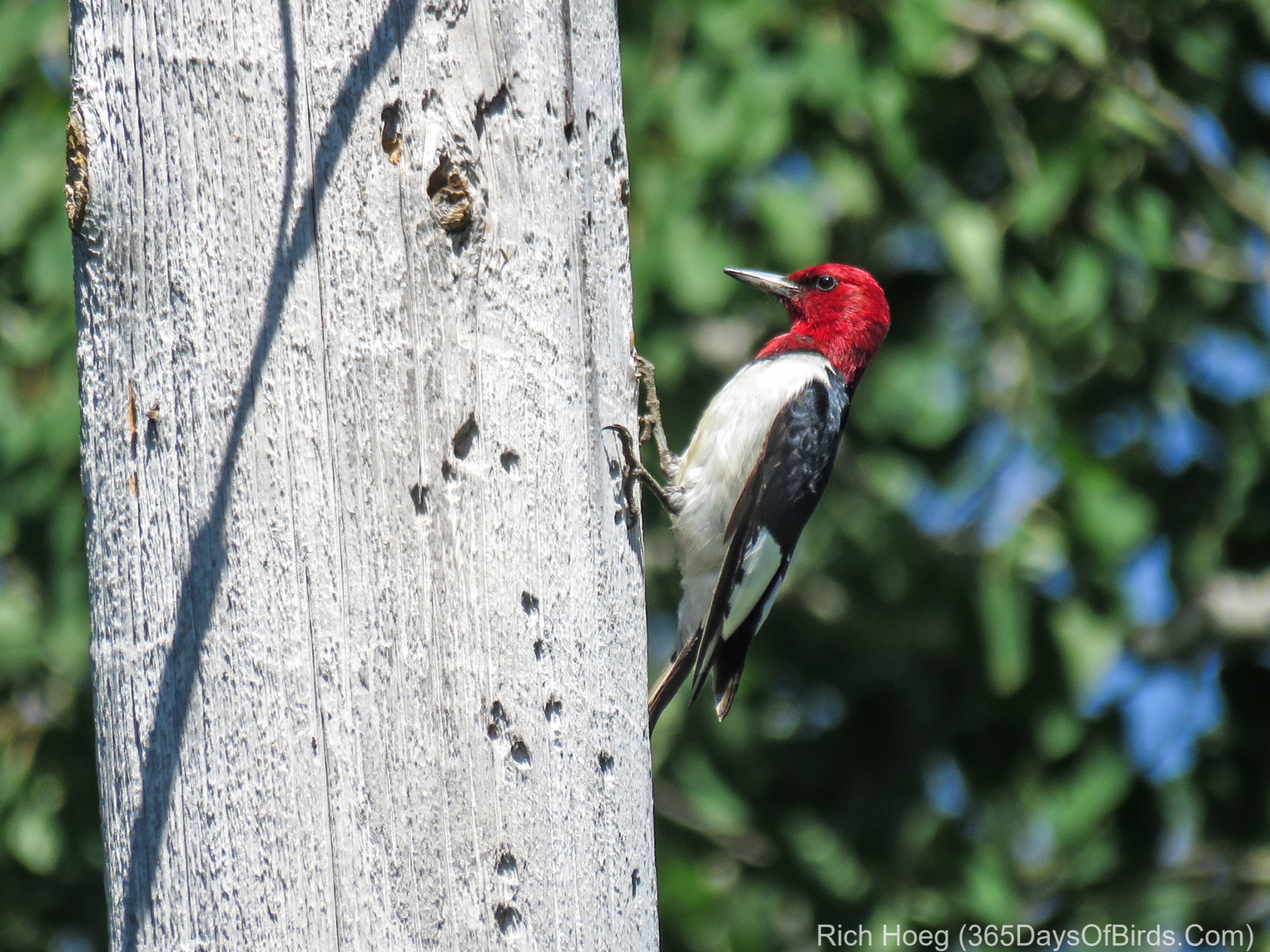
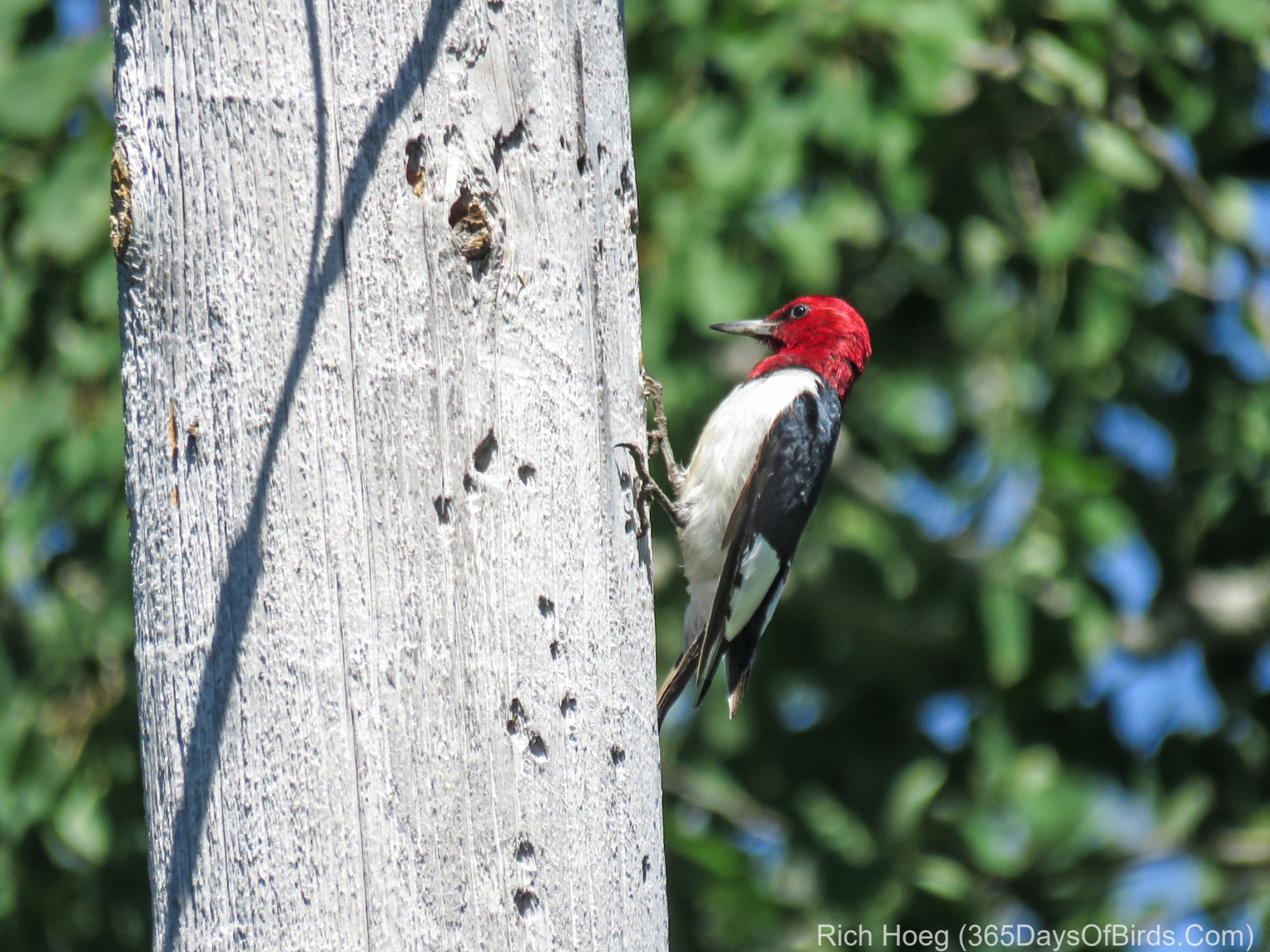
Two visits within the last week have yielded a Red Headed pair, and I have their nesting area determined to about a 100×100 foot square. I will find the hole! I’ve made some maps such that you may enjoy this area!

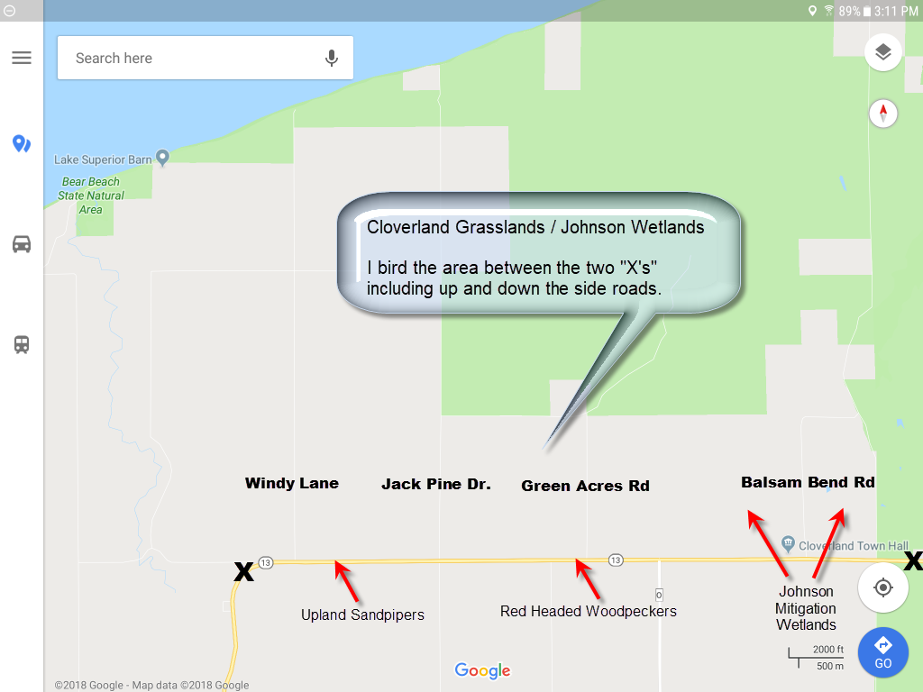
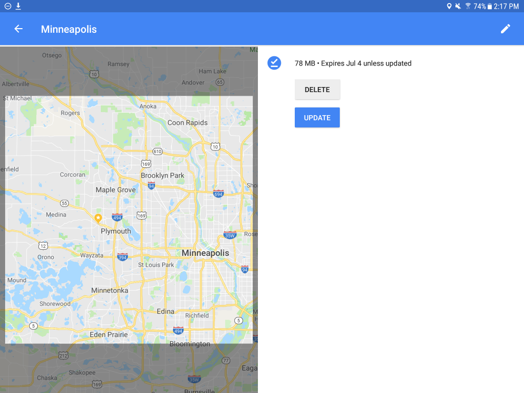
This second map is specific to the Red Headed Woodpeckers. The lines indicate areas where I have repeatedly seen these birds feeding on fence posts and telephone poles.

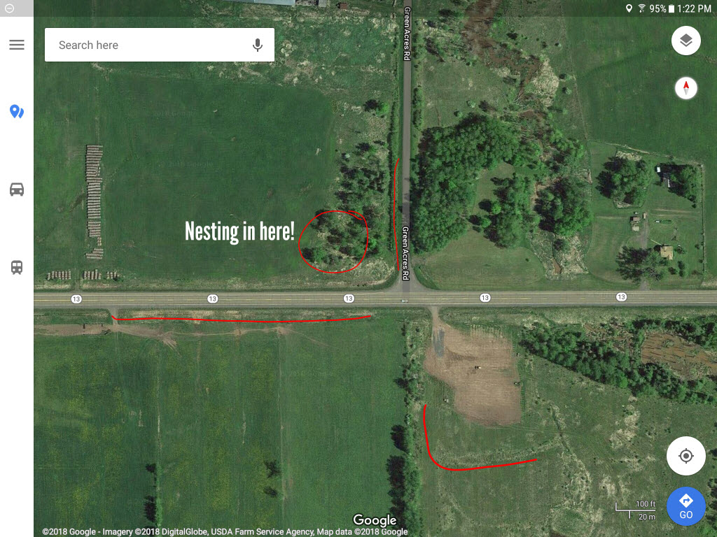
I also found a tree from which an American Kestrel hunts. It’s nice to capture an image of the Sparrowhawk not on a power line.

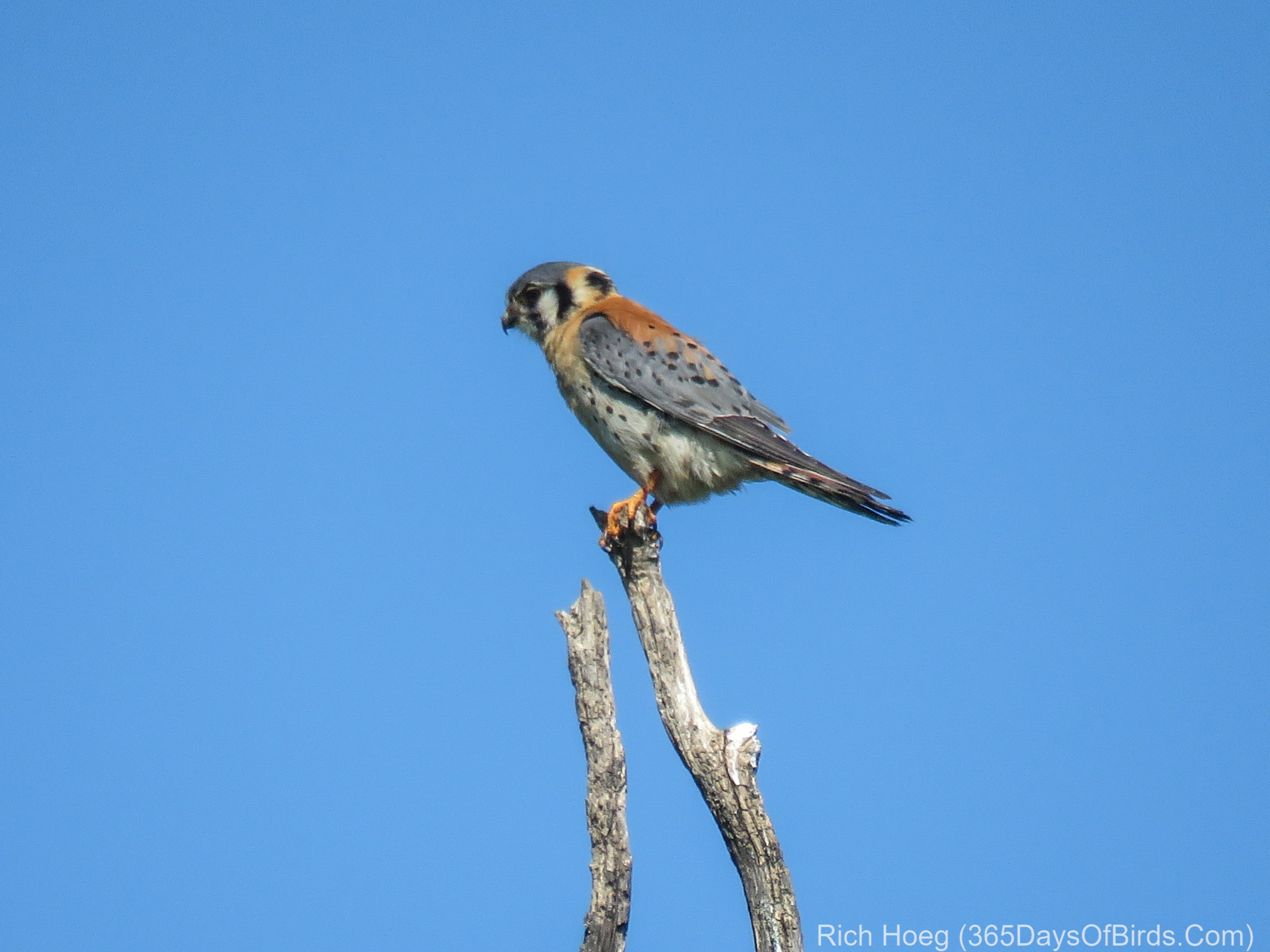
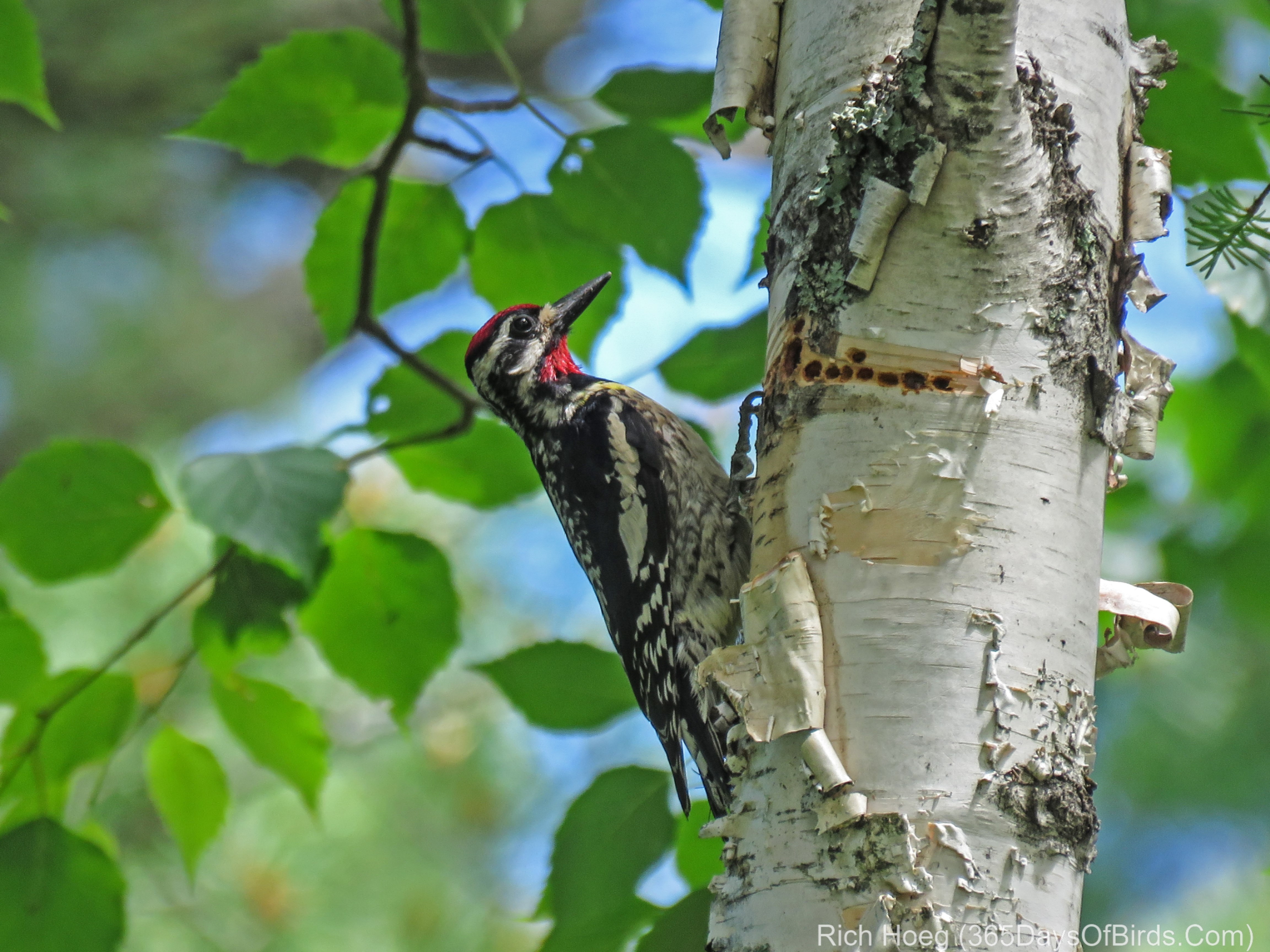
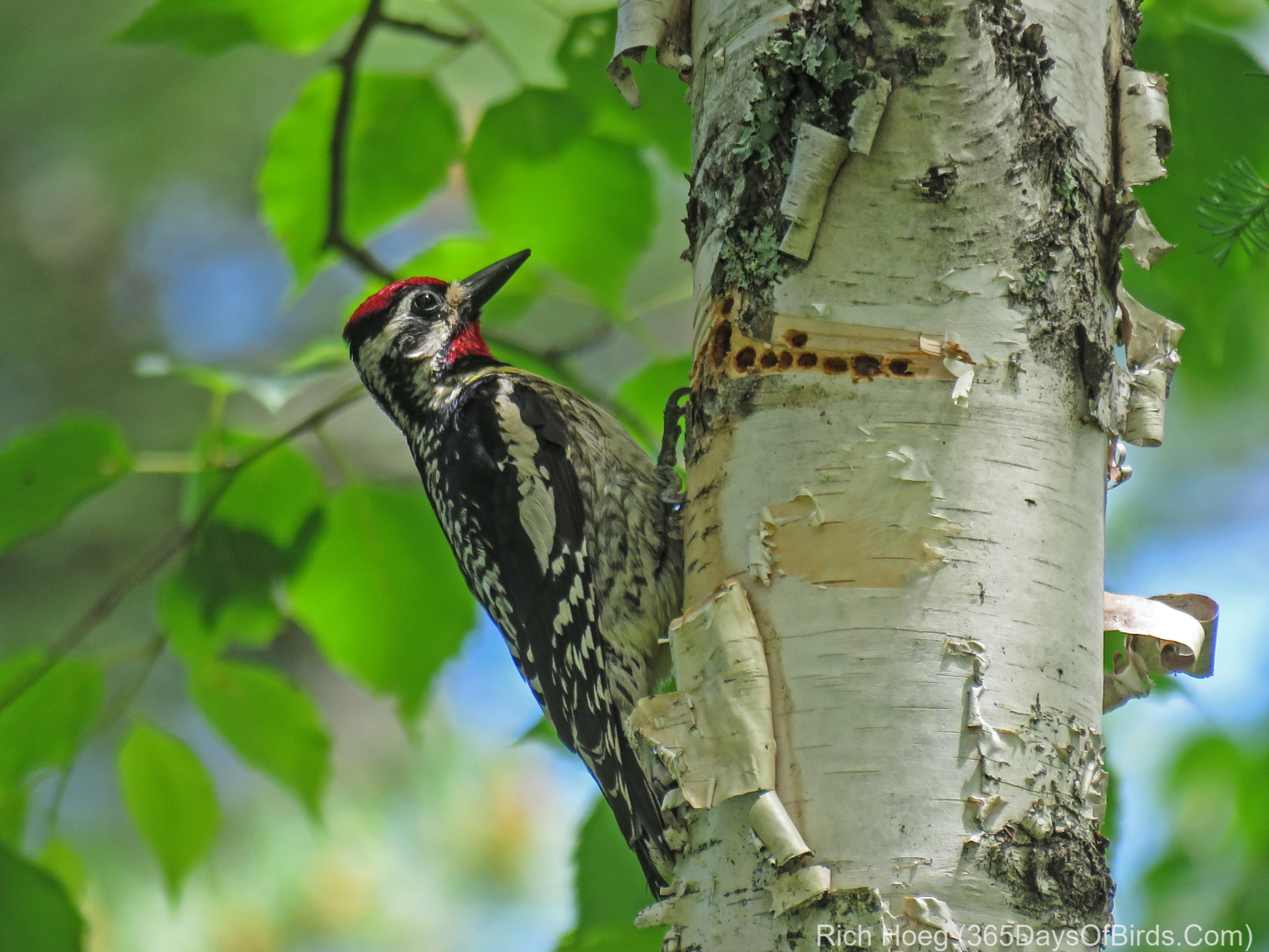
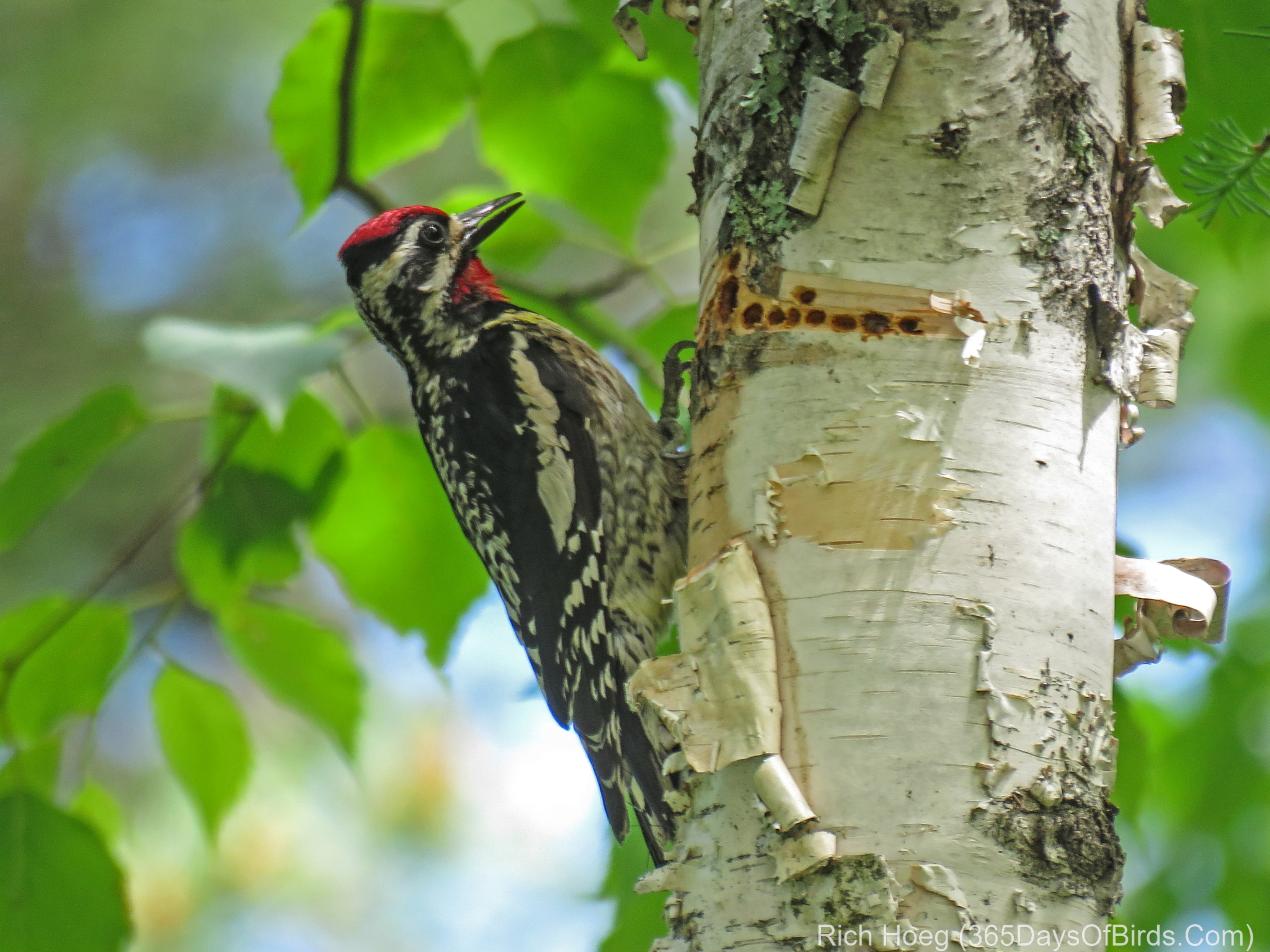
Finally, when I returned to my home on Amity Creek, back in the Boreal Forest, another woodpecker demanded equal access from my camera. While trying to track down my Pileated Woodpecker nest hole, this Sapsucker gave me some great photo opps!

Boat Nerd Post … Part 2!

It’s 6:45 am and its pouring rain outside. In short, my routine of leaving early to walk the woods in search of birds makes no sense. Instead, I am comfortably ensconced in front of the fireplace. The NE wind is blowing in off Lake Superior, and given Gitche Gumee’s water temperature is 37F, the air temperature outside 1/2 mile from the lake is 45F. Now you understand the fireplace. Our furnace is turned off, and heat is required!

One of my most loyal readers, Bonnie, commented upon yesterday’s “boat post“. As many others of you have commented favorably in the past about my nautical writings away from topics about out feathered friends, here is this morning’s “boats, not birds” follow-up! In addition to the resources noted in yesterday’s blog post, for a few dollars on either the IOS or Android platforms, one may purchase apps which track ship movement worldwide. These apps should incorporate AIS (Automatic Identification System – Wikipedia link) and Google Maps. On my Android smartphone and tablet, I have installed “MarineTraffic“.  This Marine Traffic link opens their web site which displays ships on any platform via a web browser (Android, IOS or PC … kind of cool!). Move the map around and zoom in somewhere. There is a whole lot of boat traffic on the high seas! On smartphones or tablets, their app work much faster and provides more data than the web site.

While I could use my app for the Duluth area, it works for any region of the world. Just position the map by dragging to any locale and wait for the app to update and display the current ships n that area. For instance, if I was out in San Francisco and wanted to see ships sailing under the Golden Gate bridge, I would take the aforementioned action.

Screenshot from my tablet … long pressing with my finger pulls up specific information about any ship. I used my PC’s graphics editor to add the red arrow.

Further pressing on the ships navigation white bubble yields even more information.

Anyhow … that ends today’s “Boats, not Birds” Tutorial!

Birding Off the Grid!

Or in a metro area, you should consider using Google Map’s offline feature. In my case, over the past nine days I have birded “The Big Bog” near Upper Red Lake Minnesota, Sax-Zim Bog (NW of Duluth), Cloverland (NW Wisconsin) and finally this morning … deep in the Superior National Forest in northern Minnesota. Now you may be thinking, I live in a metropolitan area, why should I worry about accessing data offline?

The answer is simple, using the offline feature of Google Maps dramatically increases the response time of your maps / navigation. While you may not be off line like me, metropolitan areas can be difficult to navigate whether your birding or just trying to find that new restaurant where you are meeting friends. Your phone will not need to download maps as you move around a region. If you have a restricted data plan, the maps can be downloaded at home while connected to wifi (i.e. no data charge).

Finally, believe it or not the navigation system with audible commands works when offline. Your GPS chip will find your location, and most smartphones will work with the offline data and speak / give directions.

Here are two of my better images found while “birding offline”

Common Merganser Trio (Guess what they were chasing? Love!)

Upland Sandpiper (rare for these parts … found 200 yards west of Cloverland town hall on Wisconsin Hwy #13)

Google Maps Offline Images

Leaving for The Big Bog from my cabin … offline and early in the morning … my phone is hooked up to my car’s display … also works fine w/o being integrated with your car.

Two Google Maps screenshots from my phone … remote and urban … shows my downloaded regions … two of my three children live in the Twin Cities. Regions update automatically.