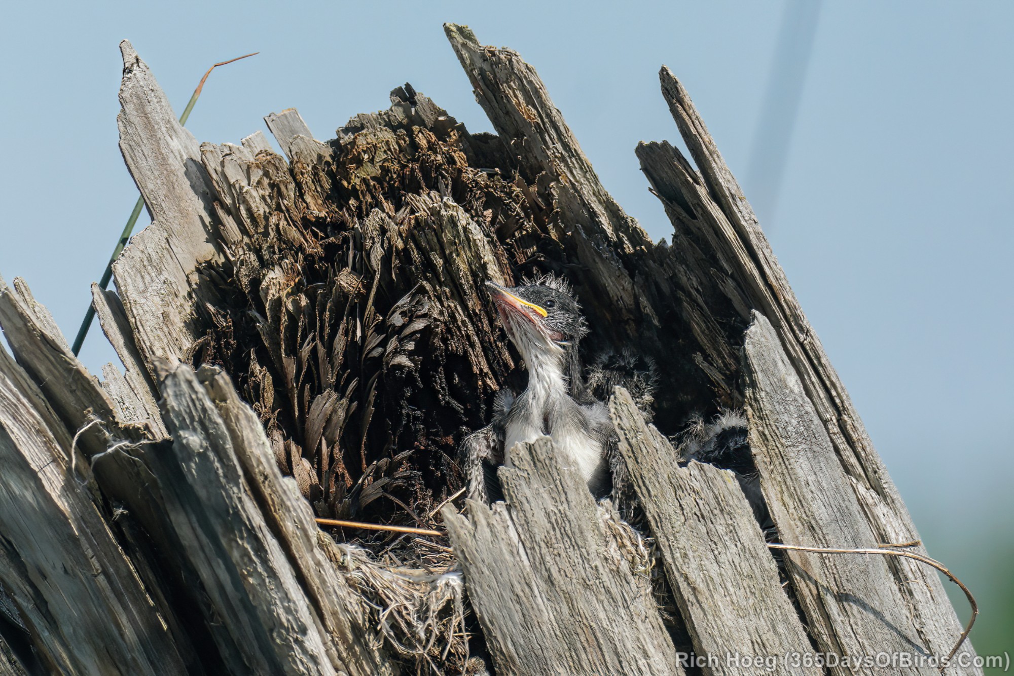
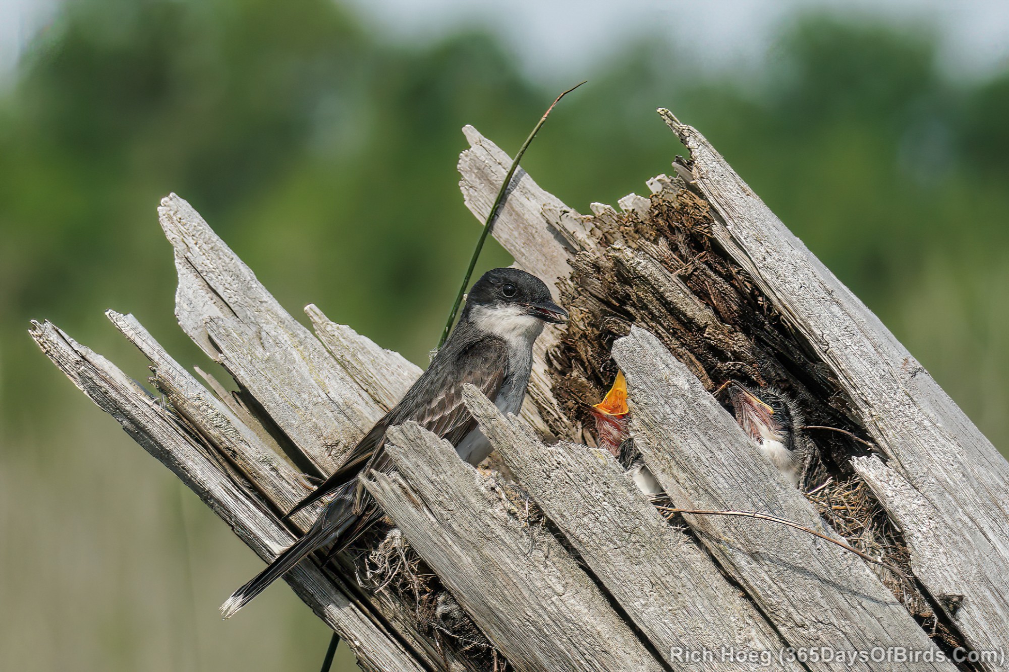
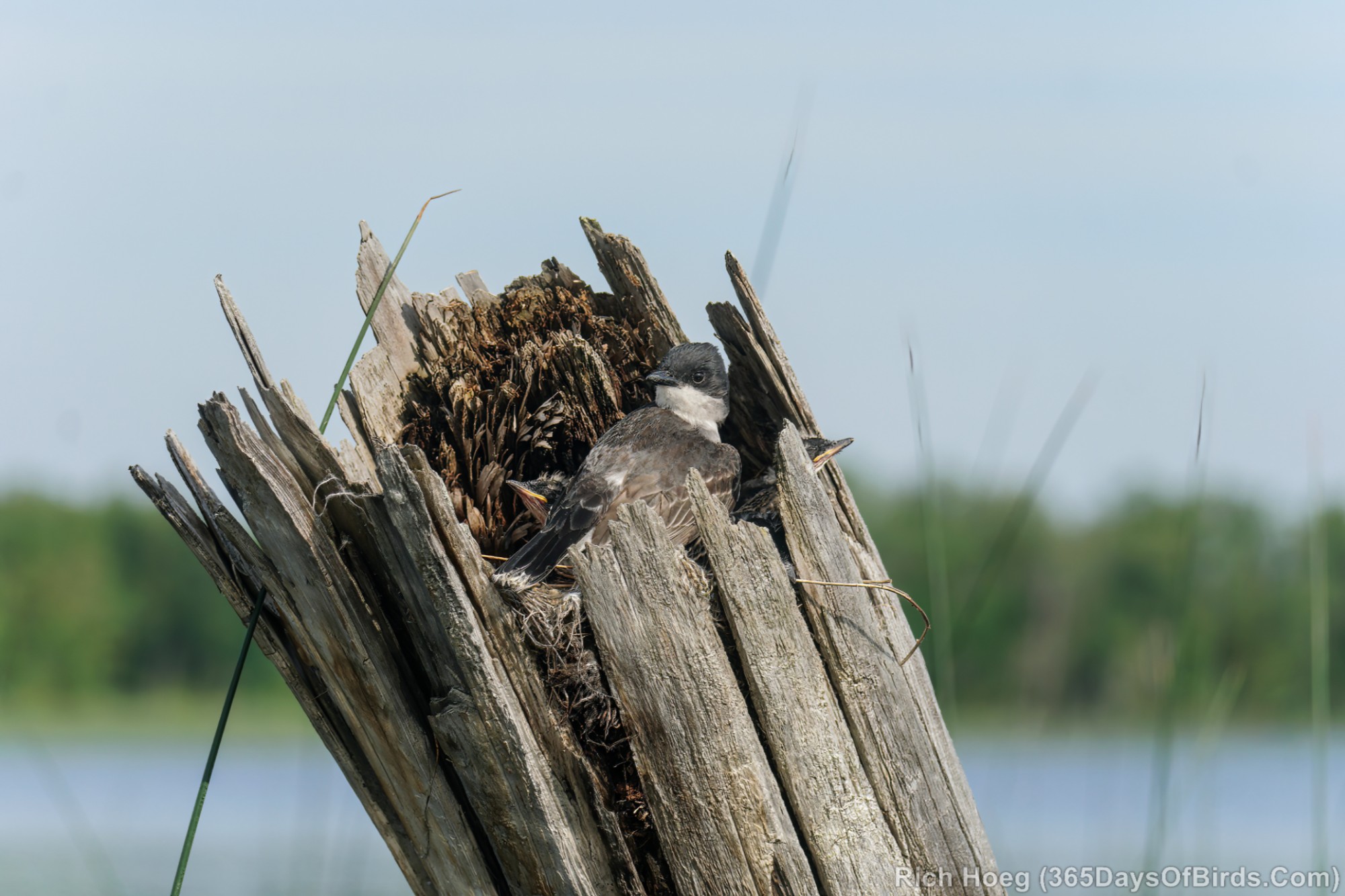
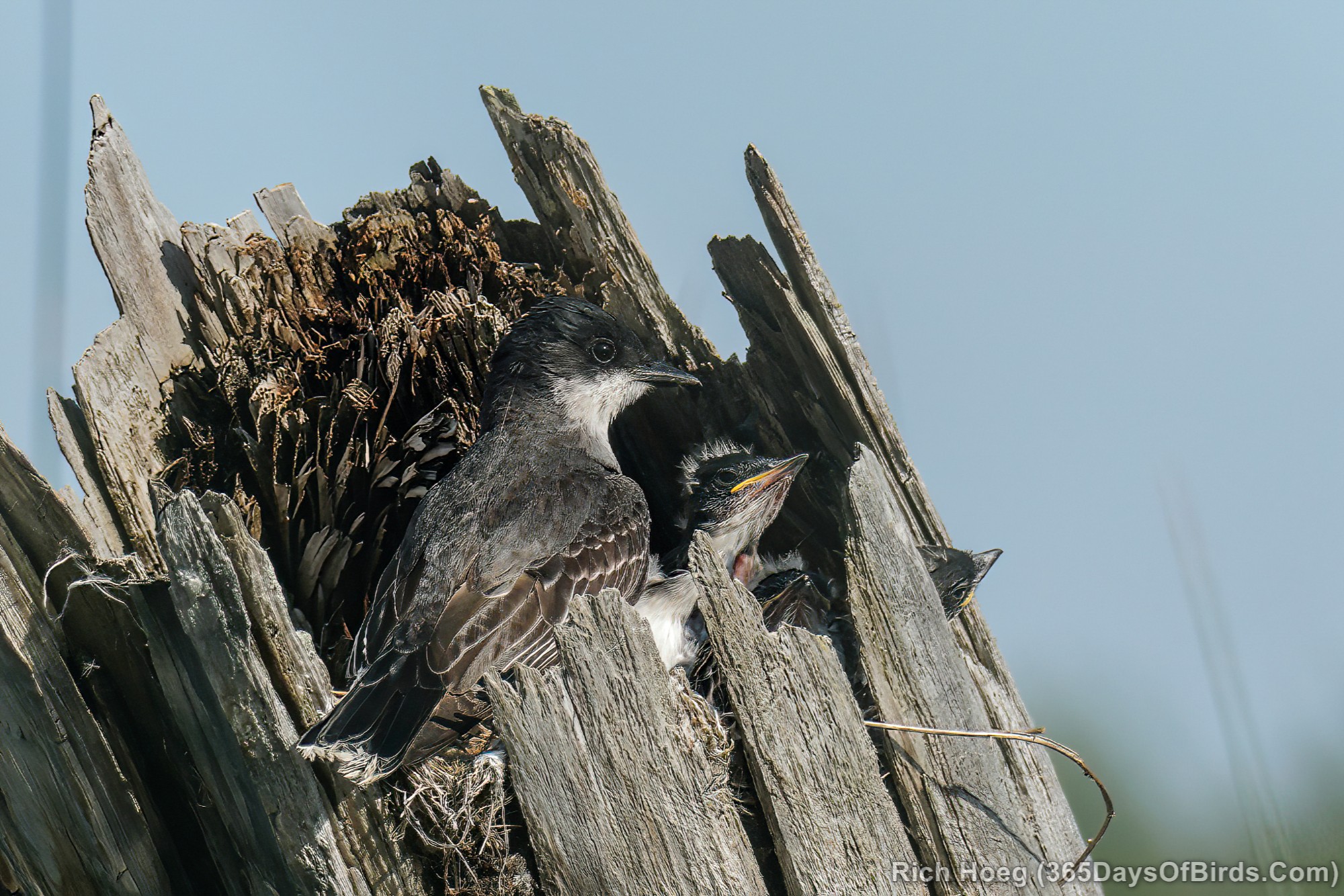
Over the past few days I have been birding MInnesota’s past … Logging Railroads. Two days ago I was up on Toomey-Williams Forest Road which actually is an old logging railroad that was turned into a forest road. As you drive a similar road you will often find ancient railroad ties breaking through the gravel. Well today I kayaked over to Trestle Landing near my cabin on Northstar Lake. I know from experience that Eastern Kingbirds will often nest in the old railroad trestles. This year was no different. Thus, meet the kingbird family of Northstar Lake! Judging by the images and the size of the chicks, these youngsters are quite new to the world.
The Logging Railroad Trestle Habitat
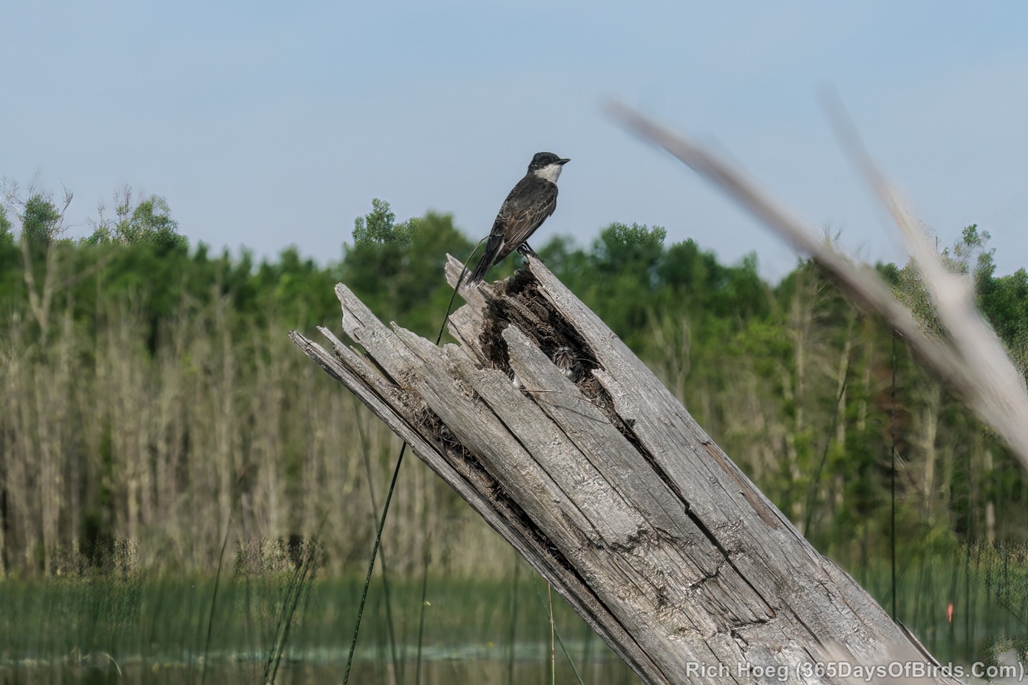
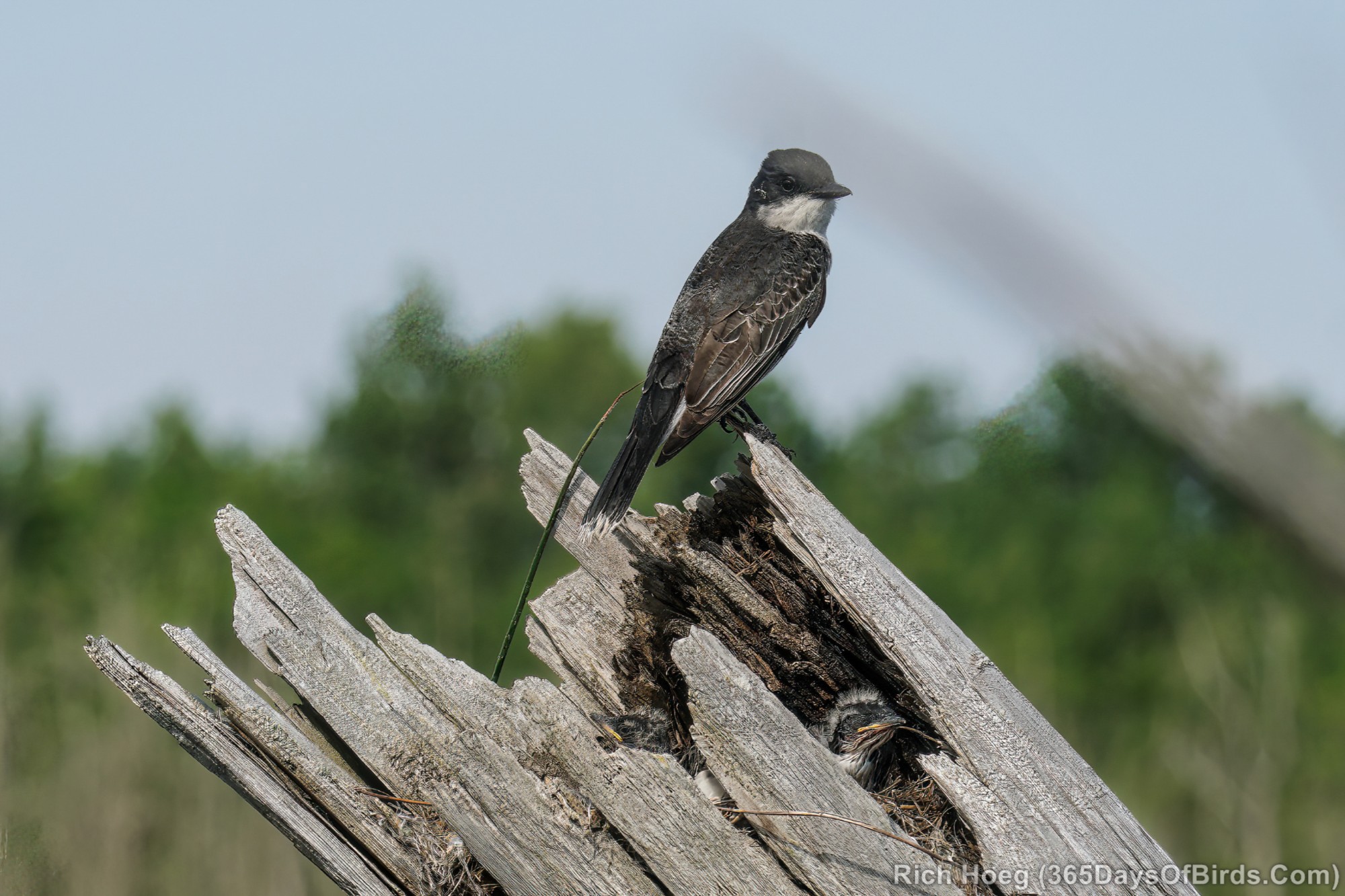
The Eastern Kingbird Nest
Eastern Kingbirds … the Movie! (video link for email subscribers)
It is worth watching one more super cool video … From stump to ship: A 1930 Logging Film (video link for subscribers). While this video documents the logging industry in the State of Maine, the Minnesota Historical Society and the Forest History Center in Grand Rapids have a short video of the last log drive in Minnesota …. on the LIttlefork River. Worth a watch. The Minnesota log drive took place in 1937 not to far from Northstar Lake and shows the unique history of northern Minnesota logging