Tag Archives: MN North: Grand Marais

Birding Off the Grid!

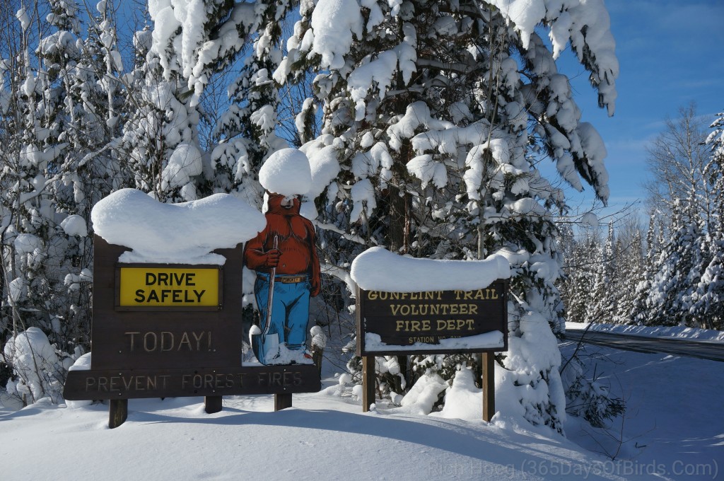
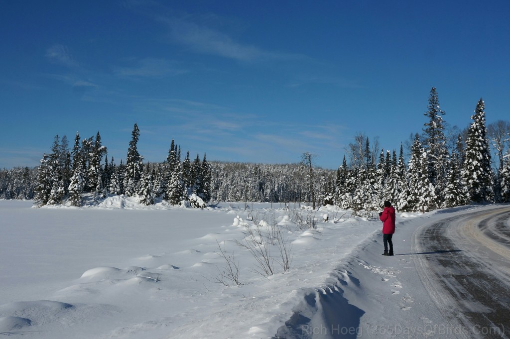
Or in a metro area, you should consider using Google Map’s offline feature. In my case, over the past nine days I have birded “The Big Bog” near Upper Red Lake Minnesota, Sax-Zim Bog (NW of Duluth), Cloverland (NW Wisconsin) and finally this morning … deep in the Superior National Forest in northern Minnesota. Now you may be thinking, I live in a metropolitan area, why should I worry about accessing data offline?

The answer is simple, using the offline feature of Google Maps dramatically increases the response time of your maps / navigation. While you may not be off line like me, metropolitan areas can be difficult to navigate whether your birding or just trying to find that new restaurant where you are meeting friends. Your phone will not need to download maps as you move around a region. If you have a restricted data plan, the maps can be downloaded at home while connected to wifi (i.e. no data charge).

Finally, believe it or not the navigation system with audible commands works when offline. Your GPS chip will find your location, and most smartphones will work with the offline data and speak / give directions.

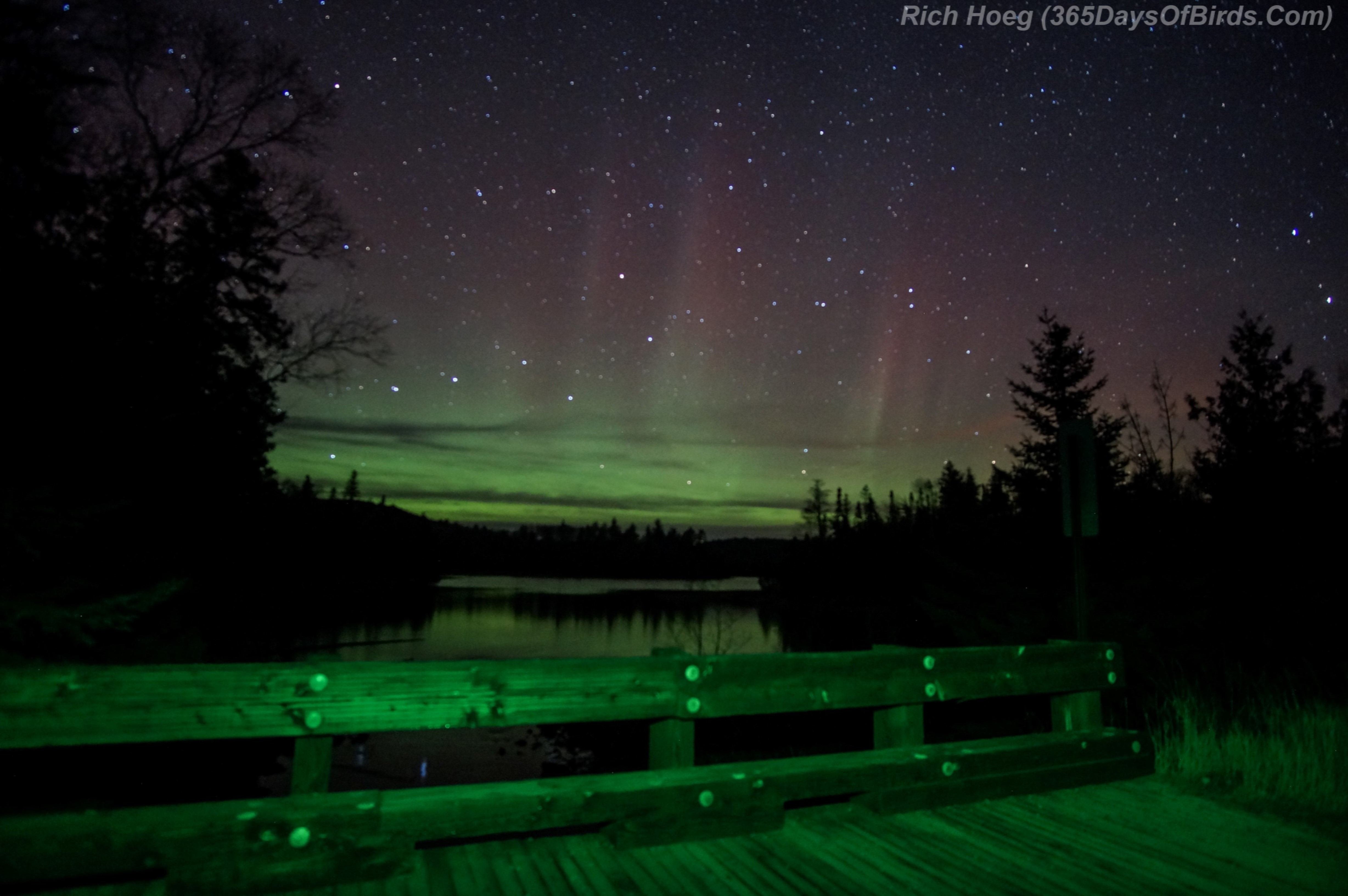
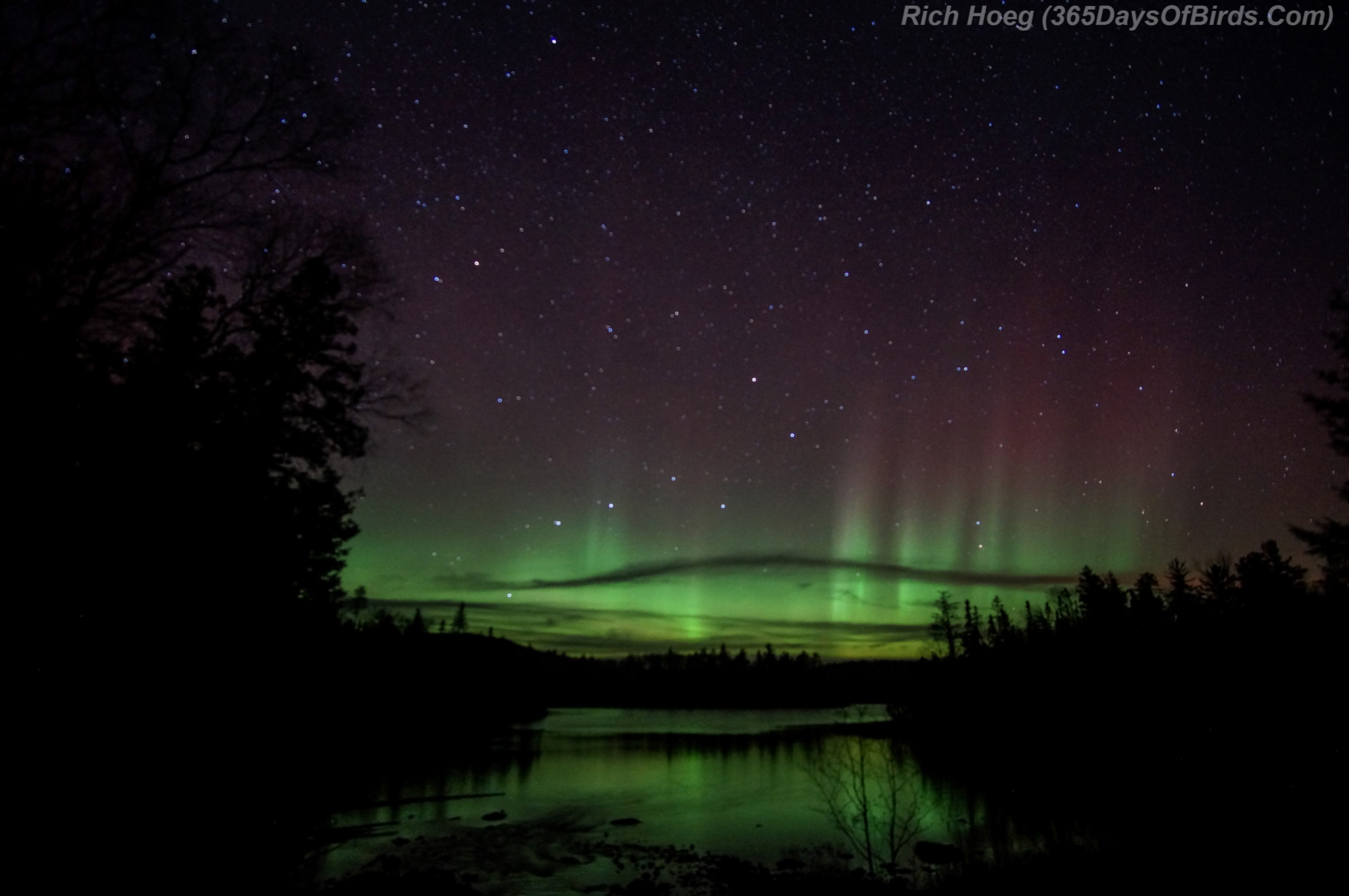
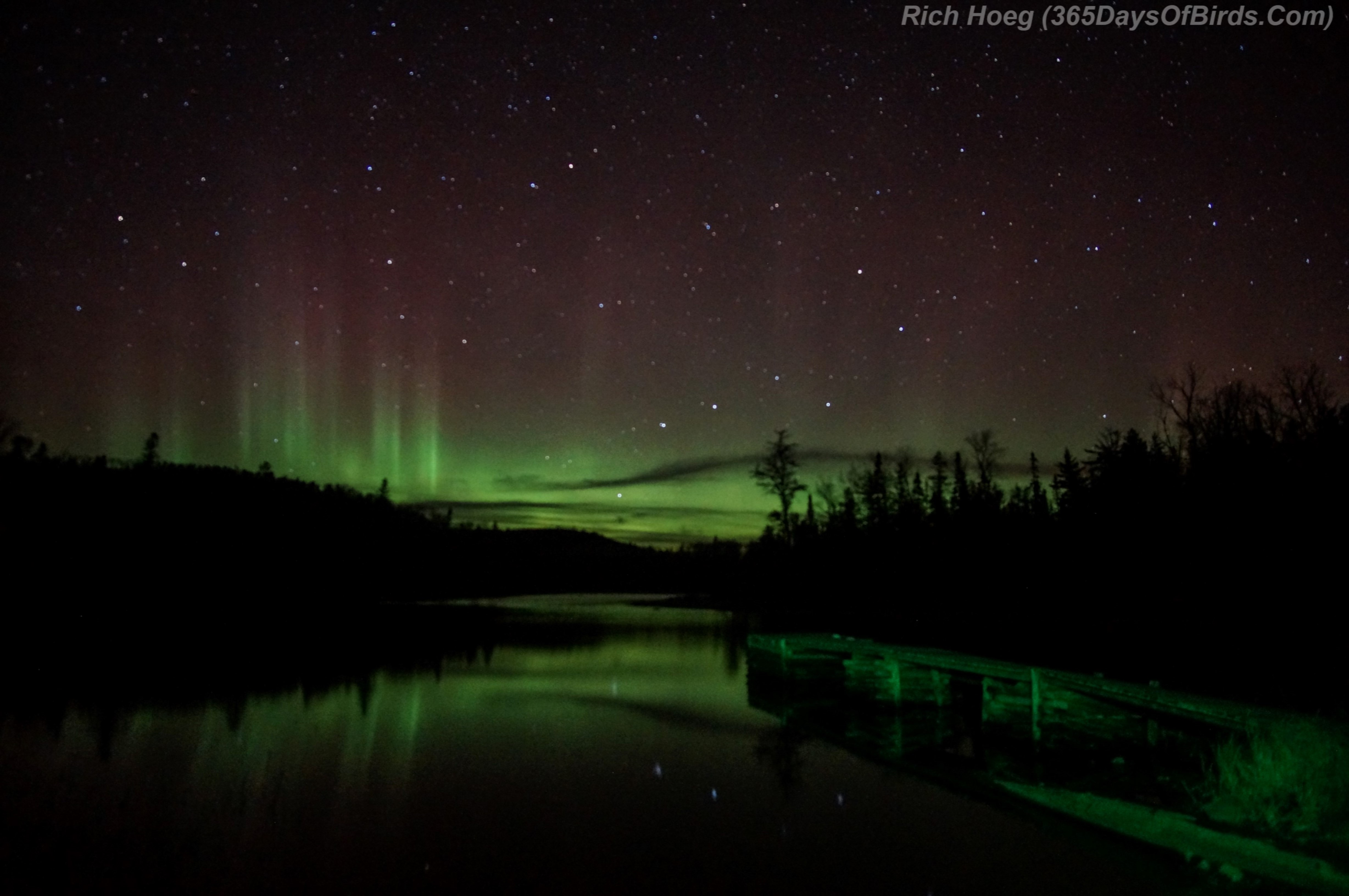
Here are two of my better images found while “birding offline”

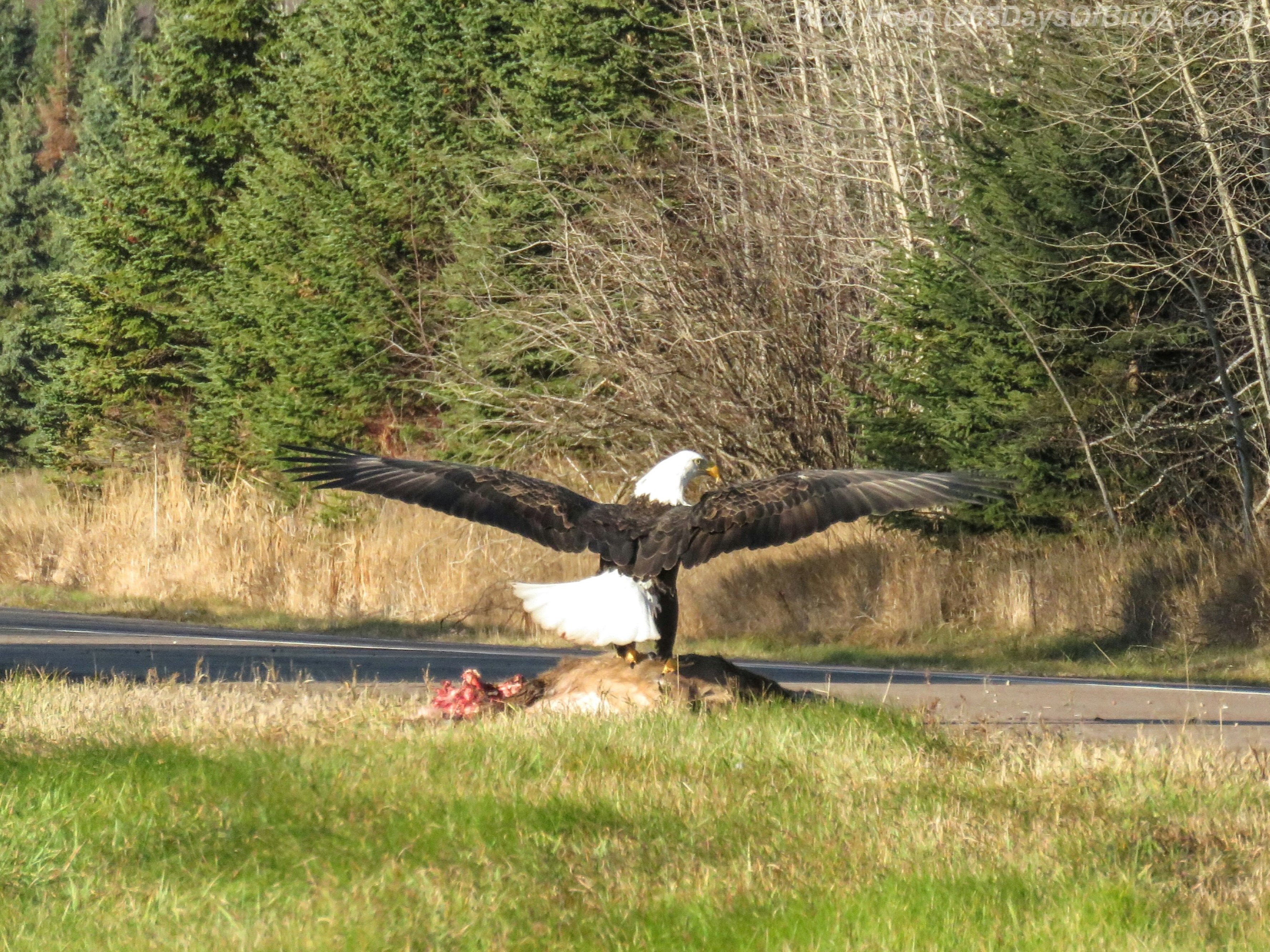
Common Merganser Trio (Guess what they were chasing? Love!)

Upland Sandpiper (rare for these parts … found 200 yards west of Cloverland town hall on Wisconsin Hwy #13)

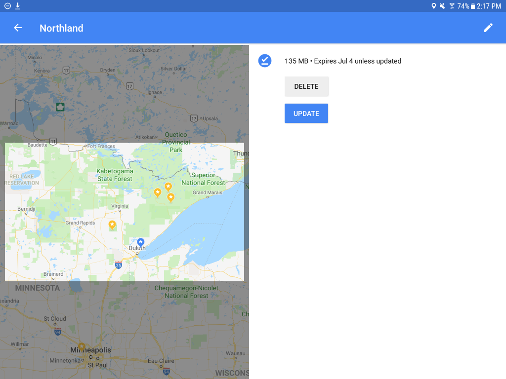
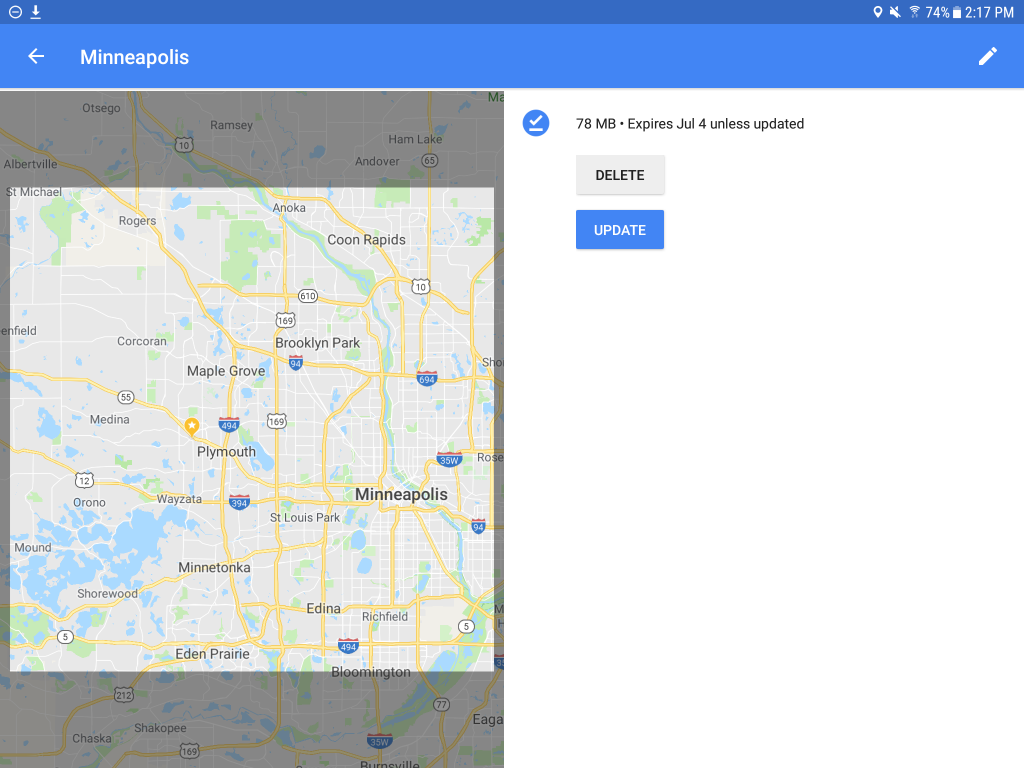
Google Maps Offline Images

Leaving for The Big Bog from my cabin … offline and early in the morning … my phone is hooked up to my car’s display … also works fine w/o being integrated with your car.

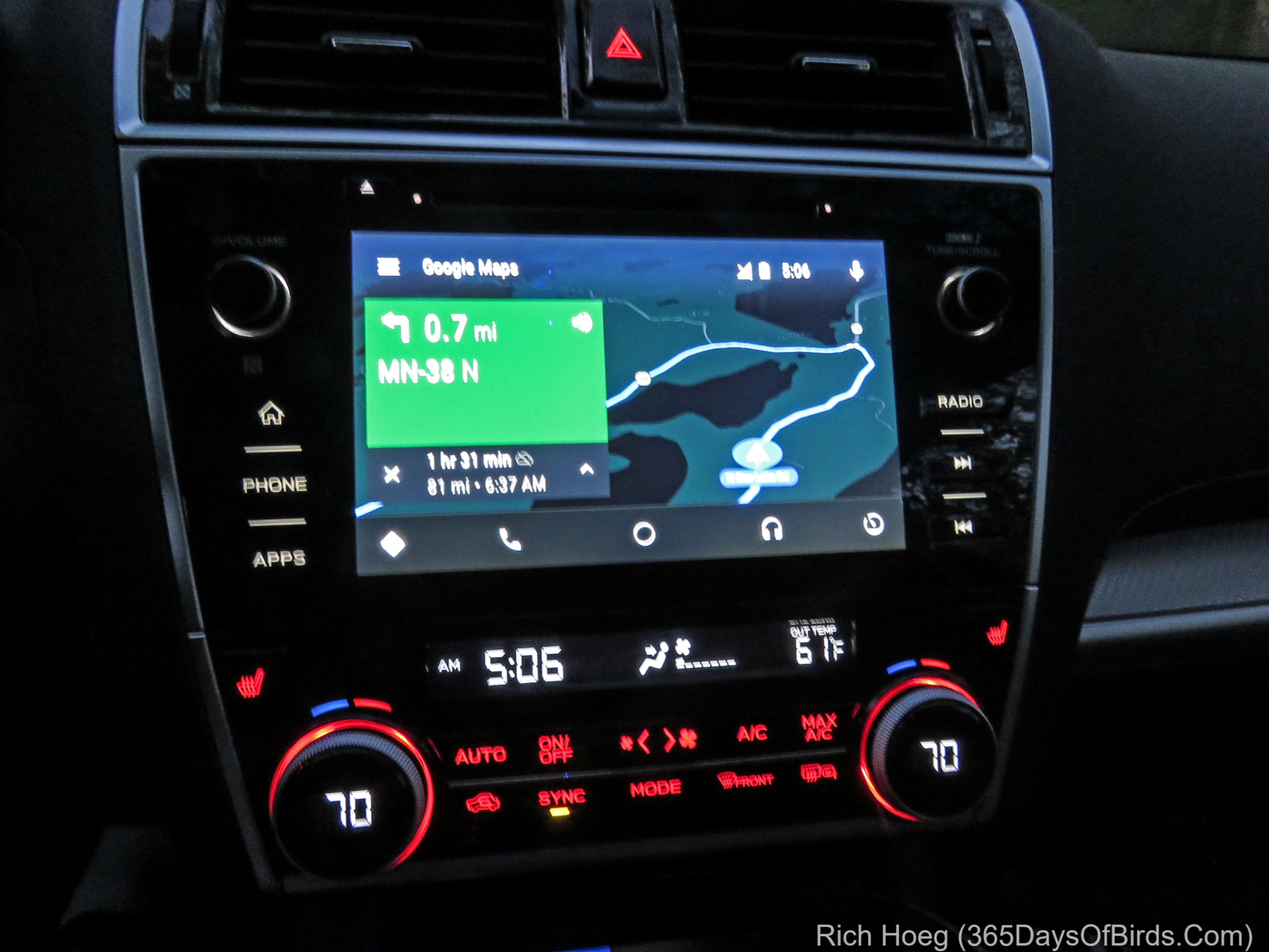
Two Google Maps screenshots from my phone … remote and urban … shows my downloaded regions … two of my three children live in the Twin Cities. Regions update automatically.

Gunflint Trail Ice Palace!

Ten days before Christmas this winter, northern Minnesota had a heavy wet snow followed by a rapid depth charging of the temperature. A few days later without a full melt, this process was repeated. The end result is the pine trees of northeastern Minnesota are flocked with snow and ice in a manner never seen before in my lifetime. Normally, within a few days or at most a week, the snow / ice falls from the trees. We are now over one month later and the flocking appears to be here for the rest of the winter. Although I thought the forests near Duluth were gorgeous, I did not realize the majesty of the beauty up on the Gunflint Trail. Along with another couple, Molly and I drove up from Duluth to enjoy a few days of Nordic skiing and relaxation in the remote wilderness of the Gunflint. Lots of layers of clothes were required as most mornings the temperatures hovered between -10F and -20F. Frankly,  it was too darn cold for skiing till around noon, but that did not stop me from going birding and doing short hikes from the car. For those of you who have never experienced temperature conditions like these, understand a car’s heater never really has a chance … and it is worth wearing long underwear for inside the car! It’s cold.

Here are a few photographs from my trip … (view my wife’s post & photos)

Was Not Worried About Forest Fires! Smokey the Bear was Diligent!
Y3-M01-Gunflint-Trail-Frozen-Smokey-the-Bear

———-

The Scene that greeted us upon arrival upon the Gunflint Trail!
Y3-M01-Gunflint-Trail-Flocked-Pines

———-

Birds out our window at Bearskin Lodge … sunflower seeds provided by me!
Y3-M01-Gunflint-Trail-Gray-Jay Y3-M01-Gunflint-Trail-Hairy-Woodpecker

———-

Photos from my photography hike … -19F plus windchill (-28F)
Y3-M01-Gunflint-Trail-Winter-Wonder-Trail Y3-M01-Gunflint-Trail-Snow-Canyon-Palace

———-

Good “warm” times at Trail Center Lodge for dinner (a true backwoods experience)
Y3-M01-Trail-Center-Lodge-Gunflint-Trail-Bar Y3-M01-Trail-Center-Lodge-Gunflint-Trail-Couples

———-

Bald Eagle enjoying Road Kill Cafe on the drive home
Y3-M01-Gunflint-Trail-Bald-Eagle

Sunrise to Sunset and Beyond: Exploring & Birding Minnesota’s Arrowhead

Minnesota’s Arrowhead region is defined by its two endpoints … my home town in Duluth on the western tip of Lake Superior, and the Susie Islands on the Grand Portage Indian Reservation. Most folks know the Duluth end of the Arrowhead followed closely by Grand Marais, but this past Sunday I started my day 40 minutes before sunrise watching dawn slowly take over the sky from my vantage point on Mount Josephine overlooking the Susie Islands. This group of 13 islands are Minnesota’s most eastern point.

I hope you enjoy my photographic tour through “Points Unknown”. Given last Fall saw me bicycle touring through the “Middle of Nowhere”, it’s good to know I’ve finally arrived! You’ll understand when you scroll down through my day … and night!

Approximately 45 minutes before sunrise is the blue hour, with a lot of orange thrown into the equation. These images look out over the Suzie Islands with Isle Royale in the background. The vantage point is Mount Josephine. After sunrise I drove the remaining mile to the Canadian border and hiked up to High Falls on the Pigeon River.
00-Susie-Islands-Sunrise-0 01-Susie-Islands-Sunrise-2

02-Pigeon-River-High-Falls———-

After watching the sunrise over the Susies, a few miles down the coast is the Grand Portage Indian Reservation. Near the end of Hat Point one will find the Witch Tree. If you visit, respect this tree which is sacred to Natives Americans. Maintain quiet while hiking and visiting. I was treated to a beaver laying up food for the winter in the nearby wetlands.
04-Witch-Tree 03-Beaver

———-

On the way back towards Grand Marais one nears the small town of Hovland. A raven was enjoying “Road Kill Cafe” when our national bird, the Bald Eagle, decided he should be served first! The high wind meant a “bad hair day” for Mr. Eagle!
05-Bird-Roadside-Cafe-Raven-Eating 06-Bird-Roadside-Cafe-Raven-TakeOff 07-Bird-Roadside-Cafe-Bald-Eagle-Landing 08-Bird-Roadside-Cafe-Bald-Eagle-Bad-Hair-Day

———-

If you’ve followed my blog for long, you will know I love to watch and photograph the Northern Lights. Thus, in Hovland I drove inland on the Arrowhead Trail. In addition to birding, I was researching possible Aurora Borealis photoshoot locations. I was amused to find I had ventured into “Points Unknown”! Last Fall while in Montana on a 1,400 mile bike tour I bicycled through “The MIddle of NoWhere”. I guess I get around!  🙂
09-Points-Unknown 10-Middle Of Nowhere

———-

Returning to Grand Marais, I swapped out my car for my bicycle. Seeing the North Shore by bike is a great way to see more of the area’s beauty. When one travels at 12 mph, items which you would miss in a car jump out at you. My ride was only 18 miles, but the birds were easily spotted. All of these birds are visitors for the sub-Arctic region which come south to Minnesota and enjoy our “warm” winters. The order of the pics are:
1. Snow Bunting
2. Lapland Longspur
3. An unfortunate Snow Bunting hit by a car (please slow down for birds)
4. Rough-Legged Hawk
11-Bird-Cut-Face-Creek-Snow-Bunting 12-Bird-Cut-Face-Creek-Lapland-Longspur 13-Bird-Dead-Snow-Bunting-2 14-Bird-Rough-Legged-Hawk-1

———-

Grand Marais is a great place to overnight. The small town is warm, friendly and has good places to eat. Make certain you don’t miss the sunset over the harbor! In the first photo I am looking back towards the lighthouse during the last light of day, and then drove over to the other side of the harbor to watch the sunset!
16-Bird-Seagull-Lighthouse 17-Grand-Marais-Lighthouse-Sunset-2 18-Grand-Marais-Lighthouse-Sunset-1

———-

Did I mention I love the Northern Lights?! Shortly after sunset I drove back north to the very end of Arrowhead Trail. Around 11 pm (sunset was at 5 pm) the Northern Lights danced across the sky for me. The display seemed to be a great way to end a fantastic day. It had started at 5:30 am when I drove north to see both the “blue hour” and sunrise over the Susies, and ended at midnight when I returned to the motel.
19-Arrowhead-Trail-Northern-Lights-2 20-Arrowhead-Trail-Northern-Lights-3 21-Arrowhead-Trail-Northern-Lights-1b 22-Arrowhead-Trail-Northern-Lights-7