Tag Archives: MN North: Gunflint Trail

Milky Way Photoshoot Results

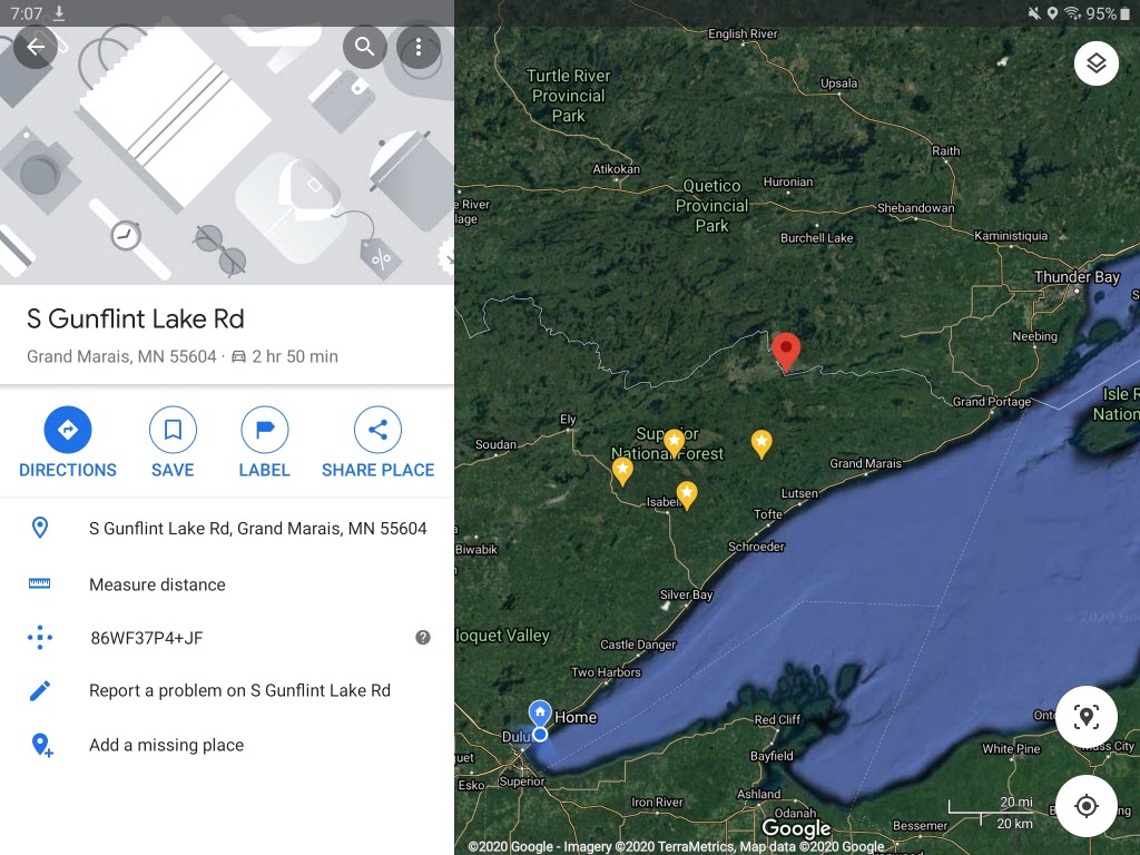
And the envelope please …

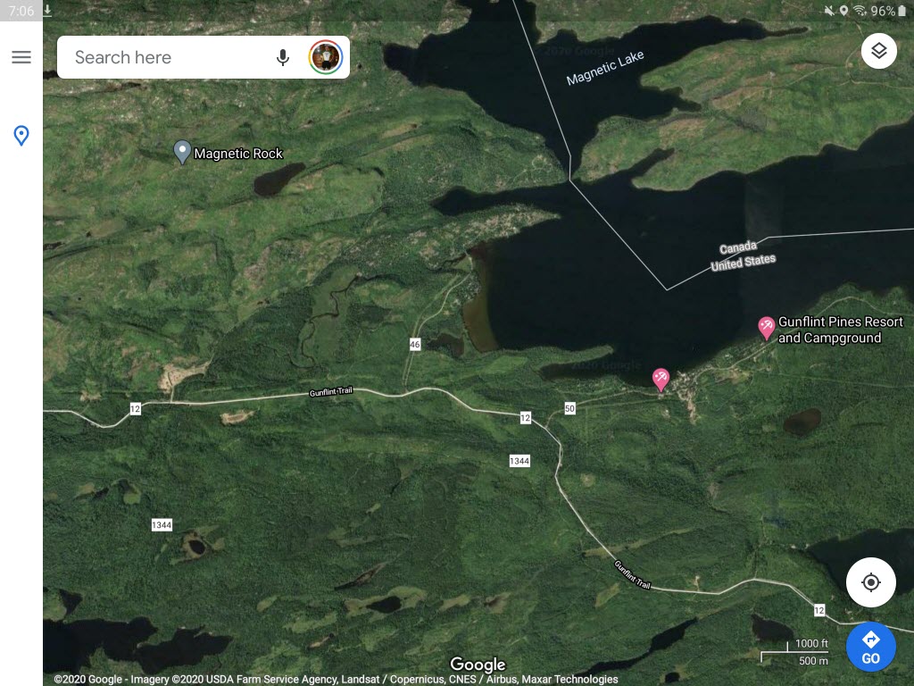
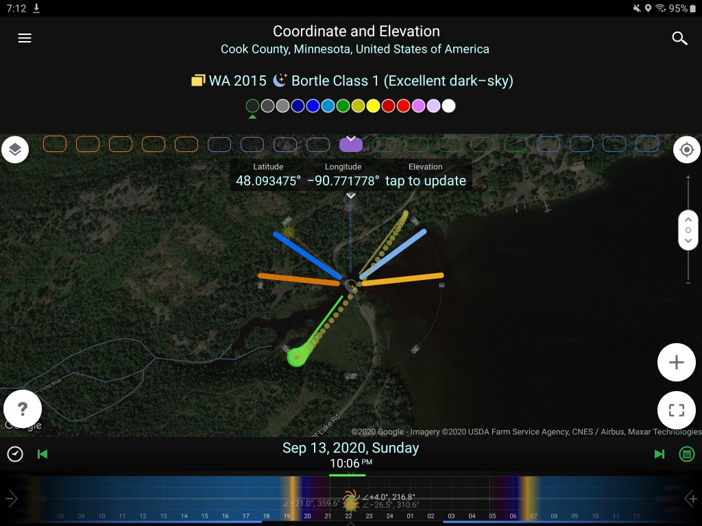
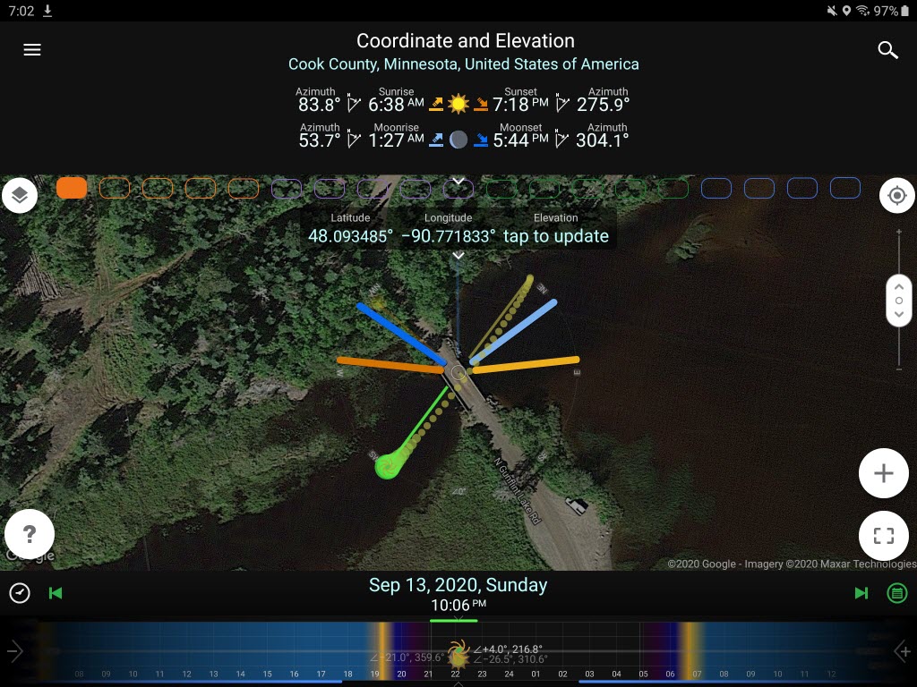
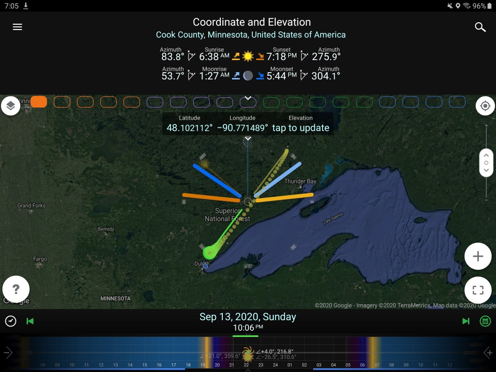
If you remember, in yesterday’s post I talked about my advanced planning process (and tools) which goes into a photoshoot. I promised today I would post the results of that planning and last night’s photos. Before revealing the images, let me comment that it is EXTREMELY rare that I go somewhere at night where I have never been to that location during the daytime. Quite frankly, it is not a good idea to stumble around in the dark at a spot you have never seen during the day. However, Google Maps Satellite View indicated both a boat launch and a bridge at my desired location … plus no hiking in the woods was required. I was comfortable with my unusual decision.

I had hoped to photograph the Milky Way around 10:15 pm, but clouds prevented that action. Skies cleared by 12:30 am, and it was still before moonrise. My only unforeseen issue was the cold air temperature (41F) resulted in fog and mist starting to form. By morning we would be socked in with fog, but at 12:30 am the skies were clear. Fog was already forming over the Cross River as I took my photographs. I expect by 1:30 am my desired photographs would have been impossible.

Milky Way over the Cross River (I light painted the scene / river with my small flashlight for about 1 second)

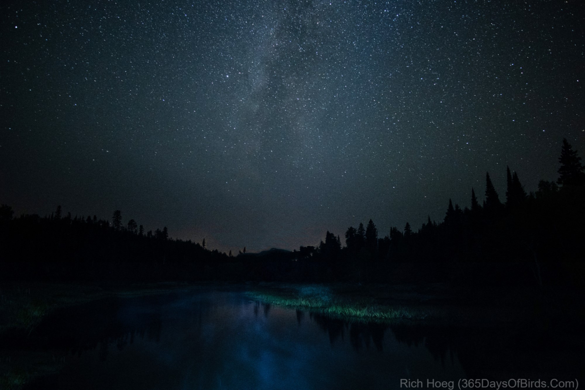
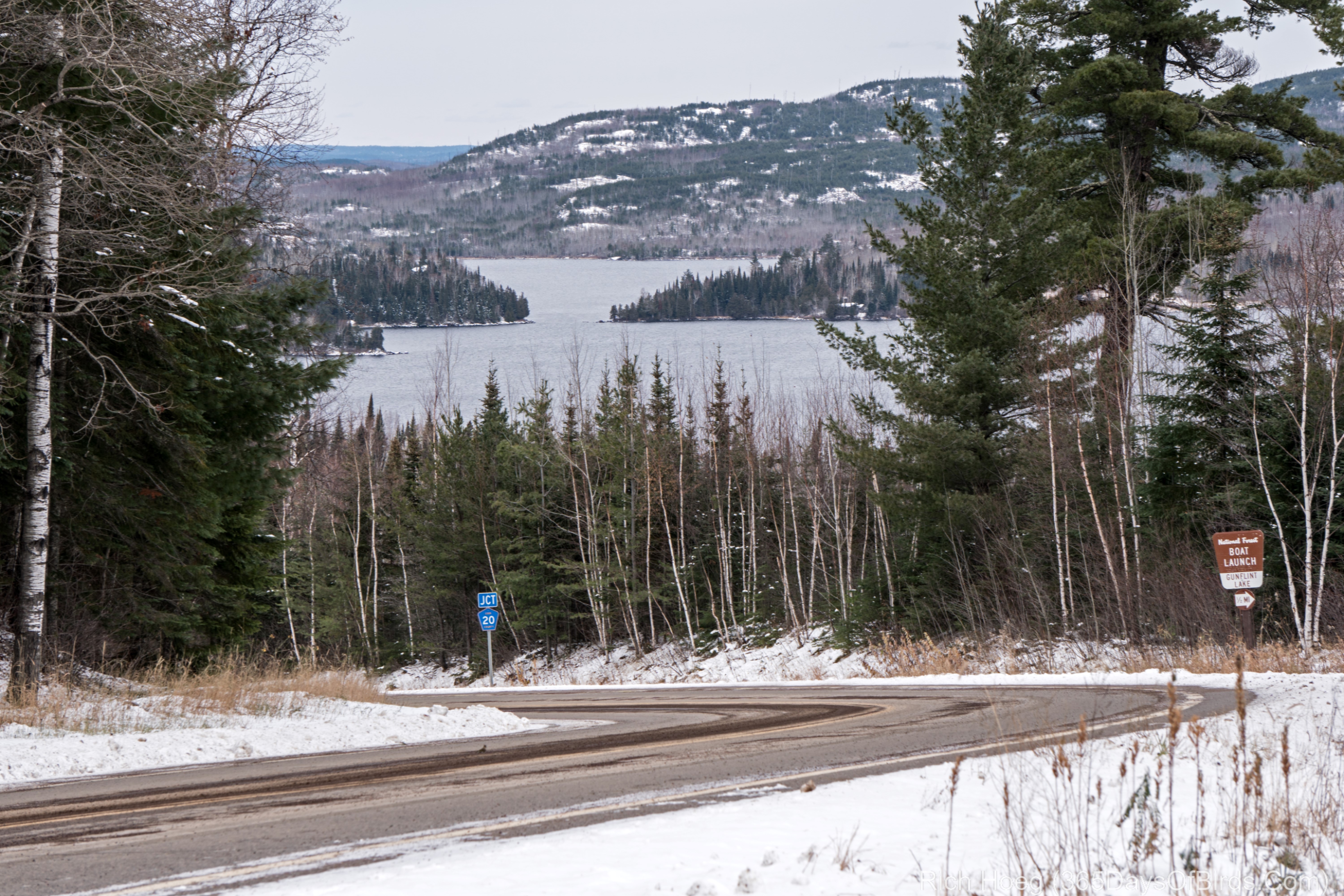
Post update … three nights later the air cleared … no moisture or forest fire smoke. This image resulted!!!


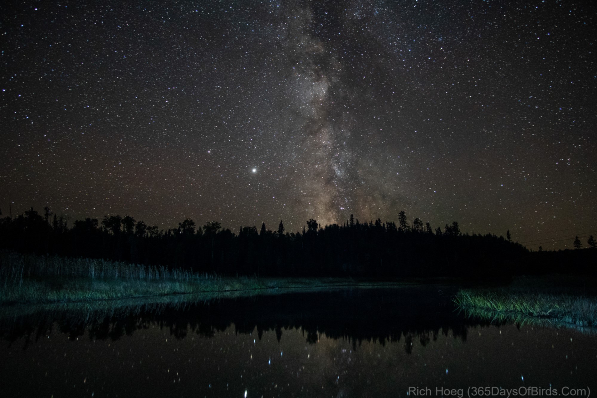
Northern Lights (very mild) over Gunflint Lake (I literally just turned around in place from where I was photographing the Milky Way! The Big Dipper may be seen just above the horizon and Aurora)


I was pleasantly surprised when I got up this morning to learn / read that the magazine Outdoor Photographer has a large article in the current issue speaking to the exact same planning process. I actually read this magazine (downloaded copy) via my local public library. They send me an email when the current virtual copy is available. Thus, even though I am only a mile south of the Canadian border in deep wilderness, I visited my public library this morning. You can use the same digital tools!

Here are three screenshots from Outdoor Photographer … specifically the cover, navigation, and the first page of the article on this blog post’s topic (Visualize, Plan, Shoot).

Advance Planning Photography

How does one get the shot? In my case my goal is to photography the Milky Way just a few thousand feet from the Canadian Border of Minnesota in the BWCA. The answer to the question is “advanced planning’. While I have never been in the exact location where I intend to visit late tonight, I have seen it “in my mind” and using online tools. Today’s post will walk you through the thought process behind my planned photograph. Tomorrow’s post will show you the result … good or bad. (see the results!)

My tools for this planning session are Google Maps (normal and satellite view), the Android App PlanIt Pro, and a Lunar Moon Phase App.

First … a screenshot of Google Maps Satellite View. I am located at the red pin maker.


Still using Google Maps, I zoom in using Satellite View. While I am staying at Gunflint Pines, I know the Milky Way is in the SW sky this time of year. For my photograph I want water, preferably calm water for reflected stars. Using Google Maps I zoom in and out looking for views to the southwest.


My Android App notes the skies where I am located at truly dark … a number 1 rating.


My research via Google Maps found the Cross River at its outlet from Gunflint Lake. Further research via PlanIt Pro gives me the exact location of the Milky Way at 10:06 pm … about 2 hours and 20 minutes after sunset. Normally, true darkness starts two hours after sundown. This location looks to give me water for reflected stars, and protection from any wind. We shall see. Remember … although I have spent a reasonable amount of time on the Gunflint Trail over the years, I have never been to this exact location.


Just providing a more zoomed out screenshot which will help folks better understand my location.


Finally a quick check of the Lunar Phases Map. The moon will not be an issue at 10:15 pm, and really all night … 21% illumination is not too much.


Anyhow … you now have an idea of my advanced planning which goes into tonight’s Milky Way photograph. Results tomorrow!

Oh yes … this is a blog about birds! I found one of my Great Horned Owls this morning about 7 am. For the past two weeks I had not been able to find any of the owls, nor have I heard the youngsters begging at night (was an almost nightly occurrence during July and August). I am beginning to wonder if the juvenile owls have finally been kicked out of the parent’s territory (normal).

Regardless, the owl was way up high, sleepy, and not open to much of any decent photographs.

Red Crossbills Near Gunflint Lake (video)

I found a flock of Red Crossbills this morning near Gunflint Lake … just a few miles south of the Canadian Border in NE Minnesota. Assuming a good local food source, Crossbills are one of the few bird species which will mate and nest in the dead of winter. Many of the birds in this flock appeared to be paired off, and by my estimation the pine cone crop looked very good in the area. Thus, I would expect many of these birds to nest soon.

Red Crossbills Gritting Up

Male Red Crossbill

Female Red Crossbill

A Happy Couple

Looking across Gunflint Lake towards Canada (about the only ice free lake in the area because it is deep)


Red Crossbills Video Link