Tag Archives: MN North: Greenwood Creek Bog

Greenwood Creek Bog Bird Feeders Update

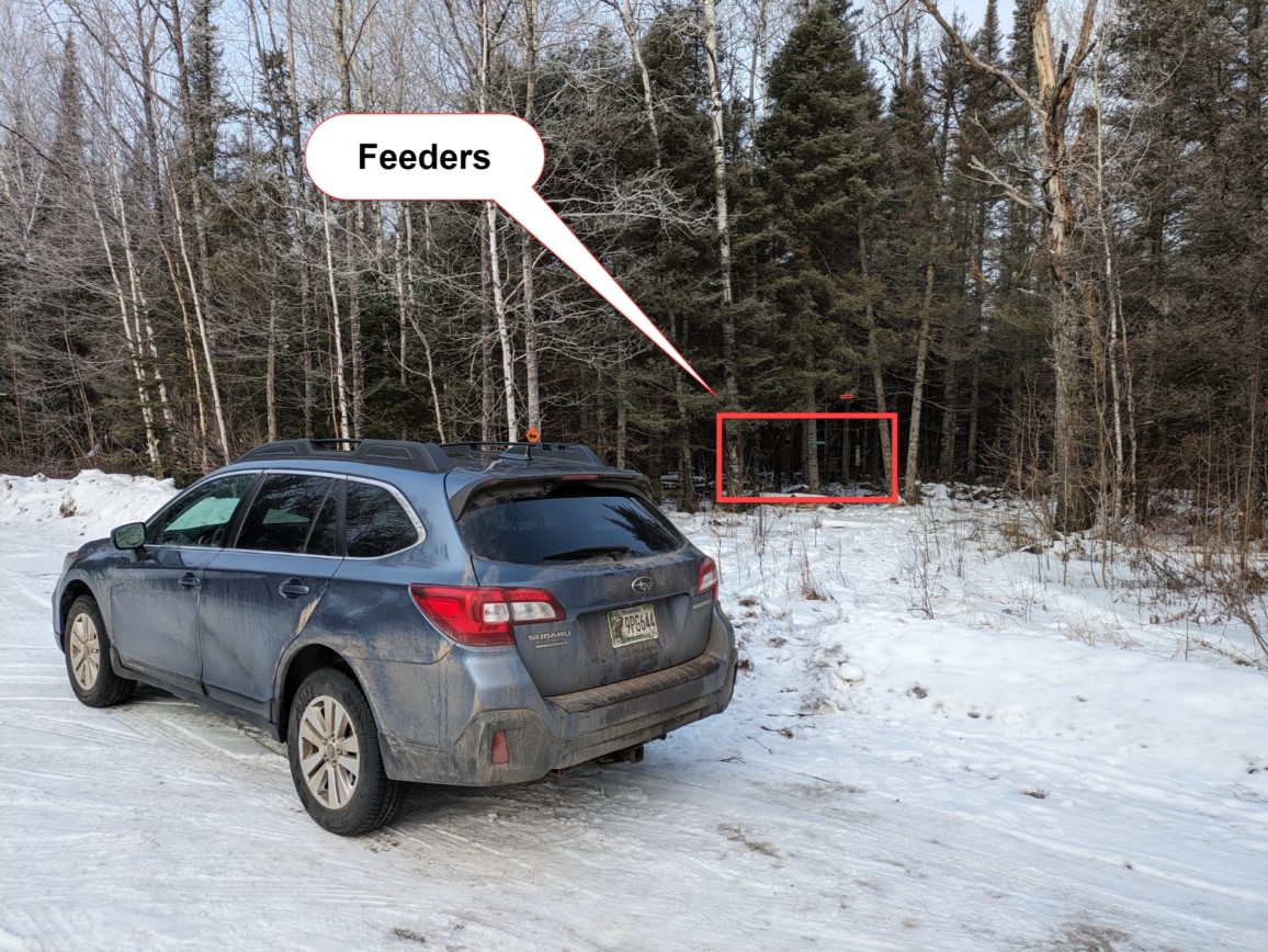
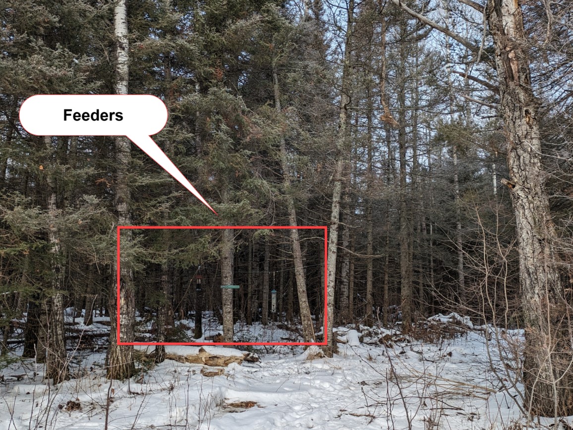
While the new location of the bird feeders still is not wildly active, the trend is very positive and it appears this will be their permanent home. Within 24 hours of my placing the feeders and scattering sunflower seeds, the local grouse population had discovered the offerings. As a fyi, over the past few months I have seen many, many roughed and spruce grouse very near this location, both on the trail (Forest Road #813) and out on the highway (Lake County #2).

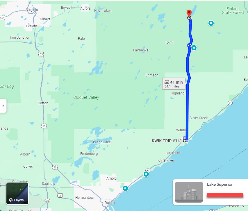
Yesterday morning, it was a treat for me to discover two different groups of birders at the feeders. Obviously I am successfully getting the location of the feeders out to both birds and humans! Here are all the details about the feeders including GPS locations, maps, hikes and more.

I enjoyed watching some Black-Backed Woodpeckers during a hike from the feeders this past Sunday. It was crazy warm … 52F in early February in the Boreal Forest. While I enjoyed the warm sun, this kind of weather is actually dangerous for the habitat and hopefully we will quickly see returns to much colder conditions.

Here are a few of my Black-Backed Woodpecker images. The couple were about 800 yards down the trail.  Before I move on to the photos two final comments:

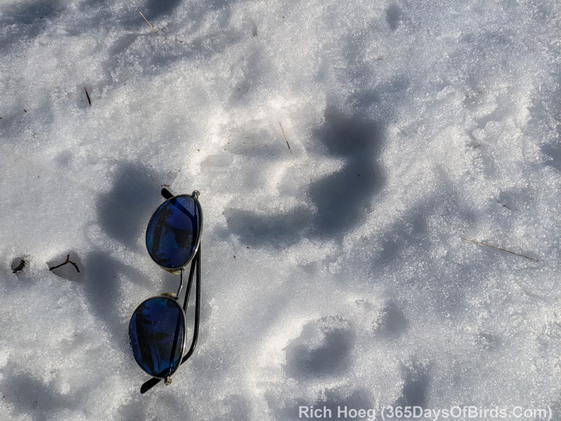
  • Included you will also find Lynx tracks. A family of these gorgeous cats are obviously in the area
  • Two owl boxes are on nearby trees. One box is about 300 yards down the bird feeder trail on the right (about ten yards off the trail). The other box is about one mile down the main trail (forest road #813) on the right … where the bog begins. I suspect the US Forest Service put these boxes up some years ago. Both boxes are in good condition, and appear to be focused towards either Saw-whets or Boreal Owls; however Boreals have not been known to have nested in NE Minnesota now for over ten years.


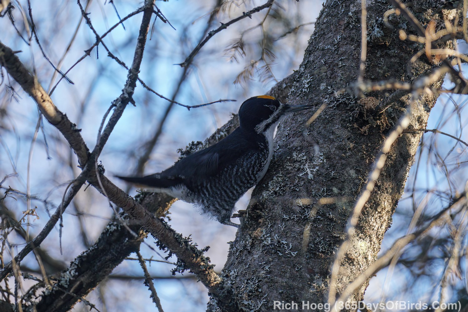
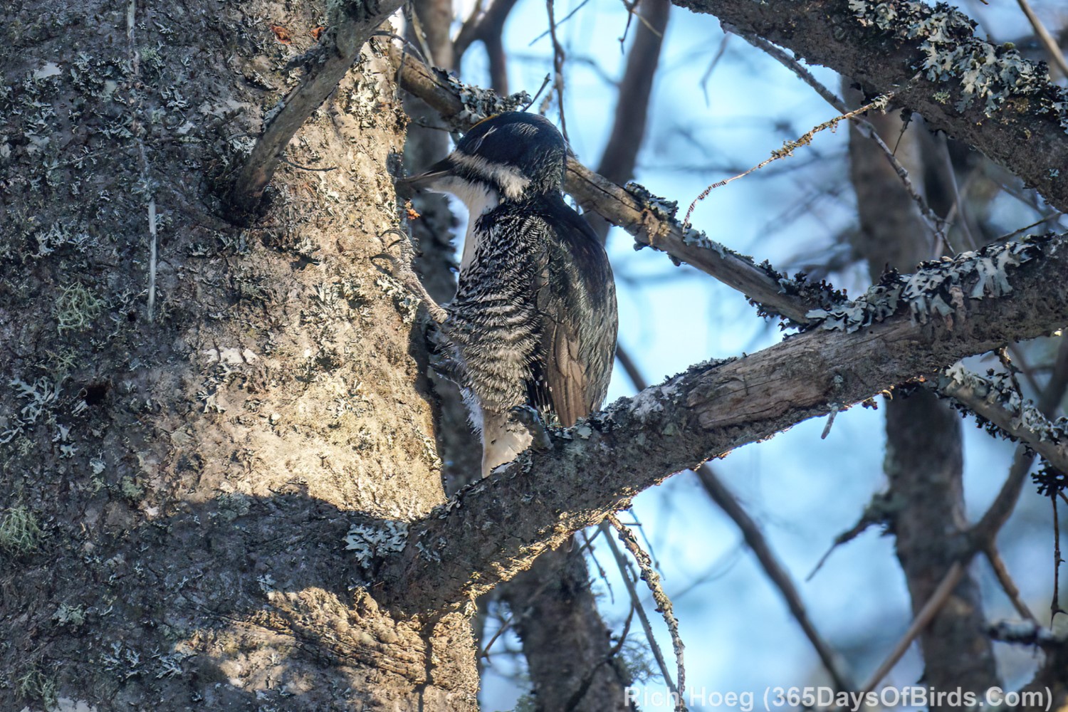
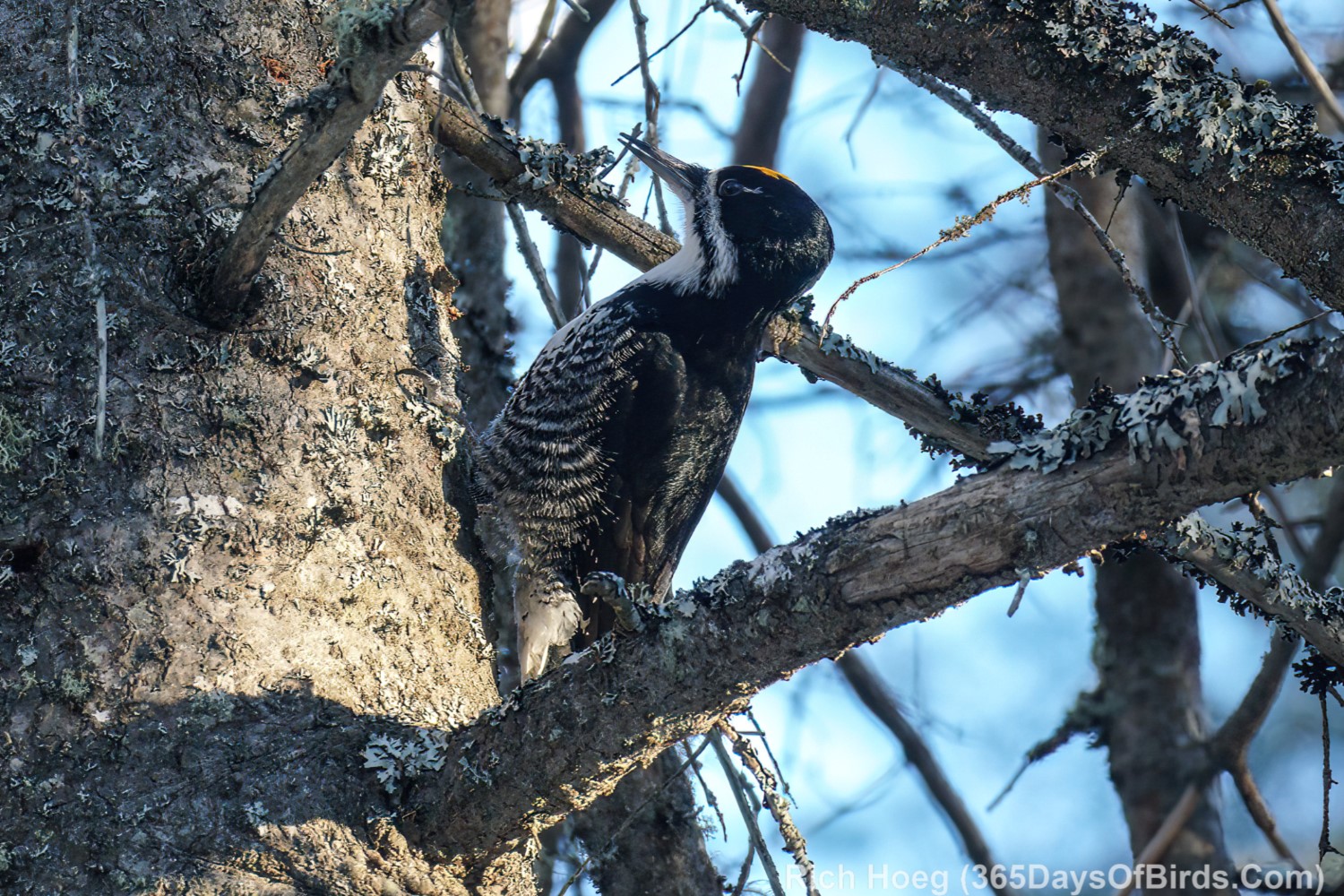
For this video of the Black-Backed, I have slowed the speed down by a factor of two (video link for email subscribers)


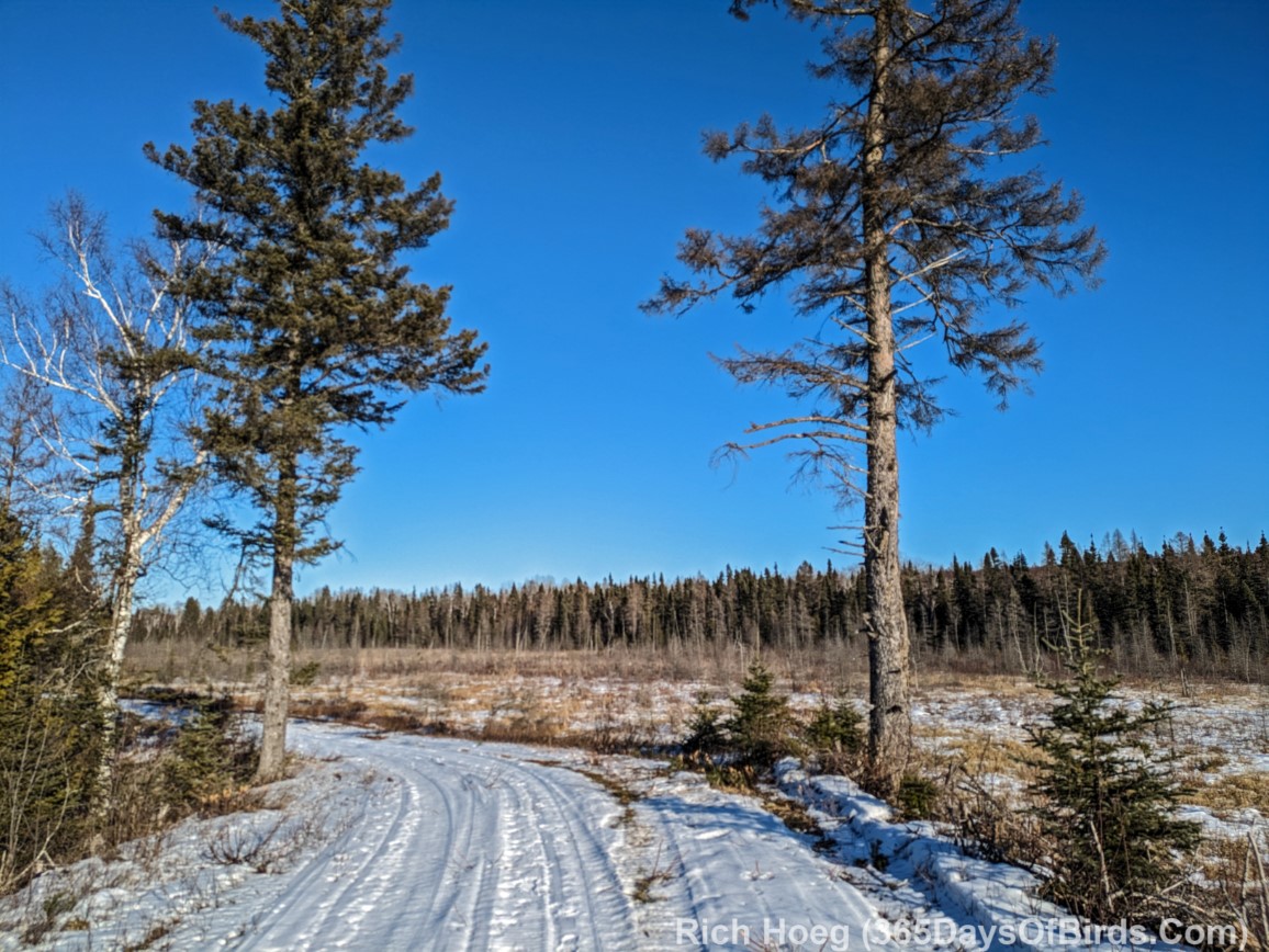
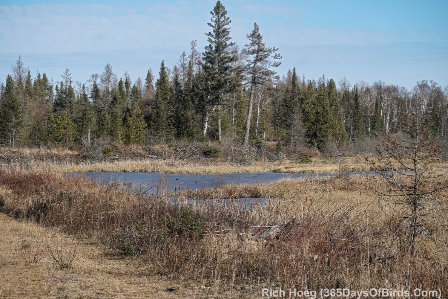
And finally two cell phone pics from my hike … the Greenwood Creek Bog and the Lynx tracks.

Ice Fog, Bogs and Feeders

My goal this morning was to move the Greenwood Bird Feeders. Over the past month there had been very little bird action near the abandoned railroad tracks immediately south of the burn area. I moved the feeders about four miles south near the Greenwood Creek Boreal Bog. Learn more … see images of the new location … get the new GPS Coordinates and see a map.

My trip 60 miles north of Duluth was into the Ice Fog. I took these two pictures on the Langley River Forest Road (built in the 1930’s by the Civilian Conservation Corps)


Finally quite a few people have asked me where the Cook Bog is located. You will never find this “place name” on a map, but here is a description: The Cook Bog is Boreal Forest Bog Habitat east and west of Cook, Minnesota. Some key roads include Hwy #22 going west from US #53, Johnson Road (#48) going east from US #53 just south of Cook, and Mn #73 which is a north / south road a bit west of Cook. Just like in Sax-Zim Bog, these roads will not be 100% Boreal Forest Bog. A person will need to learn Bog forest habitat and focus on those regions. Please understand many other back roads are worth exploring. You will NOT find “Cook Bog” on any map. In general this area is 45 to 60 minutes north of Sax-Zim Bog.

Greenwood Creek Bird Feeders (Superior National Forest)

Public Bird Feeders and Hike … US Forest Service Road #813
.
Here are GPS coordinates for the feeders: 47.493583, -91.654306
.

The feeders are just off Lake County #2 and within 20 yards of the parking area. In the winter the US Forest Service often plows this small parking area directly. Be careful NOT to block the snowmobile trail. Google Maps notes this Road as National Forest Road #813. Do NOT drive past the parking area. You will encounter wetlands within 1/2 mile of the parking area which would be difficult even for a 4 Wheel Drive Truck ..


When snow is not on the ground, there is an excellent two mile round trip hike from the feeders next to Lake County #2 to the Greenwood Creek Boreal Bog. It is an easy hike with little to no elevation change.

  • Greenwood Creek Hike Boreal Forest Bog and map: While the Sand River area north to Hwy 1 used to one of the best locations to find Spruce Grouse, the Greenwood Creek Bog area is now grouse central. I have seen upwards of 20 spruce grouse at one time in this area, but normally right after sunrise in the Fall. The hiking distance to the bog is only 3/4 of a mile along Forest Road #813. I generally hike past the bog till I reach Greenwood Creek. Without tall boots a person is not able to cross the stream.  Only 10 yards off Lake County 2 you will find a small parking area if you wish to take this hike (also the location of the public bird feeders).
  • Learn more about birding the Greenwood Area


Here is a map giving time and distance from the Kwik Trip in Two Harbors. As Lake Country Highway #2 tends to often be snow covered in the winter, assume it might take longer than noted to reach the feeders (34.1 miles). Google Maps refers to the parking area as the start of Forest Road #813. If you stop to bird along Lake County Hwy #2, pull way over. Logging tracks are common on this road.