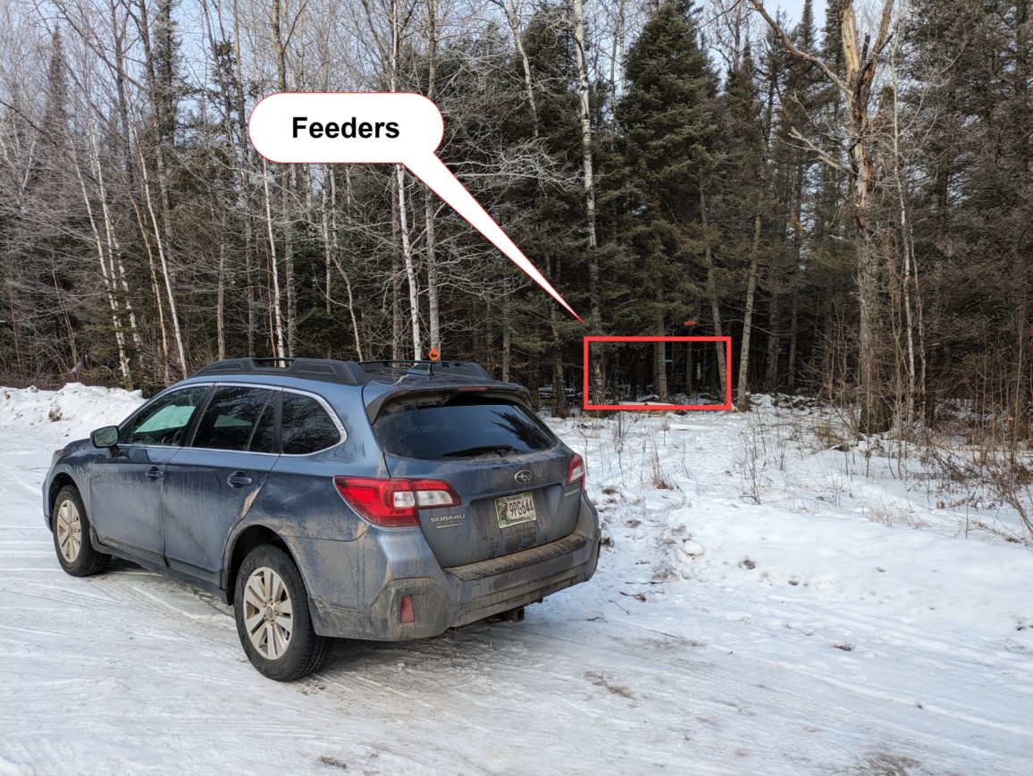
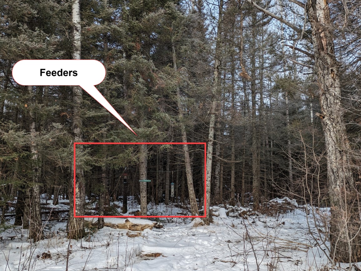
The feeders are just off Lake County #2 and within 20 yards of the parking area. In the winter the US Forest Service often plows this small parking area directly. Be careful NOT to block the snowmobile trail. Google Maps notes this Road as National Forest Road #813. Do NOT drive past the parking area. You will encounter wetlands within 1/2 mile of the parking area which would be difficult even for a 4 Wheel Drive Truck ..
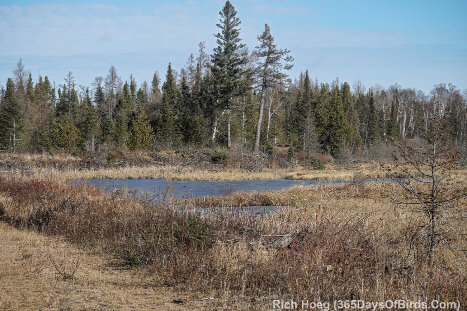
When snow is not on the ground, there is an excellent two mile round trip hike from the feeders next to Lake County #2 to the Greenwood Creek Boreal Bog. It is an easy hike with little to no elevation change.
- Greenwood Creek Hike Boreal Forest Bog and map: While the Sand River area north to Hwy 1 used to one of the best locations to find Spruce Grouse, the Greenwood Creek Bog area is now grouse central. I have seen upwards of 20 spruce grouse at one time in this area, but normally right after sunrise in the Fall. The hiking distance to the bog is only 3/4 of a mile along Forest Road #813. I generally hike past the bog till I reach Greenwood Creek. Without tall boots a person is not able to cross the stream. Only 10 yards off Lake County 2 you will find a small parking area if you wish to take this hike (also the location of the public bird feeders).
- Learn more about birding the Greenwood Area
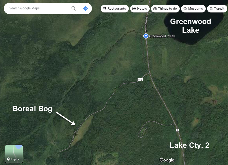
Here is a map giving time and distance from the Kwik Trip in Two Harbors. As Lake Country Highway #2 tends to often be snow covered in the winter, assume it might take longer than noted to reach the feeders (34.1 miles). Google Maps refers to the parking area as the start of Forest Road #813. If you stop to bird along Lake County Hwy #2, pull way over. Logging tracks are common on this road. 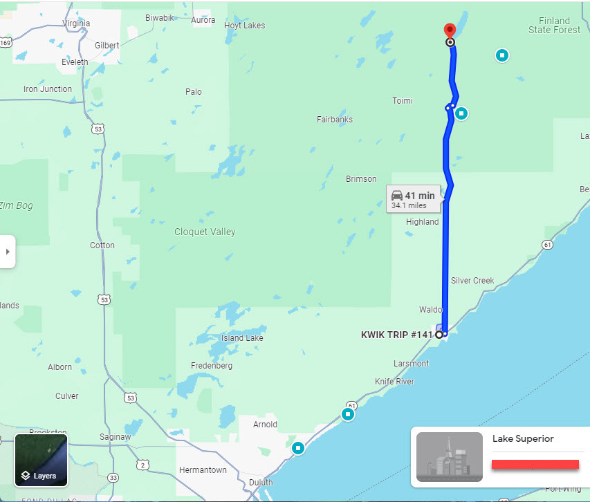
Discover more from 365 Days of Birds
Subscribe to get the latest posts sent to your email.
Awesome!! Thank you for sharing!!