Yesterday morning I ferried my two sons up to Moose Lake near Ely, Minnesota for the start of their boundary waters trek. Over the course of three days they are skiing and snowshoeing 40 miles through the BWCA. No motorized travel is allowed in this wilderness area, and there are no roads. Saturday afternoon I will pick them up at the end of the Gunflint Trail. The only other mode of transportation used in the winter in the BWCA is travel by dog sled teams.
While both boys are experienced outdoorsmen, northern Minnesota is an extreme environment in the dead of winter. I insisted that if the bus would run for their trip (i.e. me) for their trip, a satellite radio was a required addition to their kit. Thankfully, a family friend who has trekked in the Arctic and canoed twice to Hudson Bay had such a device that could be borrowed (thanks Bob!).
Ultimately our family will evaluate the satellite radio / beacon at the end of the trip, but I am quite convinced I will purchase the Garmin InReach Mini in the near future. The device costs $350 at present on Amazon, and communicates via the iridium satellite network. In addition a monthly communications contract is required. For approximately $15 per month, one has access to a SOS satellite beacon, the ability to send an unlimited number of 3 pre-defined texts, and free form texts (max ten per month, then a nominal charge applies). Last night we received a text with location information from the boys. They were safe and snug in their winter camp (i.e. tent).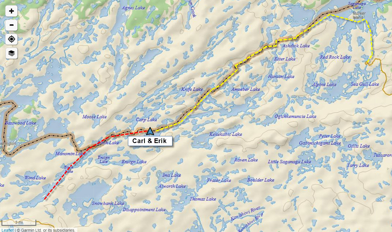
If you wish to learn more about the Garmin InReach system (three models), The Hiking Guy has published some fantastic and detailed reviews. My own research indicates the Garmin devices are more reliable than the leading competitor which is named SPOT, but check for yourself. All my serious outdoor friends who have trekked in the Arctic or tundra regions of Canada have the Garmin devices. Given how often I am off the grid either birding in northern Minnesota, or when bicycle touring throughout North American, I am thinking this may be a wise purchase. Here are the reviews from HikingGuy.com. (edit: if you are interested in these devices, make certain you read this post’s comments … good discussion and additional linked reviews)
I had warned the boys that during the drive up, we would be driving through prime Spruce Grouse habitat, and I reserved the right to make quick stops if a photo opp arose. Well, shortly after sunrise a pair of Spruce Grouse were planted right in the middle of the road. Carl and Erik commented that these birds must not be too smart given their perching location. I responded that a prime predator for Spruce Grouse were in fact logging trucks!
Here are the two Spruce Grouse … the temperature was -15F

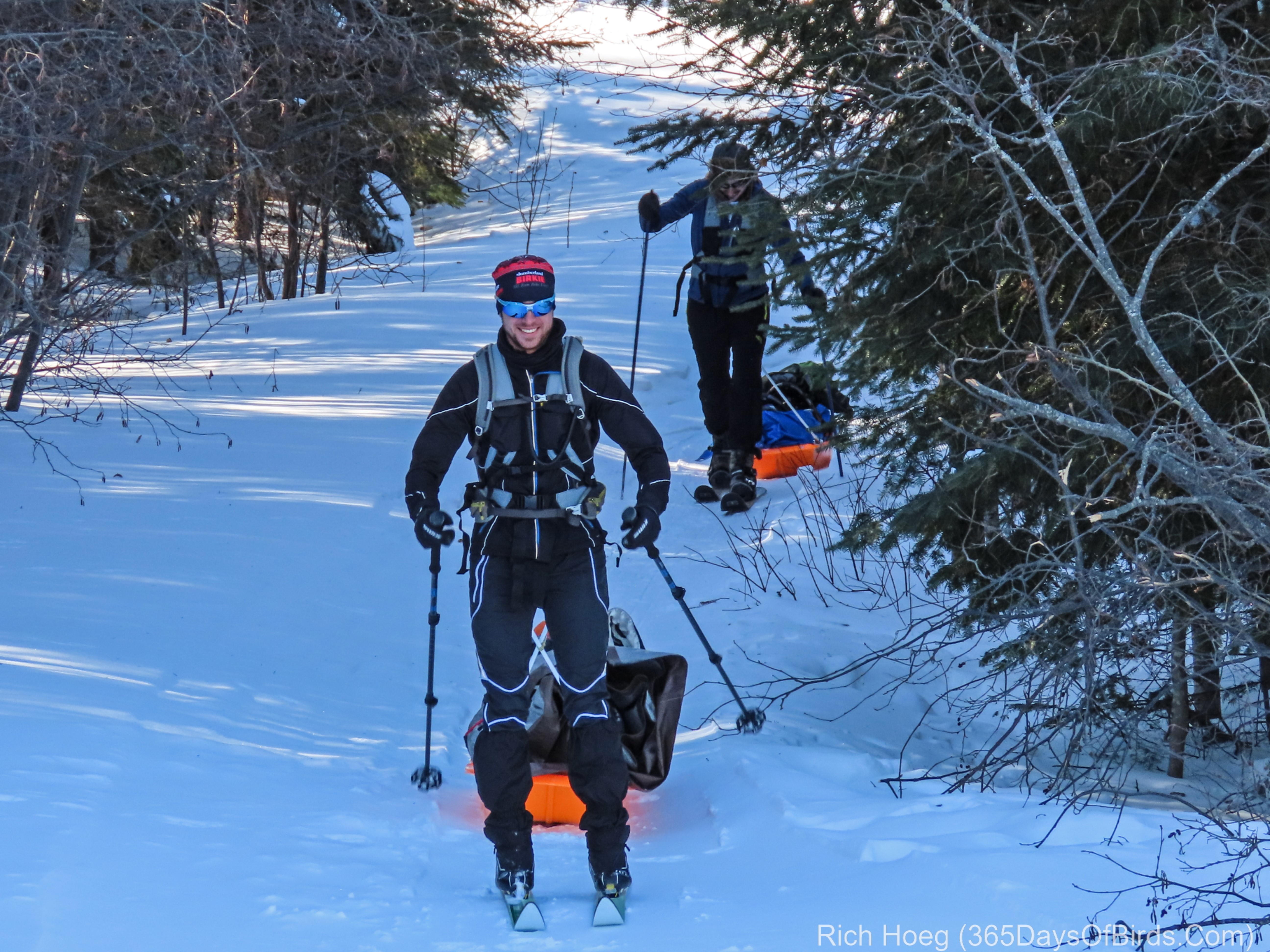
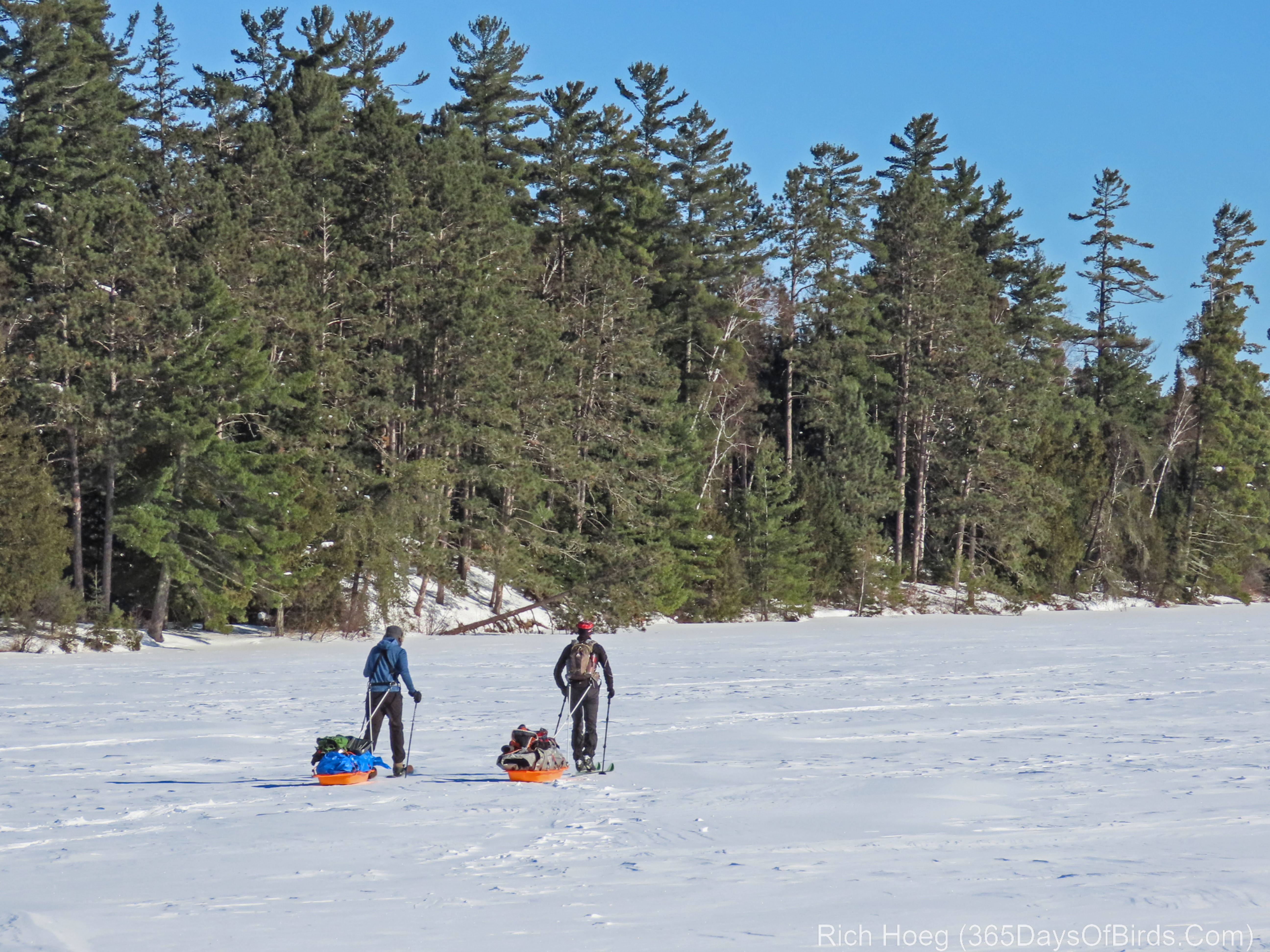
Finally, here are a few pics and videos from the boys starting out on Moose Lake. In case you are wondering, even though I put these boys on their first skies when they were just toddlers, at two weeks shy of my 63rd birthday, I had no desire to join them in this trek! LOL.
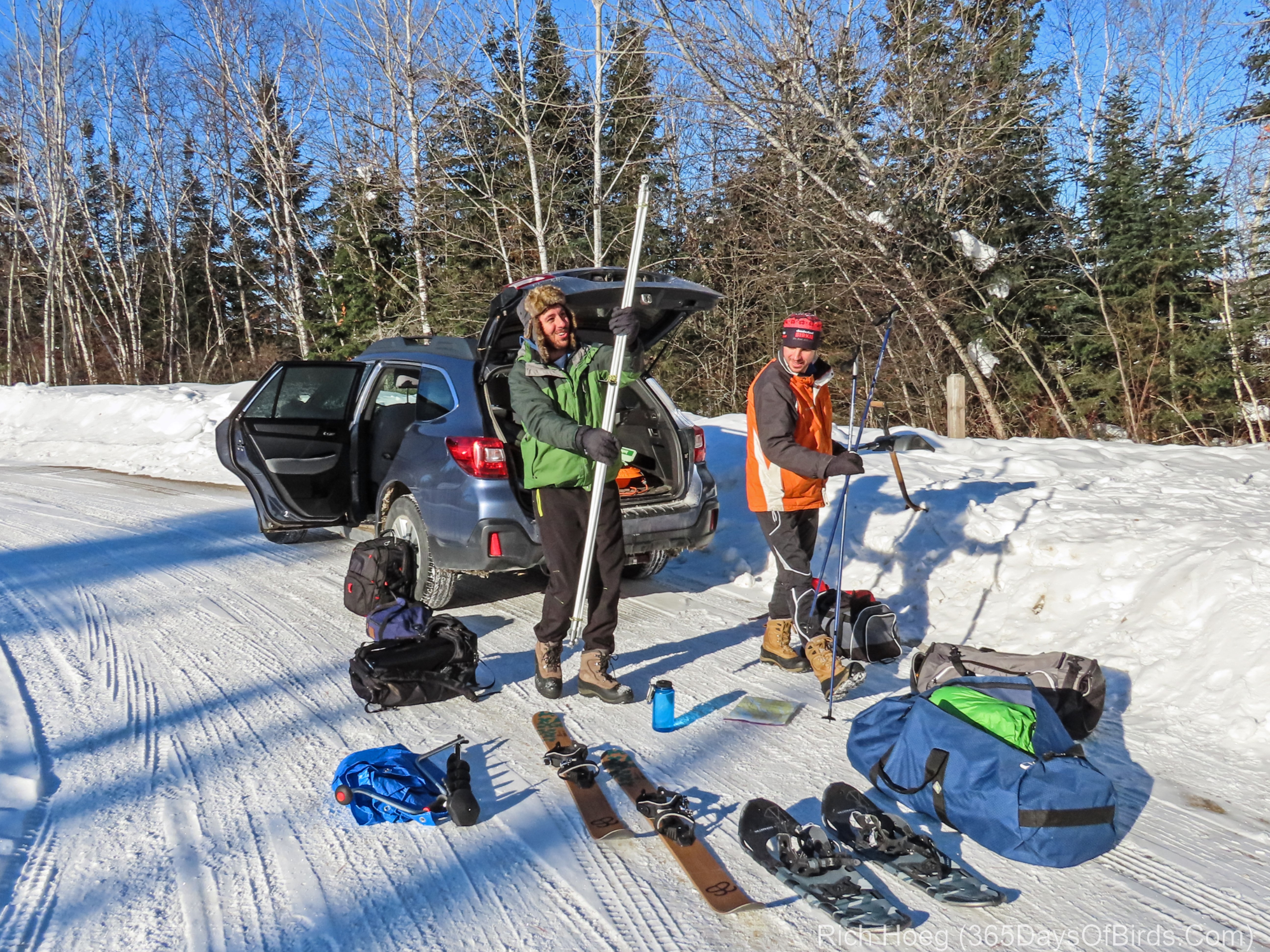
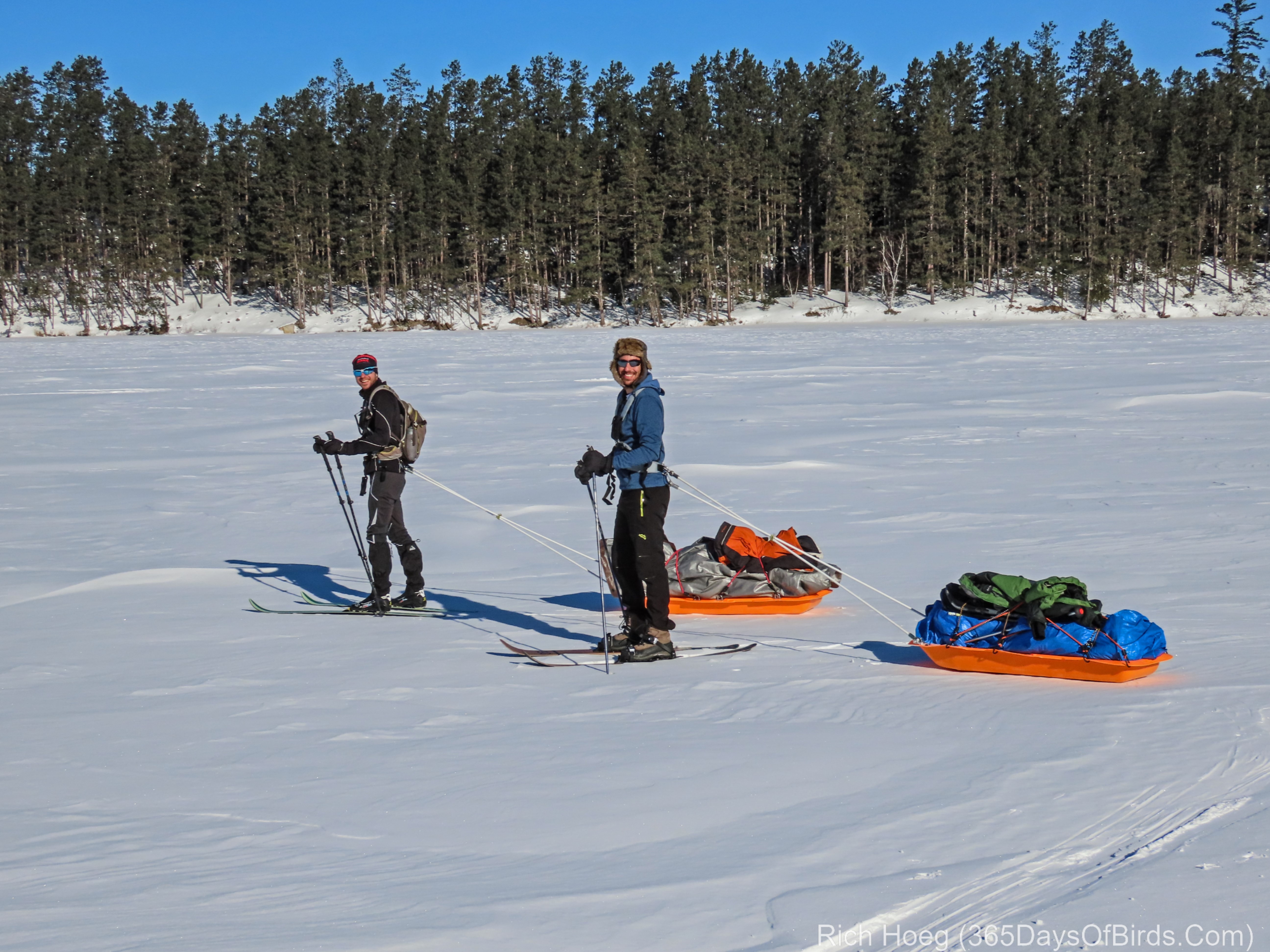
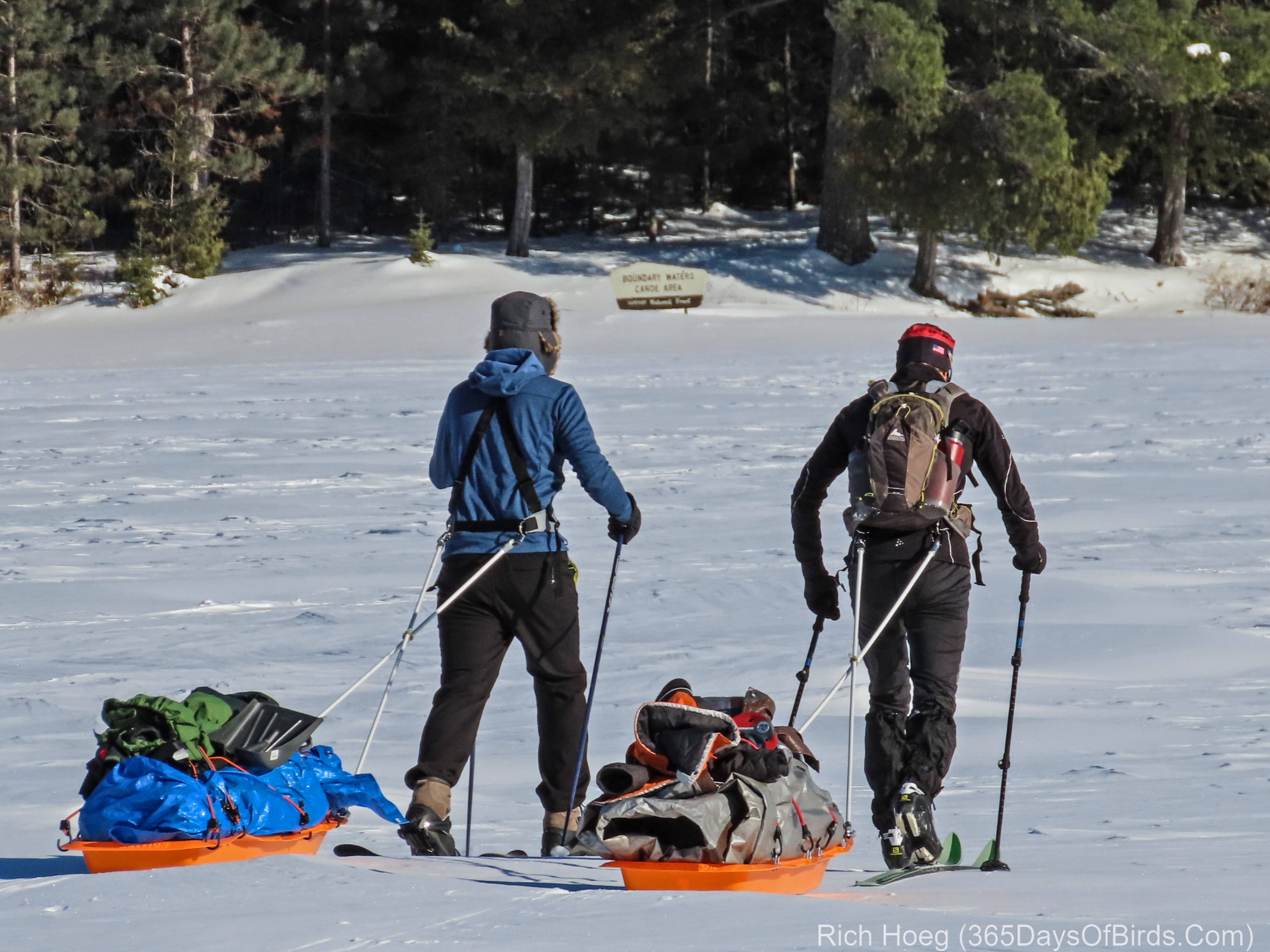
Starting Out at Moose Lake Landing
Entering the BWCA
Discover more from 365 Days of Birds
Subscribe to get the latest posts sent to your email.
Great discussion about the satellite communication GPS devices. I have been looking into getting a device like this and are leaning towards a system that does not do the messages but rather only acts as a SOS beacon. A device like this would not require a subscription plan and would only have a single purpose – to notify the authorities that your bacon is in trouble due to a SHTF situation. An example of such devise would be: https://www.mec.ca/product/5061-379/ResQLink-Plus—Personal-Locator-Beacon?utm_medium=social&utm_campaign=app&utm_term=ios&utm_content=5061-379
My experience so far with venturing into remote off-grid locations is that while you might be out of cell-phone range for most of the time, if all you want is to send a short text message you are likely to encounter intermittent, albeit crappy, signals now and then. You obviously cannot rely on this but in my neck of the woods this often seems to be the case. I am not sure why, but it could be related to the mountains. The higher you are the longer the reach your cellphone has. Just my thoughts.
The one comment many folks made to me was that it is very possible you may need help, but do NOT want to activate the international search and rescue process. Thus, being able to send some texts via satellite enhances the ability to have the proper response.
That is a good point that definitely speaks in favour of the subscription-based system where one can send messages. This might perhaps be a more likely emergency than the no holds barred scenario where the full emergency response is required.
I am so glad that I signed up to get your updates. Your adventures and your sons adventures are so inspiring and interesting, let alone the great Spruce Grouse picts. Thank Rich for taking time to share your adventures in the outdoors.
I’ve never been to the BWCA, but have heard many stories from those who have. One thing I can say is that at least they won’t have to battle the mosquitoes.
It was amazing 0 bugs!
Well done, Carl and Erik … follow-up post coming this evening which will feature Bullwinkle … the moose which gives car washes at the end of the Gunflint Trail!
So great to hear about this. I look forward to more updates.
I just started a comparison list of satellite GPS communication devices like the inreach. The device they are using is the one I am considering getting the most. I have an active spot currently and I am fine if you want to borrow it to compare the differences. And actually would appreciate another brain to help with me committing to a new device. The spot worked for me but requires a year subscription which I really don’t like. Besides the antiquated software to make it work. I am hoping my next device has a month by month plan & can help with route finding as well. I will peek at your links above.
Great idea. Would love to compare. Check out the review of the InReach devices on Hiking Guy. There is a communications plan which allows you to turn it off and on … only using it when desired. The cost is a bit more per month. If you only need it at certain times of the year, this kind of plan saves money. Another item I really like about the InReach is it confirms the message was sent. It sounds like Spots do not confirm actual receipt / connection with the satellite network. The Spots uses a different network, not Iridium. The reviews I have found seem to indicate Iridium is a better network.
We use a pair of inReach units when we go to Isle Royale, since we are often hiking in different areas and can keep each other up to date on progress, locations, etc. (Mine are the old Delorme units… can’t believe how much Garmin has upped the price!) The ability to do two-way communication, which Spot can’t, is the critical difference to me. Plus, if you do need to make an emergency call, the rescuers can contact you and find out exactly what the issue is. The interface on the inReach is clunky — you have to use the joystick to select each letter (for those messages not preprogrammed).Garmin has done very little to update these units, but you have to think that’s around the corner. I also really like the ability to turn off the subscription for extended period of time. Two other reviewers to check out — dcrainmaker.com and andrewskurka.com. Both have extensive reviews. (dcrainmaker is best in the business with this stuff.)
Thanks for personal use cases, and other review sites!
It appears they share their father’s adventurous spirit.
This just me smile for several reasons. Lucky boys–I’m sure they know it:-)