Two days ago at sunrise I explored the Pine Island State Forest … Boreal Forest bog land (Google Maps link). This area is sweet! Fantastic Boreal forest habitat. The Google Maps location I pinned is 25 miles from the town of Big Falls … half by wilderness paved road (county road 30), and half by small, beautiful dirt road (Pine Island Island Road). For entire 50 mile round trip I saw zero cars or people. This area makes Sax-Zim Bog in terms of bog road access look puny. Think of either McDavitt or Admiral Roads … only a few miles each of prime bog habitat and now increase BIG time! I would have driven additional roads, but many roads are closed due to the record flooding and washouts in the Rainy Lake Watershed (see Pine Island State Forest website for road closures). If you want to replicate my drive, take County Road 30 from Big Falls west till the pavement ends at a T-Junction. Turn right onto Pine Island Road. (smart idea to download Google Maps for offline usage … see my post)
Why would you visit this area, specially when Sax-Zim Bog is much closer to civilization? That’s a good question. During the prime winter months if a Great Gray Owl is spotted on one of the popular roads in Sax-Zim Bog, you will likely be sharing your viewing experience with 10 to 25 of your best friends (i.e. folks also birding the bog). Pine River State Forest will return you to the wilderness experience where one enjoys the solitude of the outdoors, but you will need to rely on your own birding skills.
The town of Big Falls provides many resources for a great birding experience:
- Canoe the Bog (yup … use Rivers North Mn … rent a canoe, do the Big Fork River, paddle downstream and be shuttled back to your car)
- RiversNorth is located (and part of) in Gordon’s General Store … the store just purchased by Joslin last week … the name of business will may change in the future to Big Falls Mercantile.
- The municipal campground is beautiful, spotlessly clean, and even has flush toilets … located right next to the Big Fork River rapids. I took the short video given below of the rapids (vantage point is the municipal campground)(video link for email subscribers). The water was steaming because even on June 7th, the temperature was 39F shortly after sunrise.
- The place to stay … by far … is The Home Town Motel in Littlefork. Birders for years have stayed here, and the town of Littlefork is just down the road, US71, from Big Falls.
- Big Falls has a small grocery store, gas station and motel (looks nice, but I did not personally stop and meet the owner or see the rooms (Becki’s Inn)
- If you want a restaurant, that requires a drive of 20 minutes to the town of Littlefork and the Jackpine Savage Grill (closes at 8 pm, not a bar)
Here is one photograph and two videos from my drive. The mosquitoes were worse than I have ever experienced, but that is because of the record flooding. I got out of the car once and that was a major, major mistake.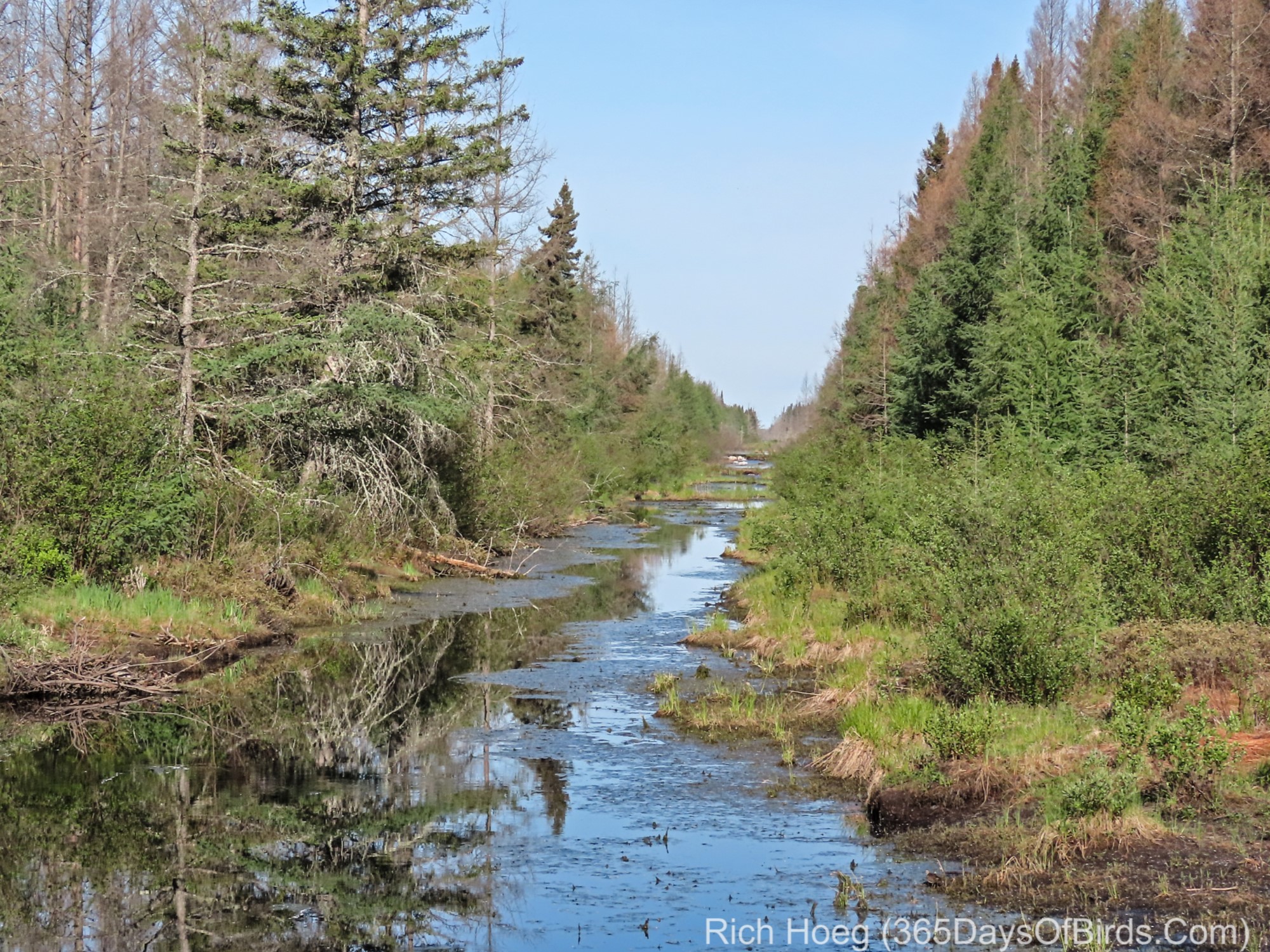
My drives along Pine Island Road through bog land … video links for email subscribers: one | two
Apparently a few other folks have birded this area. Here are eBird reports for the other road back to County 30 (Toomey Williams Road) … people often counted 10 to 20 Nashville Warblers! Toomey Williams Road was closed due to washouts and flooding; however zoom in on Google Maps using satellite view and notice that Toomey Williams has a small stream running alongside it for almost its entire length!
In short Pine River State Forest is very much worth a trip … but when the waters recede and some mosquitoes die! I’m willing to give the area some PR because most folks by far will still only go to Sax-Zim Bog.
Discover more from 365 Days of Birds
Subscribe to get the latest posts sent to your email.
It was such a pleasure to meet you! Thank you for the kind words!! Your knowledge is amazing !! Can’t wait to have you back in the Bigfalls Mercantile!!!