No bird photographs accompany this post … just very important birding information and maps. For those of you who have ever driven the stretch of US Hwy. 2 just West of Floodwood, you have undoubtedly noticed the HUGE area of beautiful Boreal Bog that stretches as far off the road as the eye can see, and is on both sides of the highway for miles. This bog’s formal name is the Wawina Peatland and Scientific Area. The region is remote, and almost impossible to access, but I finally found a road yesterday afternoon that provides extremely good access … the Hedbom State Forest Road (just west of Floodwood). The biggest section of the Wawina Bog is actually on the southern side of US Hwy. 2. My impression of the habitat seen from Hedbom State Forest Road is it is truly magical … with lots of Bog with open spaces interspaced into the forest yet also including a large number of deadheads for use as raptor hunting perches! Warning: Be very careful of logging trucks if the road is plowed in the winter. The forest road is single lane, and would require you to back up a loonnng ways!
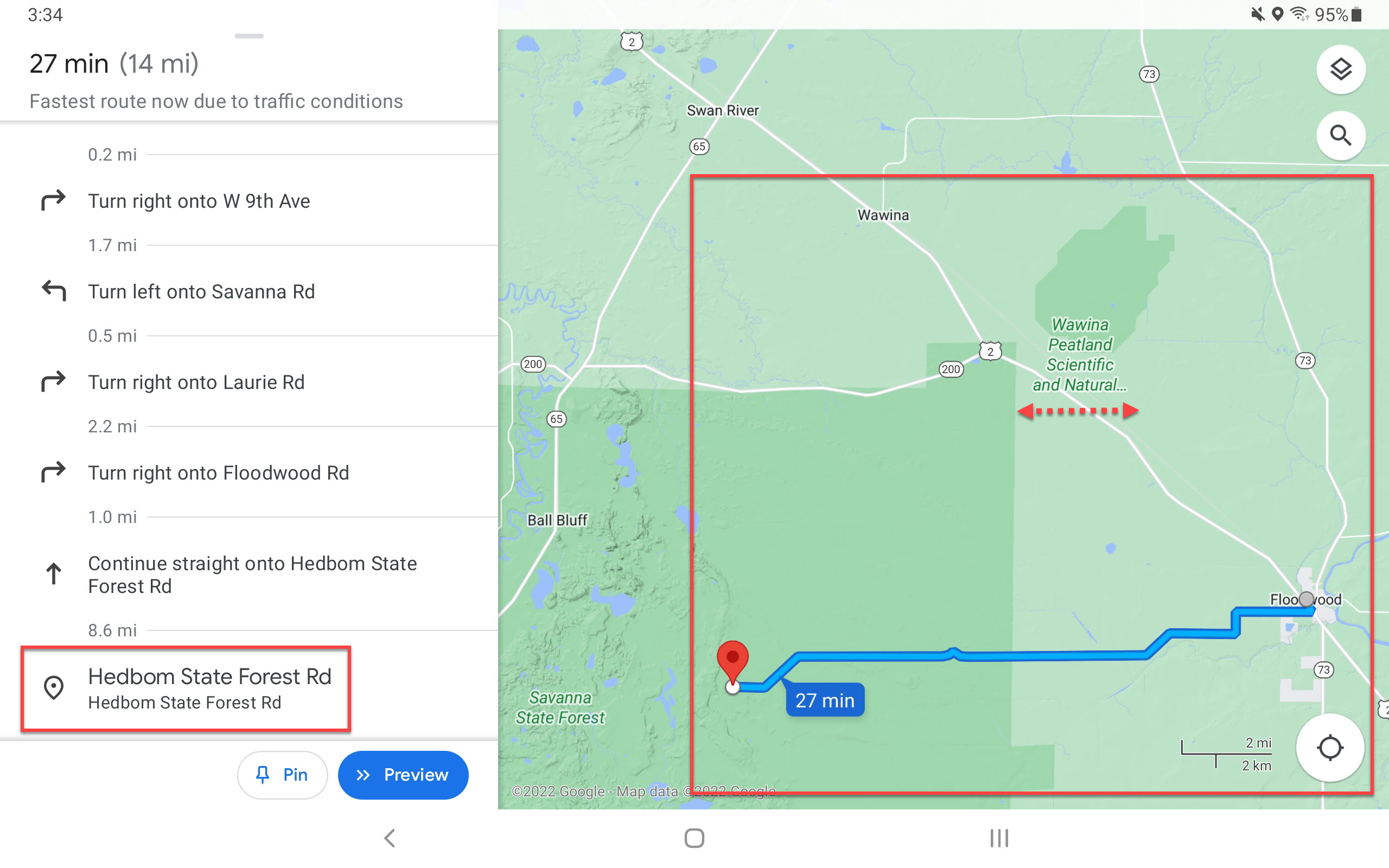
Here are two screenshots I took via Google Maps and annotated. The satellite image shows the Bog area (my rectangle area), and the terrain version demonstrates it is not worth driving past my Google Maps GPS Point. Further west of my point on the Hedbom State Forest Road the land becomes rolling hills and deciduous forest … still beautiful, but not what this birder was looking to experience.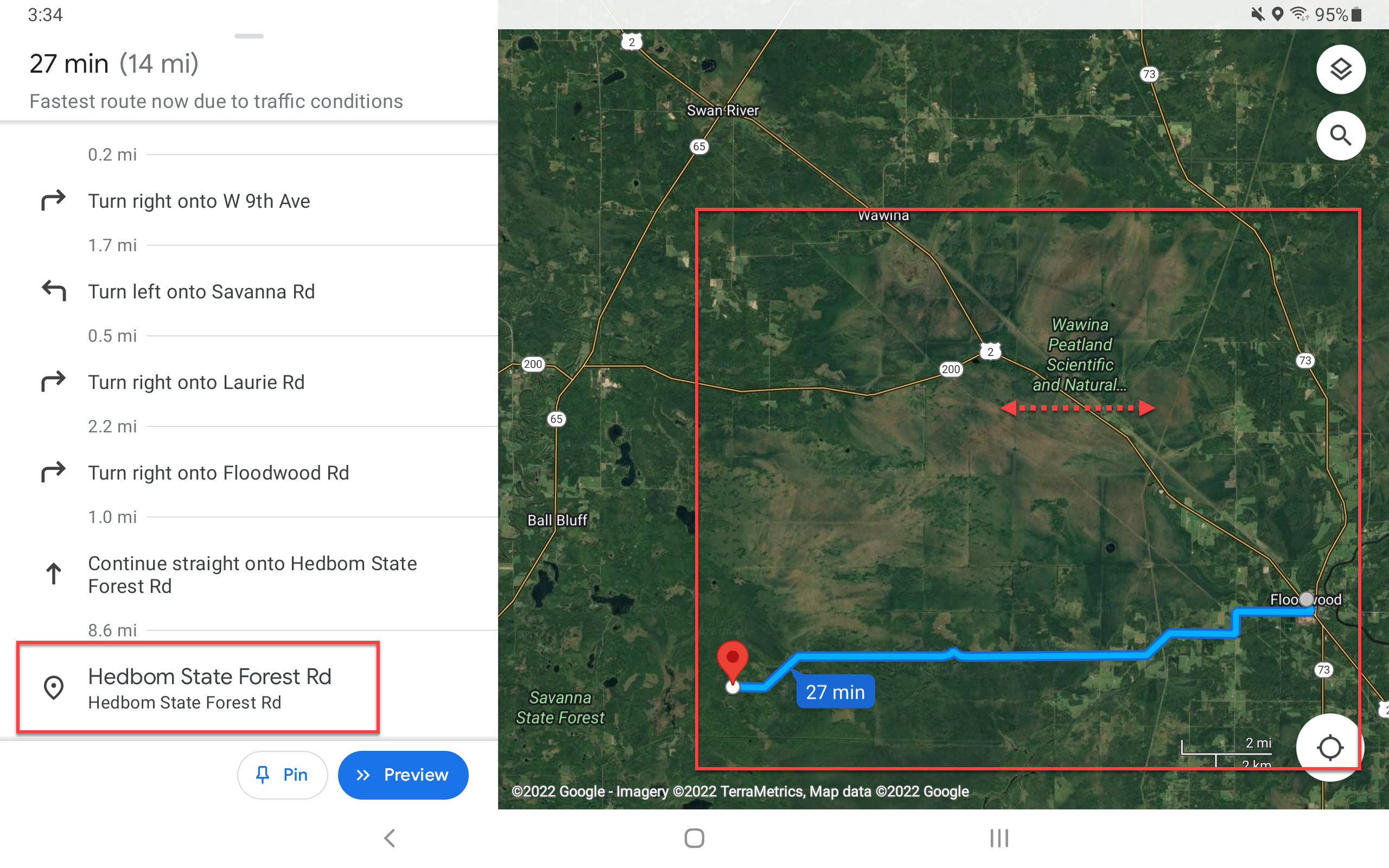
If you don’t have the time to drive the Hedbom State Forest Road (or later in the winter it will be snowbound … not plowed), then try the short four mile stretch of Cty. 429 that starts at Wawina Township on US Hwy. #2. This road will be plowed through the winter, but it does not get you anywhere as deep into the Bog. I found this Red-Tailed Hawk on Cty. 429 this past fall.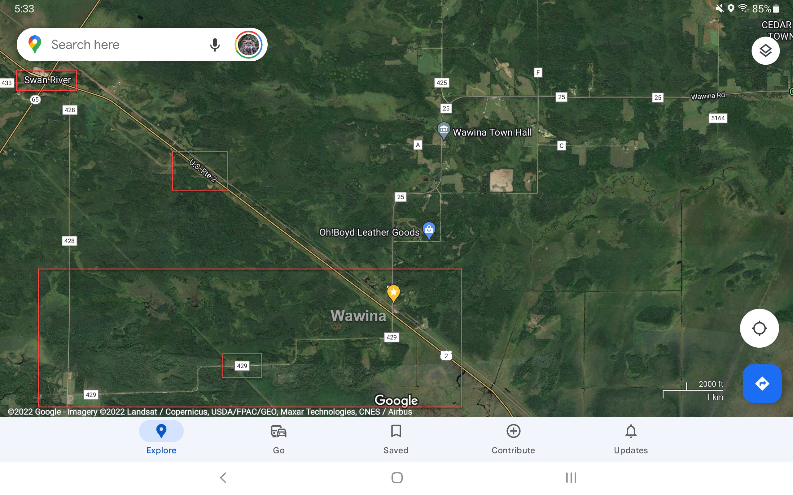
Once again, here are the GPS Points for the Wawina Bog / Floodwood Bog via the list I maintain on Google Maps.
- Google Maps GPS Links: My List
- Cty. 429 near Wawina
- Hedbom State Forest Road west of Floodwood
Discover more from 365 Days of Birds
Subscribe to get the latest posts sent to your email.