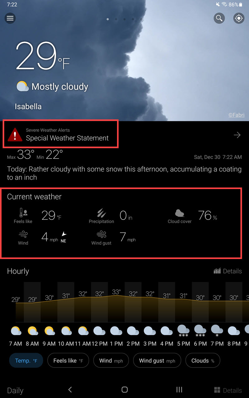
This morning I had planned to return to the Greenwood Forest Fire Burn Area which is 40 miles north of Two Harbors. Before heading out on a birding outing, I always check the weather conditions, and sometimes the road reports. Optimal weather in the winter involves both safety, and understanding if I am likely to be successful. My check of the weather this morning put an end to my birding plans … icy roads and low visibility.
The number of weather apps available for either the Android or Apple platform is mind boggling. I will review the app I use, and indicate the aspects of the app I like and why. Obviously other apps may have similar features … the key is does your app provided you with the necessary data. My app is WeaWow (Google Play | Apple App Store). The basic app is free and has no advertisements, but for a small $2 donation you may unlock additional sources used for weather data input.
Click / Press Upon any Image to View at Full Size!
The StartUp Screen & Overview
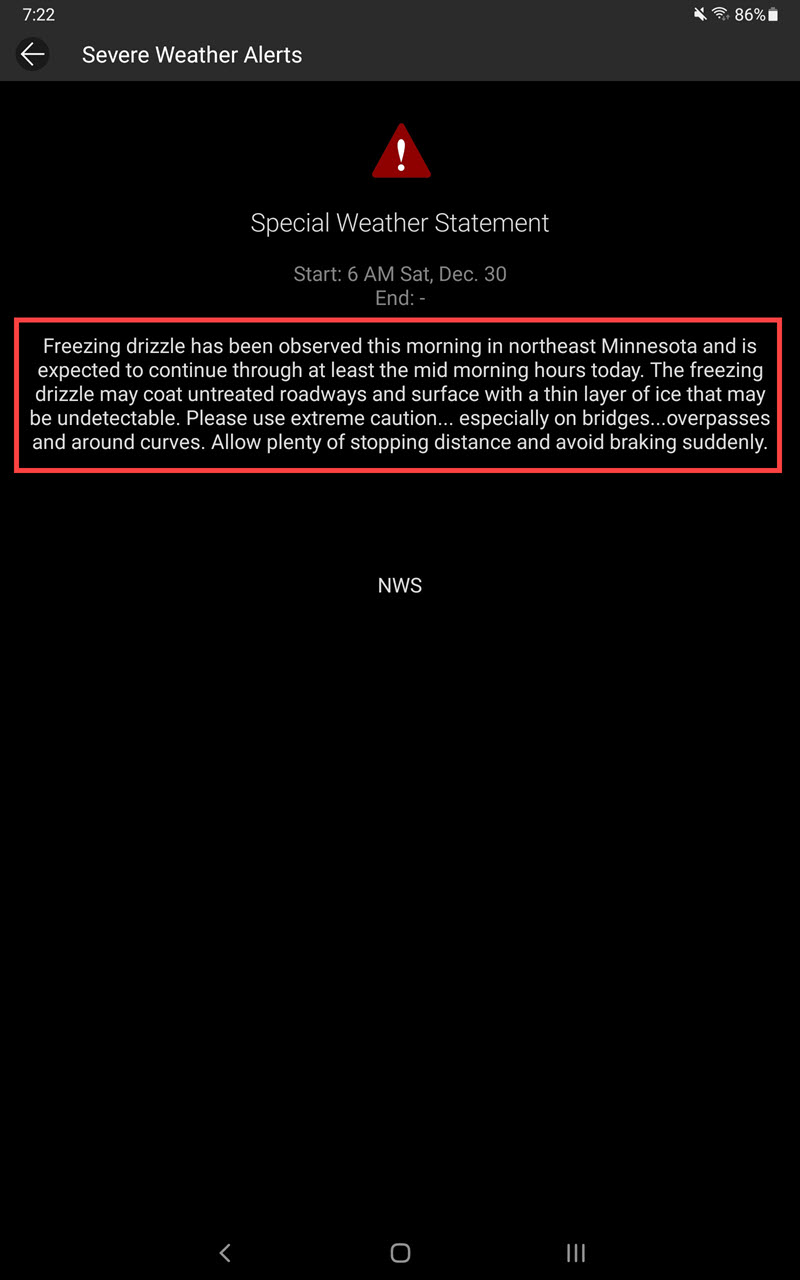
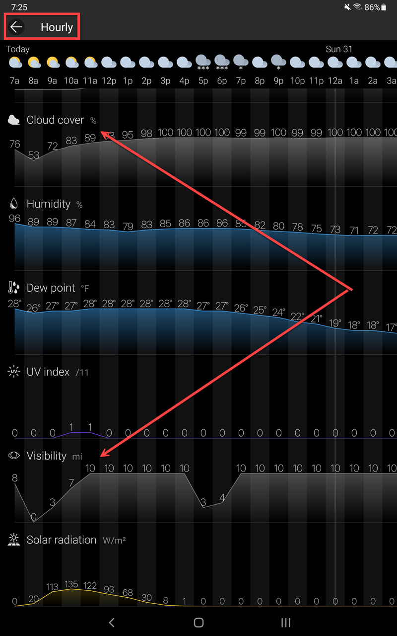
The Weather Warning from the US Weather Service (based upon this warning I did more research. Not too surprisingly I am very interested in wind speed / direction, cloud cover, and visibility)
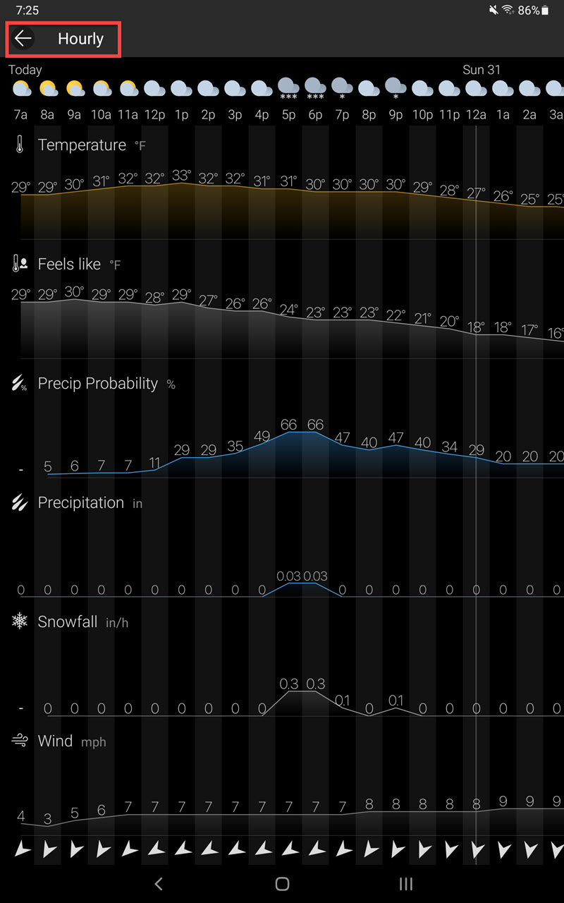
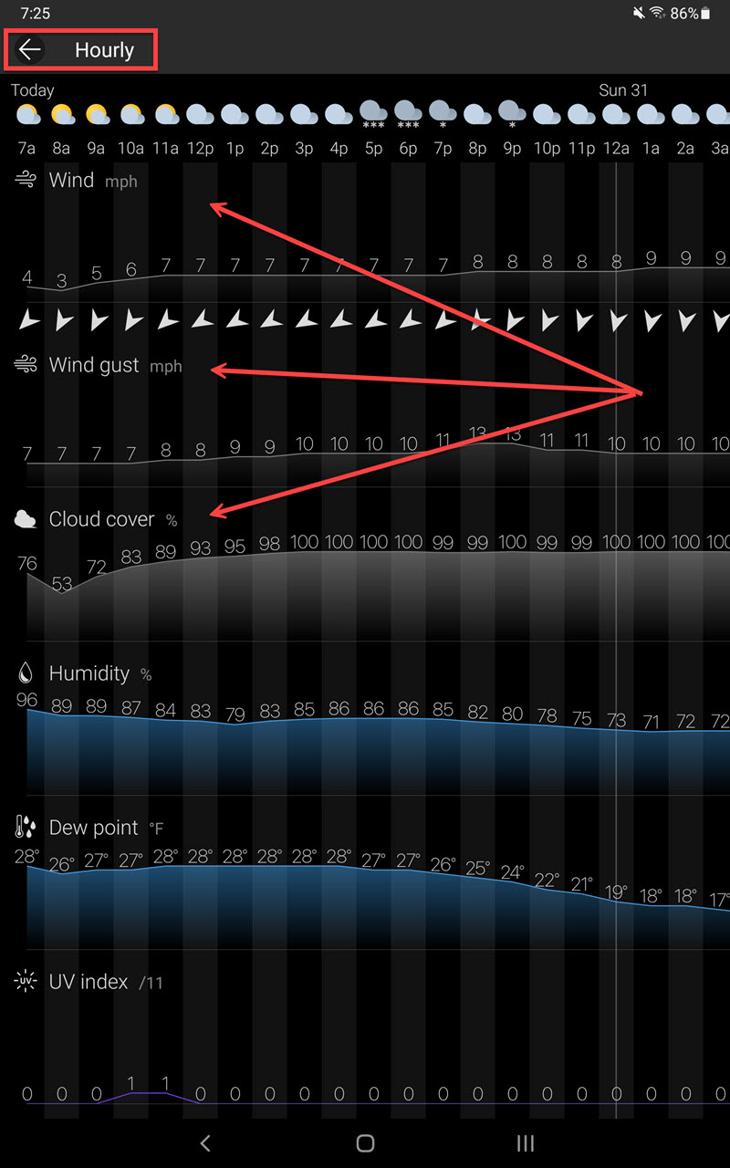
Hour by Hour Forecasted Details (my arrows point to information in which I have most interest)
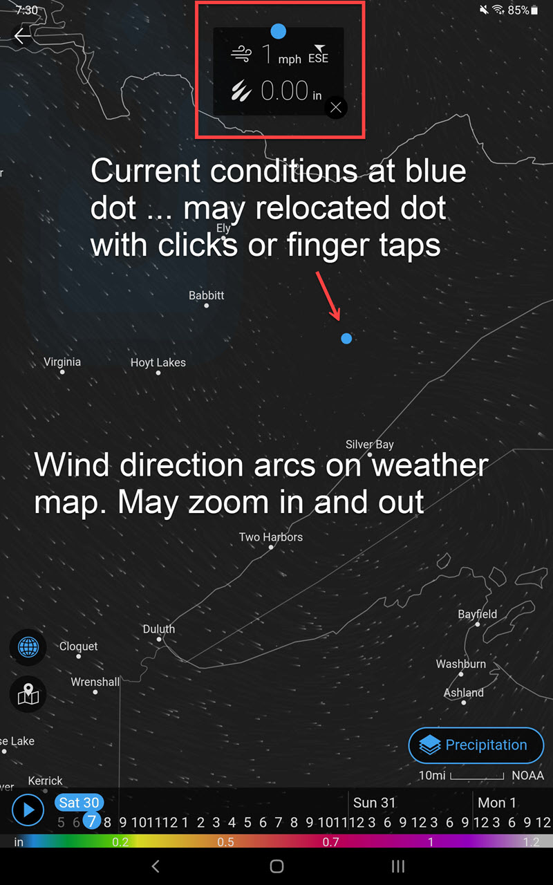
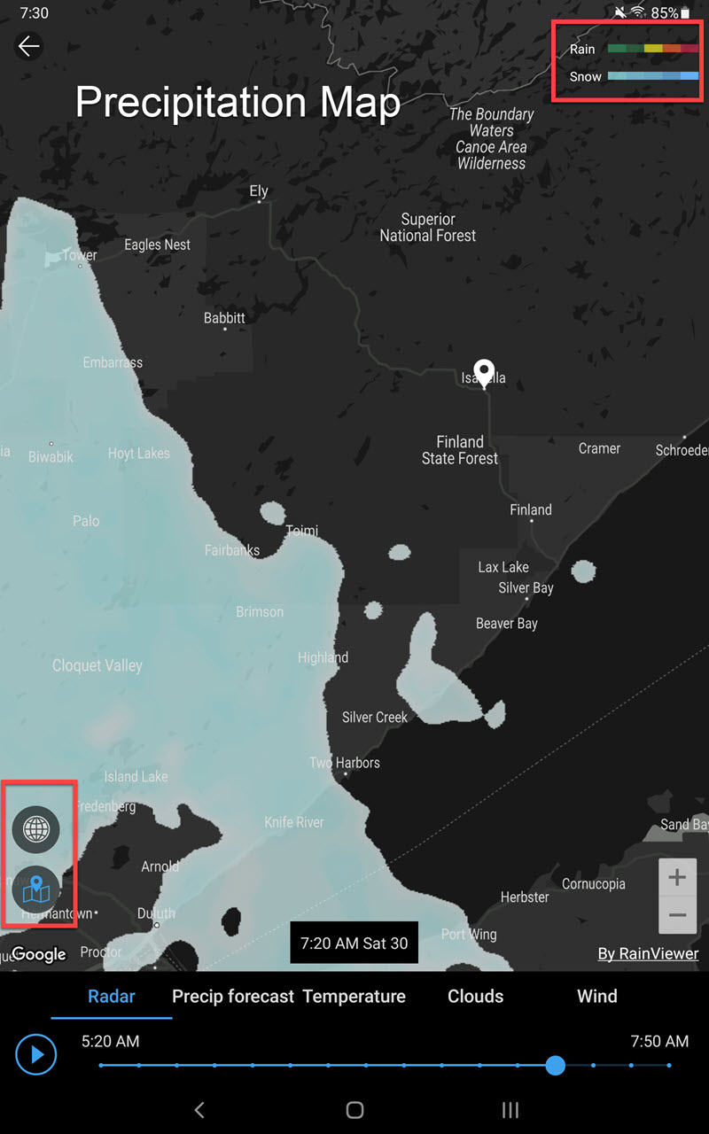
Weather Maps (what is happening right now … rain/ snow and wind are my primary interests)
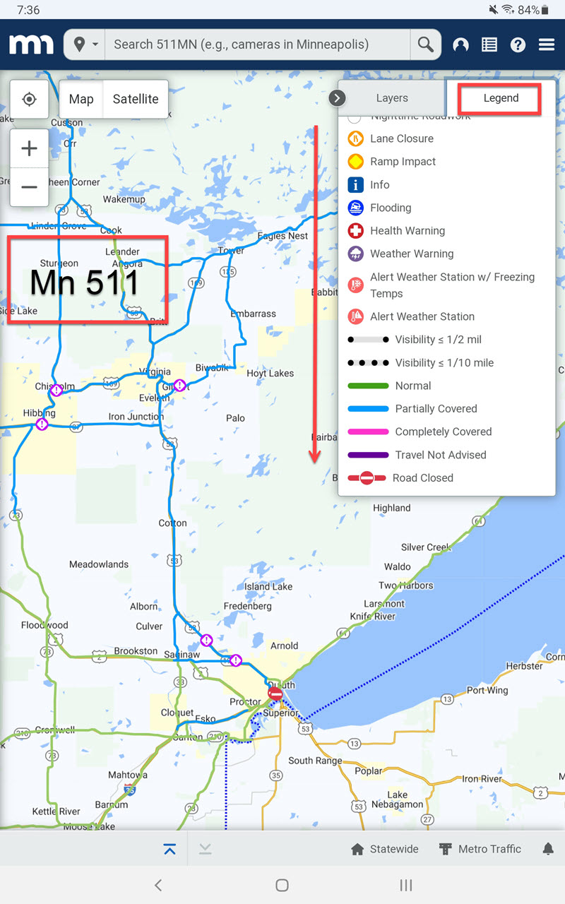
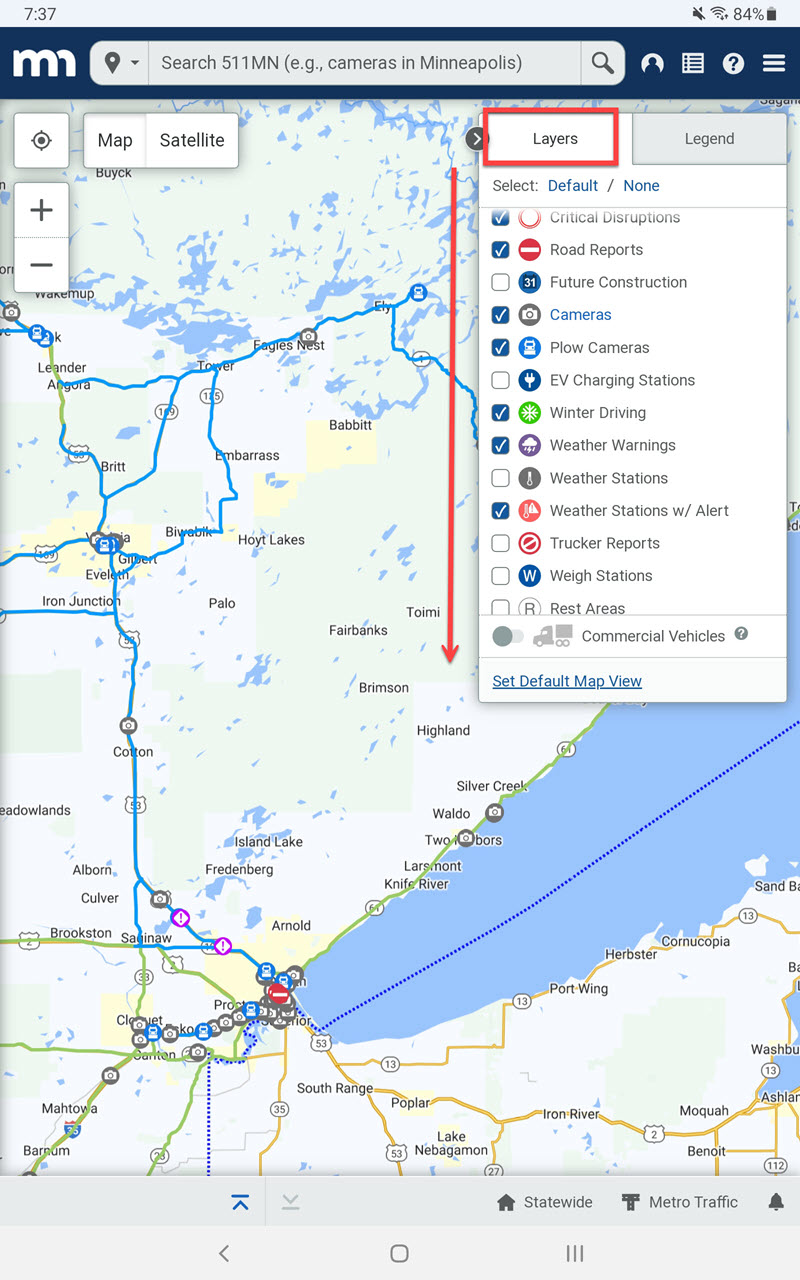
The weather data concerned me enough I then browsed to Mn511. This service of the State of Minnesota provides current road conditions. I can even look at pictures only minutes old from snow plow cameras (real cool). Most states have similar services.
Here are two screenshots taken earlier this morning when I decided to cancel my morning birding outing. In summation, use the weather apps / services. I doubt I would have seen anything, and already many car crashes were being reported.
Discover more from 365 Days of Birds
Subscribe to get the latest posts sent to your email.
Thank you! I love this app!!!