Wilderness Wayfarer: Google Maps Offline

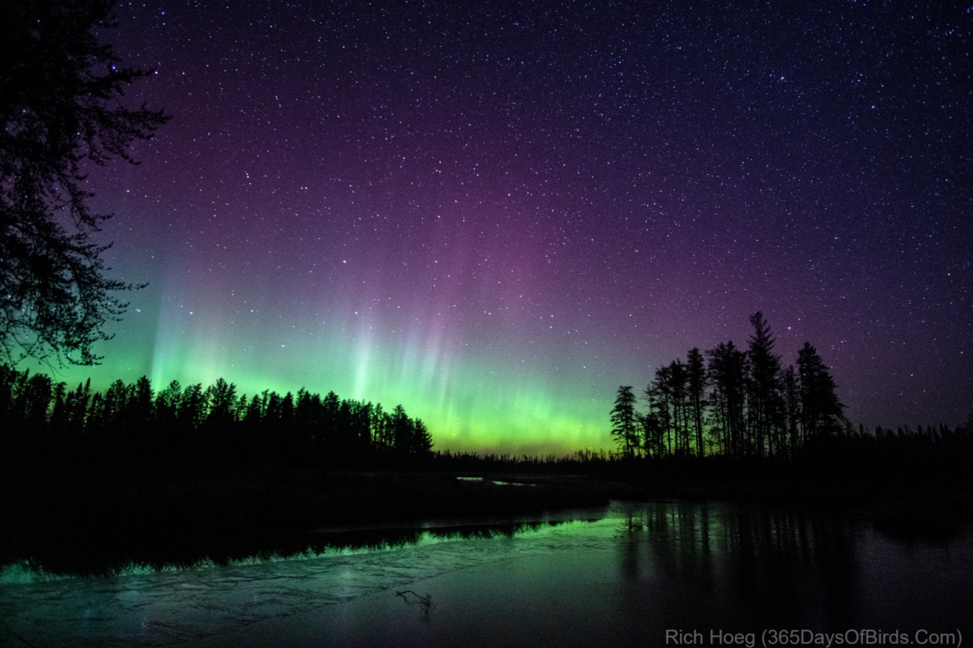
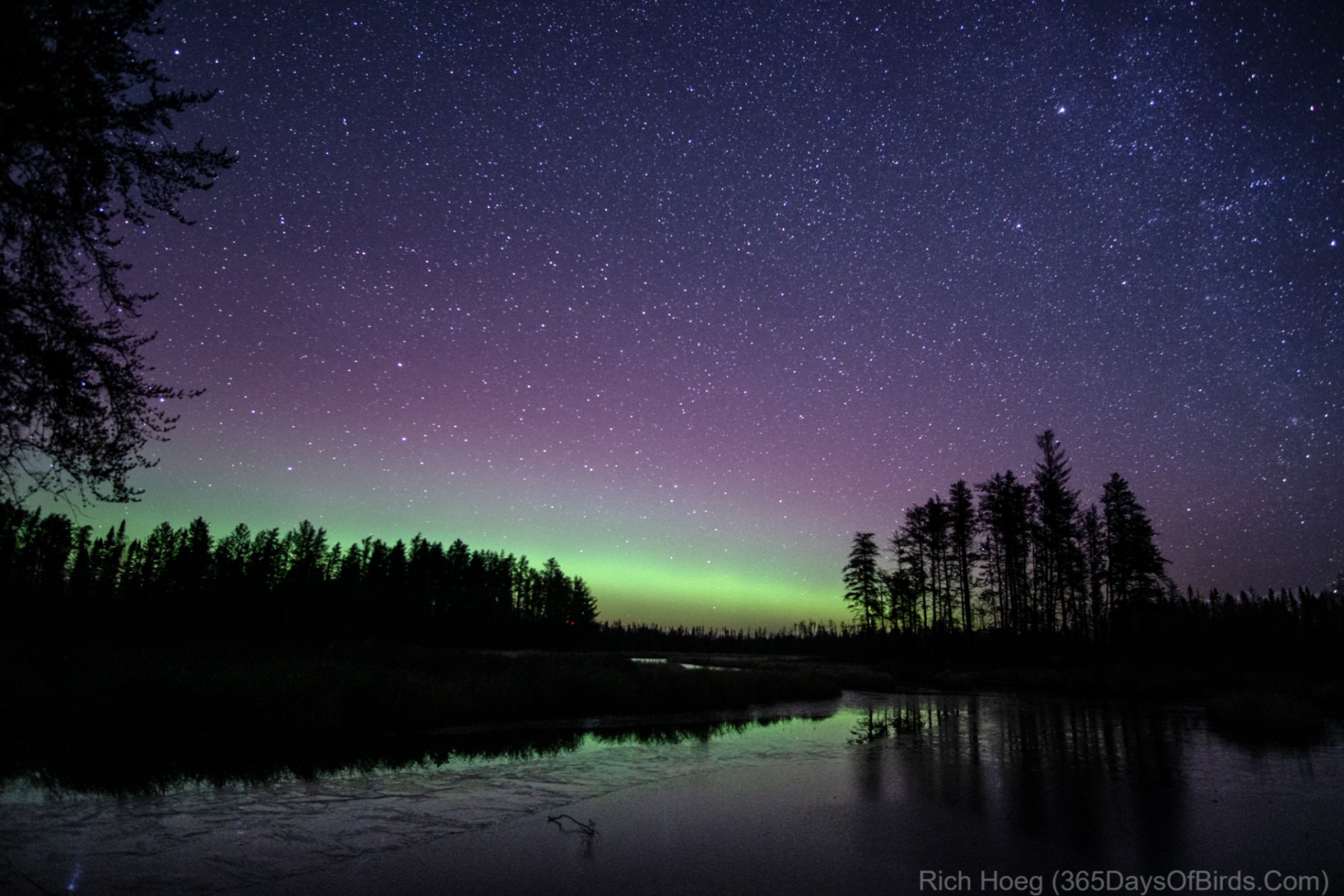
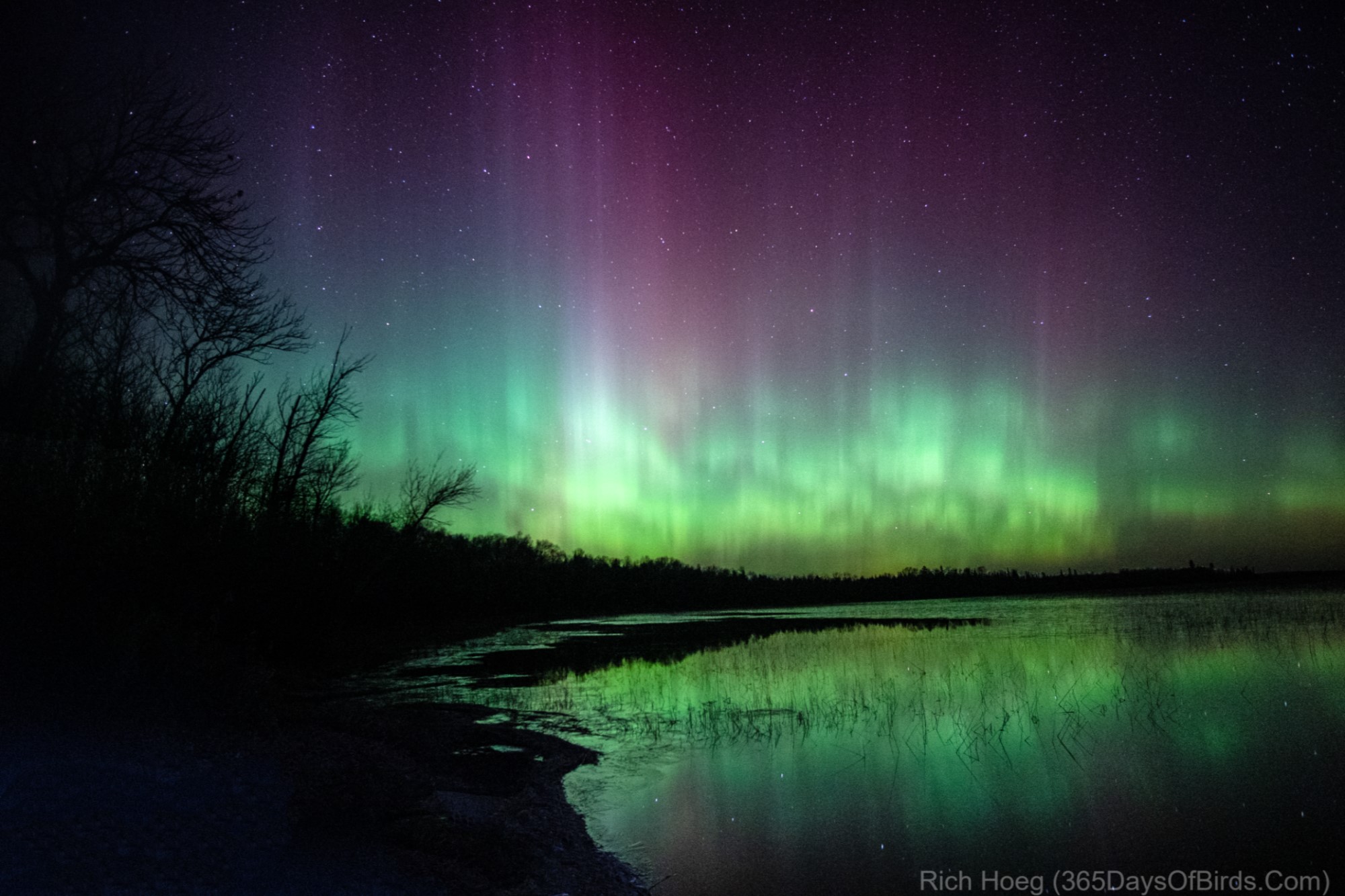
For the last few days I have been hanging out in Grand Marais and the Gunflint Trail region. This reminded me I have been wanting to blog about Google Maps offline usage. Even if you live in a large metropolitan area, Google Maps Offline will help you:

  • Connectivity is never perfect. Google Maps Offline insures your directions work even if you lose your connection.
  • Given your phones’ GPS chip works w/o connectivity, pre-downloaded maps means never getting lost
  • Having downloaded map regions via wifi, you save on your data contracts
  • In northeastern Minnesota next to the Canadian border, having a data connection is a pipe dream

Here are some screenshots from my phone while exploring the wilds on the Northland this weekend.

.1. Looking at Google Maps on my phone. Tap upon my icon to pull down the menu.


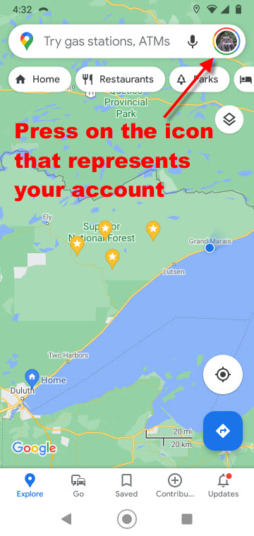
.2. This menu appears, and I want to select “offline maps”


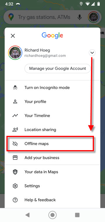
.3. I already have some maps downloaded, which Google updates when required. In addition, I may download and name an area specifically desired by me


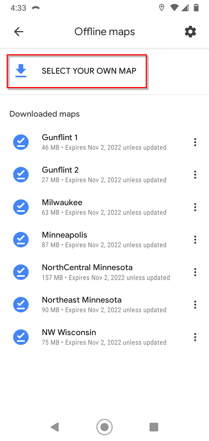
.4. Given I pressed “select you own map”


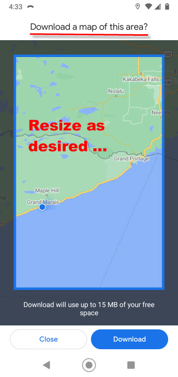
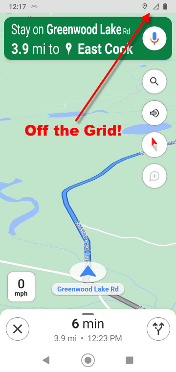
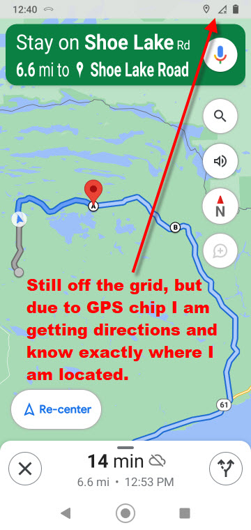
These two screenshots were taken while I was in navigation mode. I may zoom in and out as desired. Even without a connection, Google talks out loud and tells me when to make a turn.


Now for some photography …

I was hoping to find some moose. This is the time of the year when moose are in love, but alas, there was no voyeurism for me! Instead, I mainly saw Ruffed Grouse and Common Redpolls.  I am also including a few road signs and sunrise / sunset lighthouse pics from Grand Marais.

A Ruffed Grouse

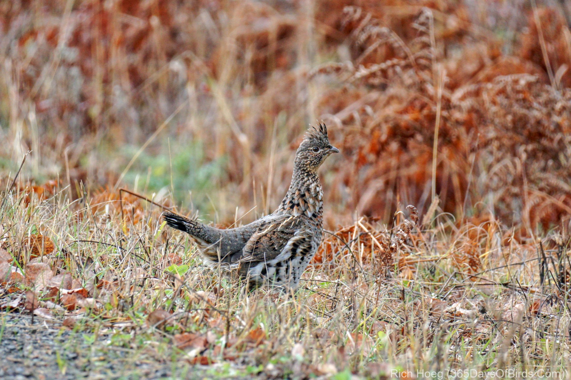
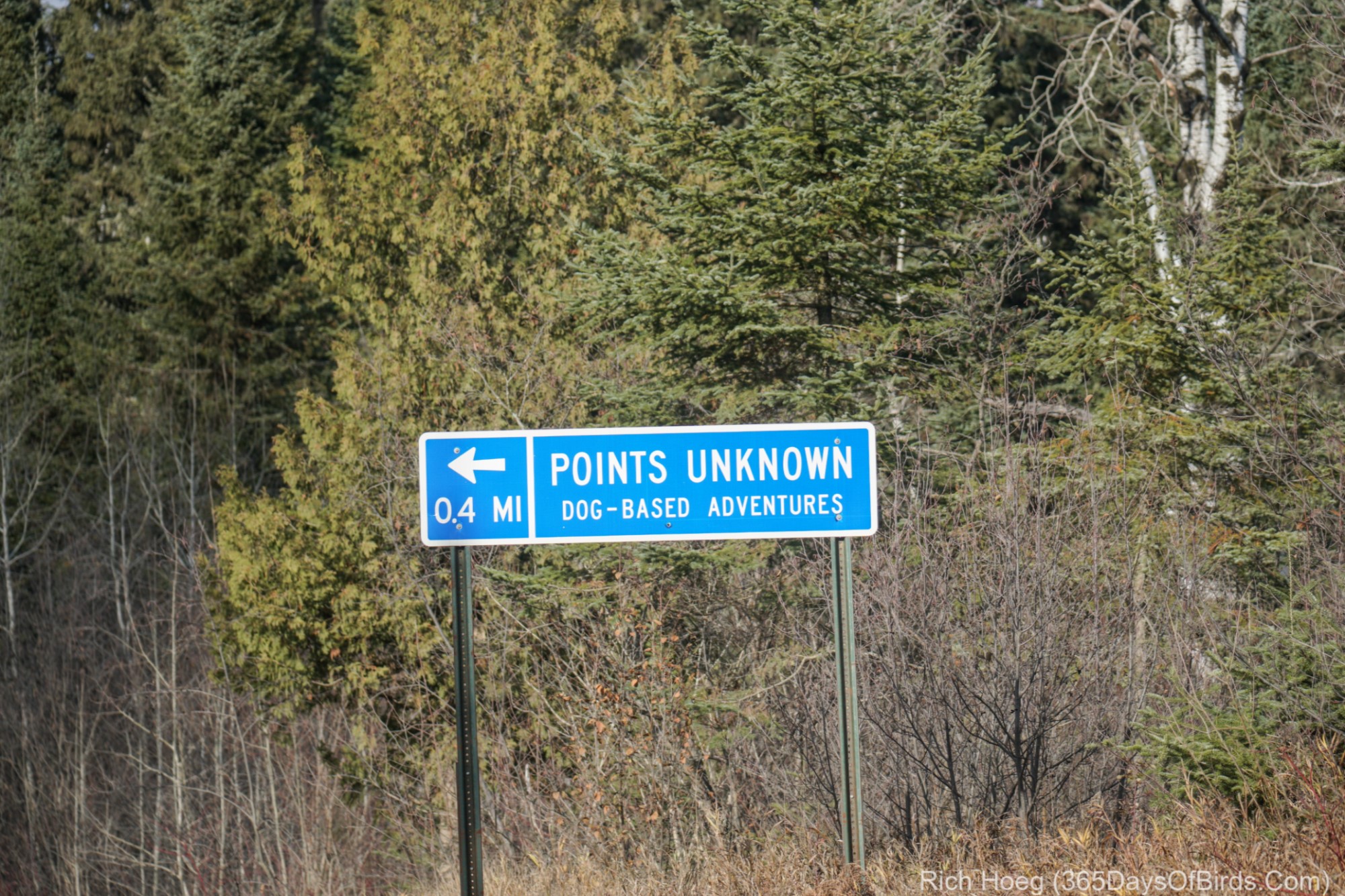
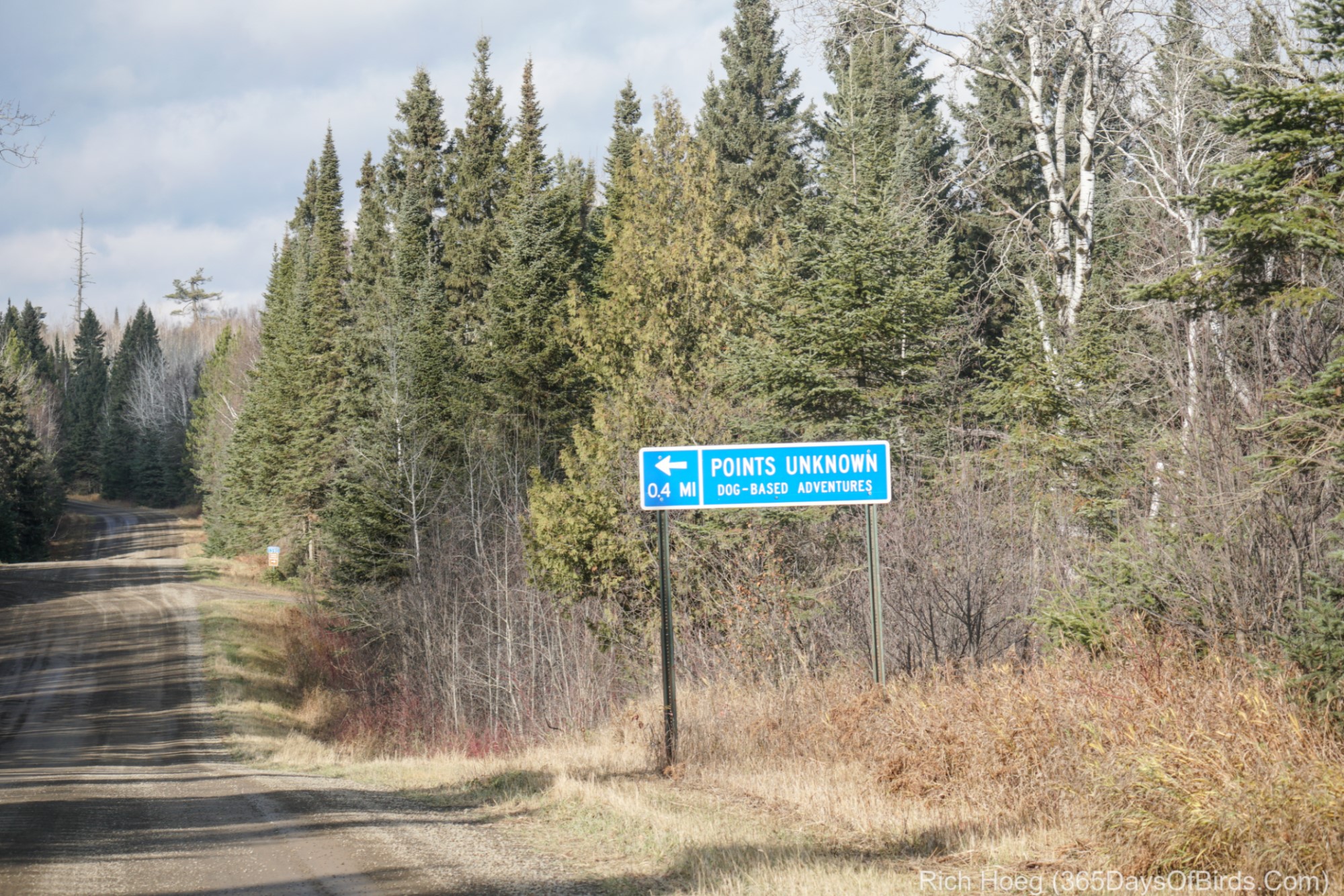
The ONLY road signs I saw other than United States Forest Service numerical road signs during almost three hours of exploring yesterday afternoon.

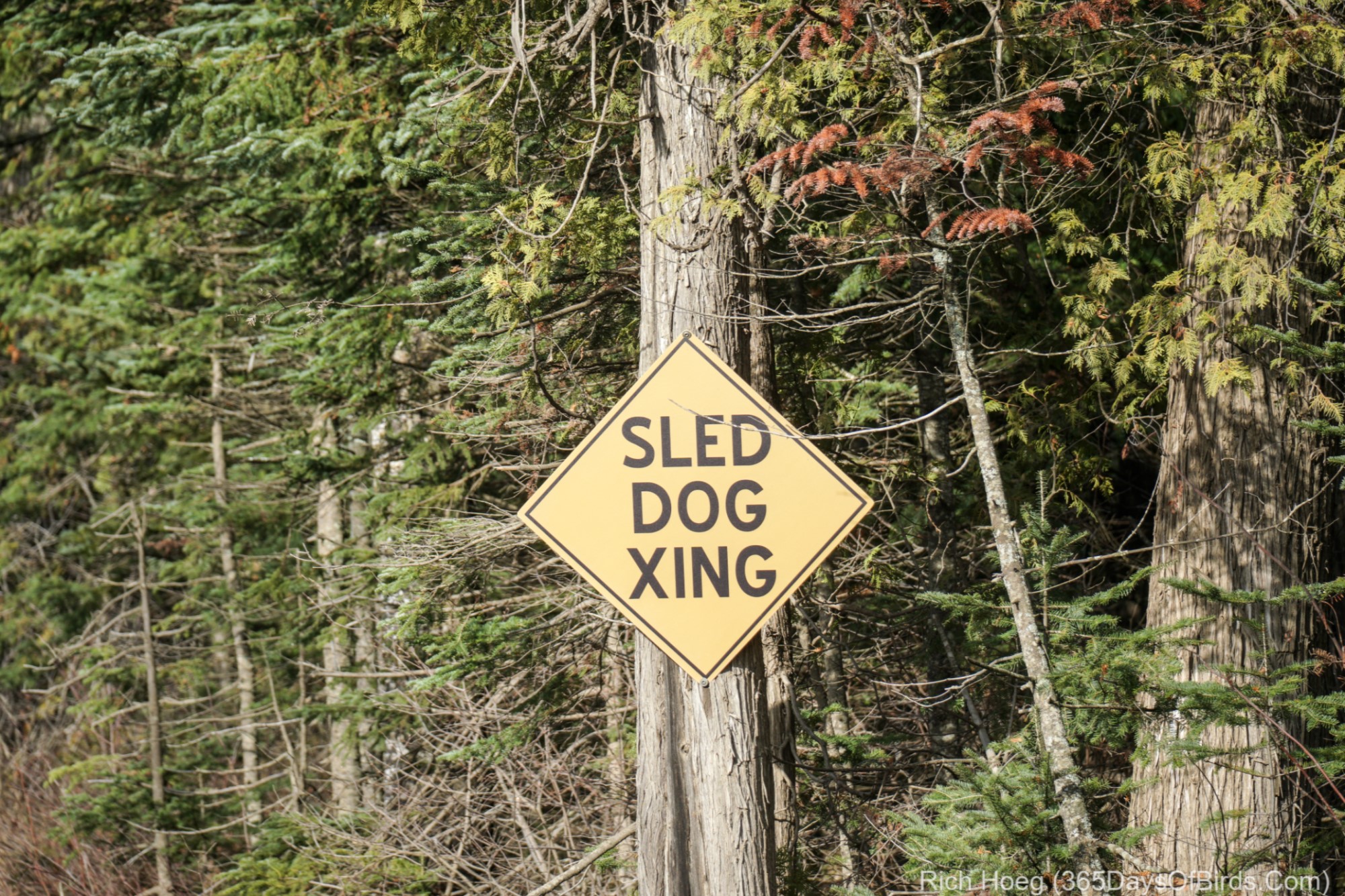
Sunset followed by Sunrise of the Grand Marais Lighthouse (last night and this morning)

Now Arriving on Track 9 from Hudson’s Bay and Points North!

What is unusual about this bird species? (not the individual, but the type of bird, a Rough-Legged Hawk) I watched this hawk hunt early yesterday morning just north of Duluth during its migration down from the Hudson Bay / Arctic region. Scroll down beneath this image for the answer to my question.


.
.
If I am not mistaken there are only three raptor species (other than owls) in North America that have feathers down right to their talons … Rough-Legged Hawks, Ferruginous Hawks, and Golden Eagles. These birds breed in locations where even in the summer, snow and extremely cold temperatures are not unheard occurrences. Thus, all three species have evolved to have feathers down to their talons to keep warm. The above image shows feathers very much reaching down to the talons.

If I am lucky this individual will stick around hunting near my house for approximately the next month. I have seen this bird two days in a row, and the habitat it has chosen is great for hunting small mammals. However, when the snow covers the ground the hawk will move south (most hawks are not able to hunt effectively through the snow).

Hanging Out and Take-Off

Forest Fire Burnout Aurora Borealis

Ever wonder what an Aurora looks like against a forest fire burned out background?! I wondered also and drove up to the Greenwood Forest Fire Burn Area last night (27,000 acres). This is actually the Sand River (45 miles north of Two Harbors). At this specific location as one looks up the river, lots of the smaller trees burned out, and some of the pines. Amazingly right next to burned out pines there will be sections of untouched trees. One other interesting fact on the night of November 3rd, the backwaters of the river were iced over and there was about one inch of snow on the ground (temperature was 19F).
Camera settings: ISO 3200, Aperture 2.2, Exposure 6 seconds (Sony a6300)
.
This second image is what the sky looked like as I waited and hoped Lady Aurora would come out and dance. Notice the Big Dipper waiting to get filled (it did). You may need to maximize these images to get the full effect.

This final photograph was taken about 11:15 pm at Greenwood Lake (40 miles north of Two Harbors … just out of the burn area). Although my drive between locations was only 8 minutes, I about had a cow when I pulled into the public access.
Sub-Storm! This is what I actually was seeing with my naked eye. The Aurora filled the sky up to the zenith.
Camera settings: ISO 3200; Aperture 2.2; Exposure 4 seconds (Sony a6300)