We all need lazy mornings! It has been pouring rain off and on since midnight. It is now 11:00 am. Most mornings I awake around 5 am, and am gone within 30 minutes on a birding expedition. However the present weather dictated I might as well hang out in PJ’s well into the morning. In short, it is an excellent time for satellite birding!
The logical question is … “what the heck is satellite birding”?! Simply put the “smart birder” explores back roads and habitat by Google Maps in Satellite Mode. While I am out birding by car, bike or foot I come across dead-end backroads without time to explore same. However, I often wonder what these roads are like. Is there good birding habitat? While neither Google nor eBird will not answer these questions, satellite birding can help answer your queries. Remote areas rarely get birded … let alone eBirded.
Enter logic and Google Satellite Mode and the probability of experiencing future good birding increases dramatically. Here is what I consider:
- Have I previously experienced decent birding in the area?
- Does Google Satellite show …
- Breaks in forest cover? Thick heavy forest tends not to support as much wildlife because of limited food opportunities. Forest with openings such as farms and meadows provides both cover and better food options.
- Is water present? Wetlands, creeks, streams and rivers combined with #1 make for even better food options. Birds and mammals prefer the best possible habitat in terms of food production with ease of access to water.
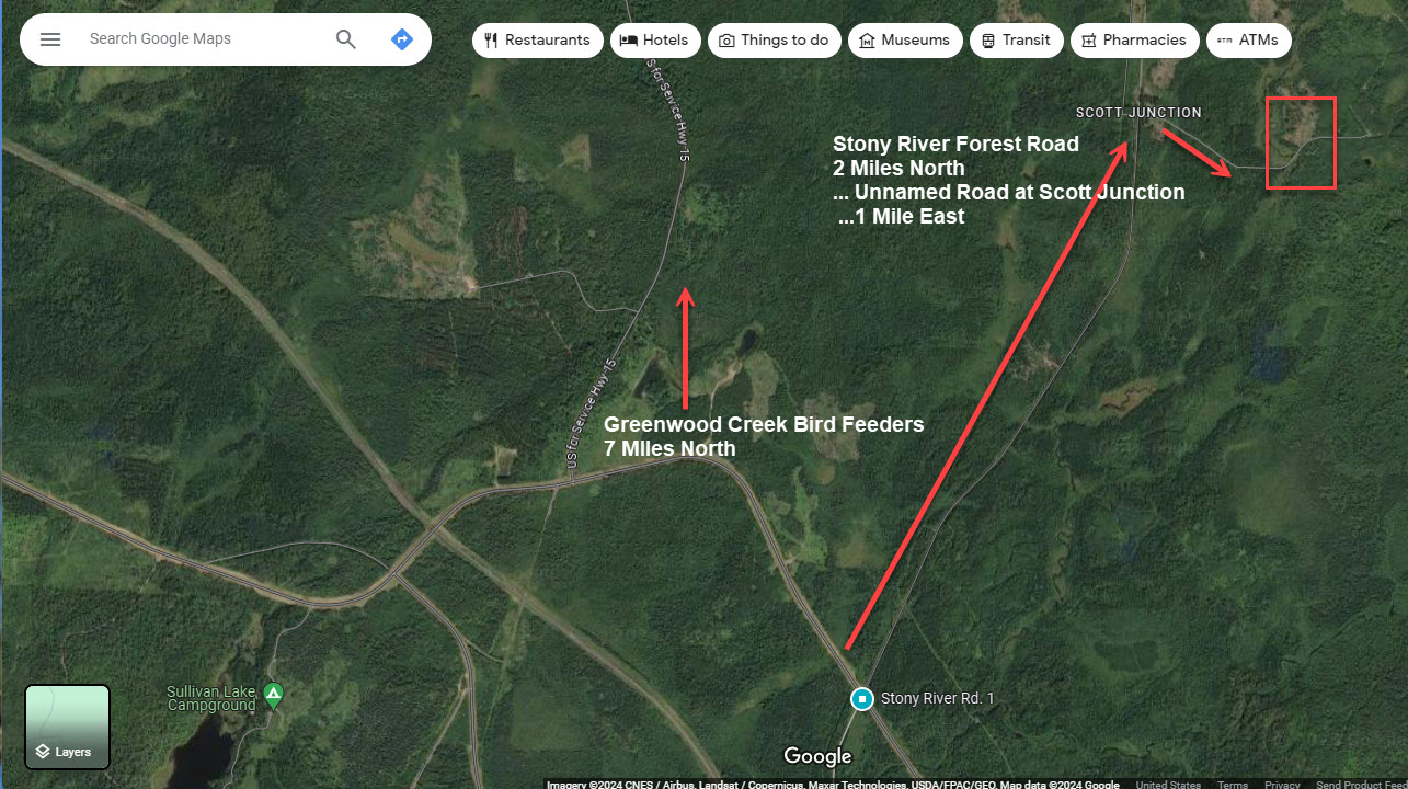
In mid April I wondered about an unnamed dirt road near where I was birding on Stony River Forest Road which has a nice Boreal Forest Bog. I had watched a Great Gray Owl female get fed by its mate over a number of days … a sure sign of nesting coming soon and nearby). Take a look at the map I provided immediately below. Inspection of Google in “satellite mode” convinced me to make the side trip. I did in fact discover one mile along the unnamed dirt road a large wetlands area and creek. This habitat was obvious when I zoomed in via Google Satellite Mode.
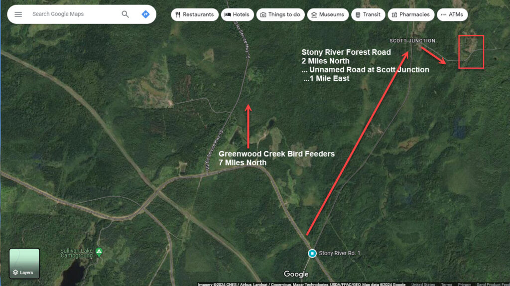
Now the bummer … Stony River Forest Road is closed because of a huge number of washouts. However, once the mosquito plague calms down a bit, I intend to take my gravel bike and ride! In just a few weeks it will be time for Great Gray Owlets to start exploring away from their nests. By bicycle I intend to be looking for the “gray ghosts of the forest”. Anyone else willing to invest some sweat equity, I will let you know that Great Gray Owls are likely nesting this year 2.6 and 4.9 miles north of Stony River Forest Road. My plan had been to hike the forest (bushwhack) looking for their nests, but the amount of water in the remote bogs combined with mosquitoes immediately stopped that plan this year.
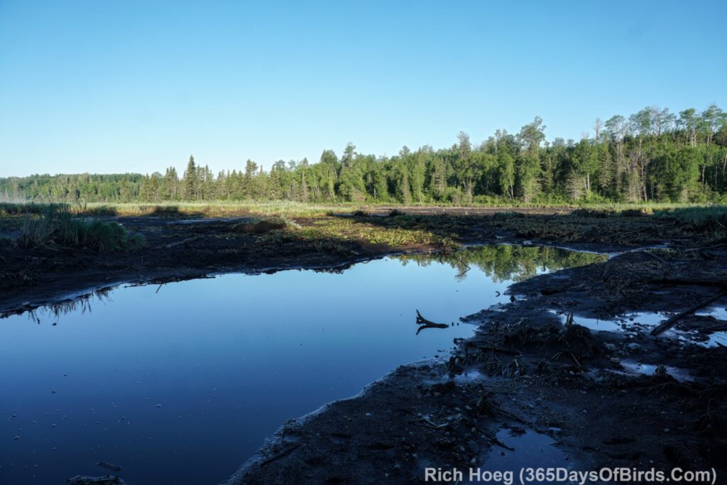
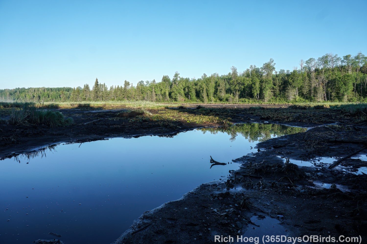
Last week we had a 7+ inch rainstorm in this region. Take another look at the map provided above. In the lower left hand corner of the map there is a lake named “Sullivan Lake”, or at least ten days ago there was a lake with this name. Apparently the lake was formed back around 1905 when an earthen logging dam was built. This structure blew out and thus the lake disappeared last week. I visited the boat launch … such that it is / was yesterday morning a bit after sunrise. The temperature was 38F at 6:20 am. Welcome to my world!
Just remember Google only “remaps” their service with new satellite imagery on an occasional basis, particularly in remote areas.
Sullivan Lake Boat Launch Blow Out (what remains of the lake is hundreds of yards distant … most of the land seen via this image was under 5 to 15 feet of water two weeks ago)