Welcome to the start of 365 Days of Birds 10th Anniversary Year! Unlike Year #1 when I did a 365 Day Photography Project about birds, for my anniversary year I will have a different themed hashtag for each month. Thus, anyone may participate with their photos, but any image should be taken during the month in question (learn more).
For January 2024 the hashtag is #365Birds01White
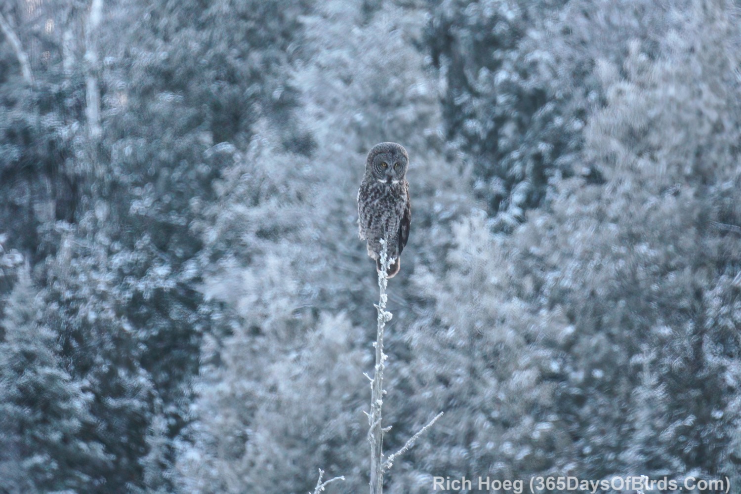
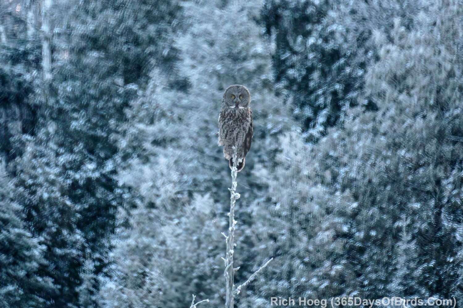
With the January theme in mind, I drove north to the Greenwood Forest Fire region starting an hour before sunrise. While there are no guarantees, nature was cooperative!
Great Gray Owl Hunting Just Before Sunrise (frosted white pine trees)
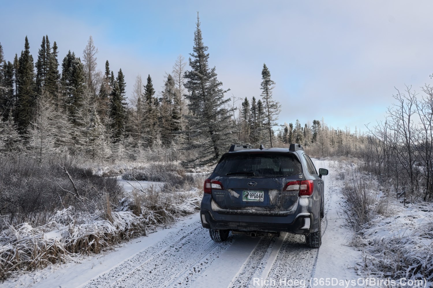
Whyte Road After Sunrise (white should be obvious!)
Unlike today (bad weather), yesterday was drop dead gorgeous … calm winds and crystal blue skies in the afternoon. I took advantage of the situation and drove up to the Greenwood Lake region. Roughly speaking, the abandoned RR tracks immediately south of Greenwood Lake divide the forest fire burn area from boreal bog which did not burn. I love going up to this area because I get to hang out in the burn area and find wildlife (difficult) that is reclaiming the burned out habitat (it is 2.25 years since the fire), and then drop just a few miles south into boreal bog country! Last year by the end of December over 50 inches of snow was on the ground. This year in an unheard of occurrence, we have zero snow giving me amazing access to the backcountry (I want snow).
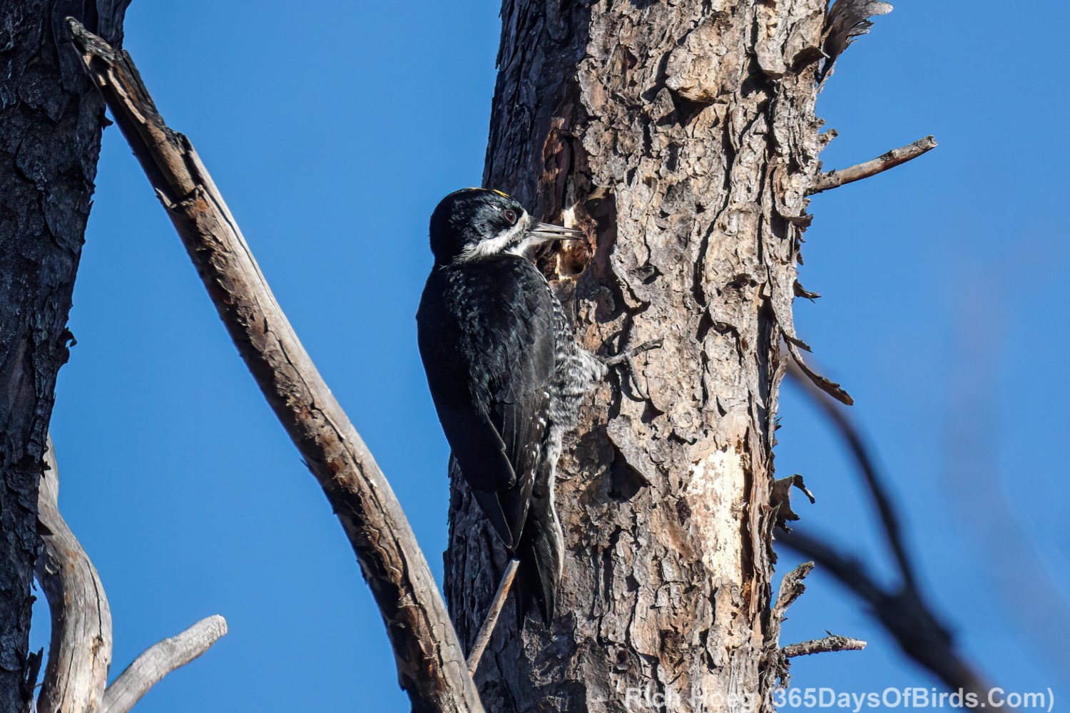
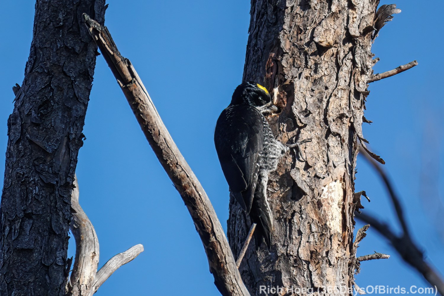
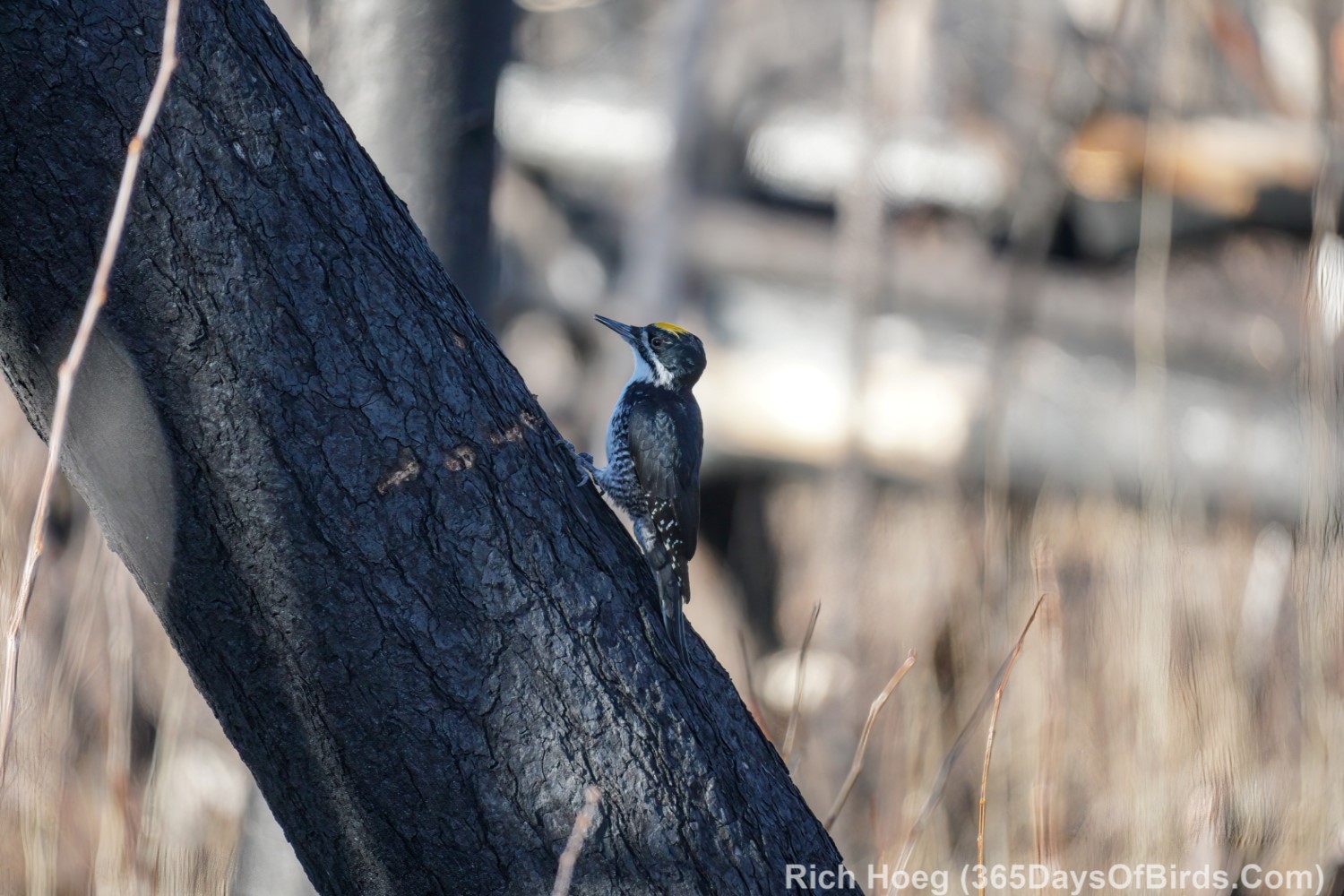
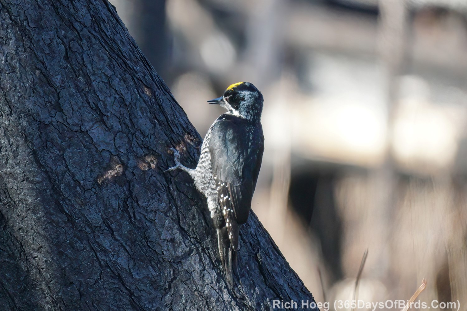
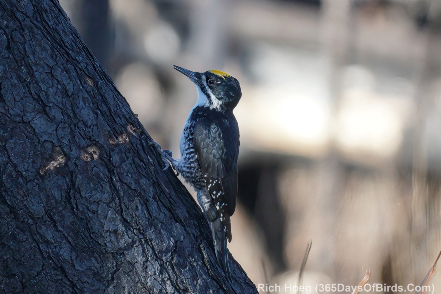
I was hoping to re-find the Northern Hawk Owl I found last Friday, but I was defeated in that effort. Instead the Black-Backed Woodpeckers (another bird species that loves recently burned habitat) were out in force.
Black-Backed Woodpeckers (listen for their tap, tap, tapping to find)
2 different woodpeckers that working opposite sides of Lake County Hwy #2. If you walk any distance off the road (which I do) be prepared to get ashes on your closes!
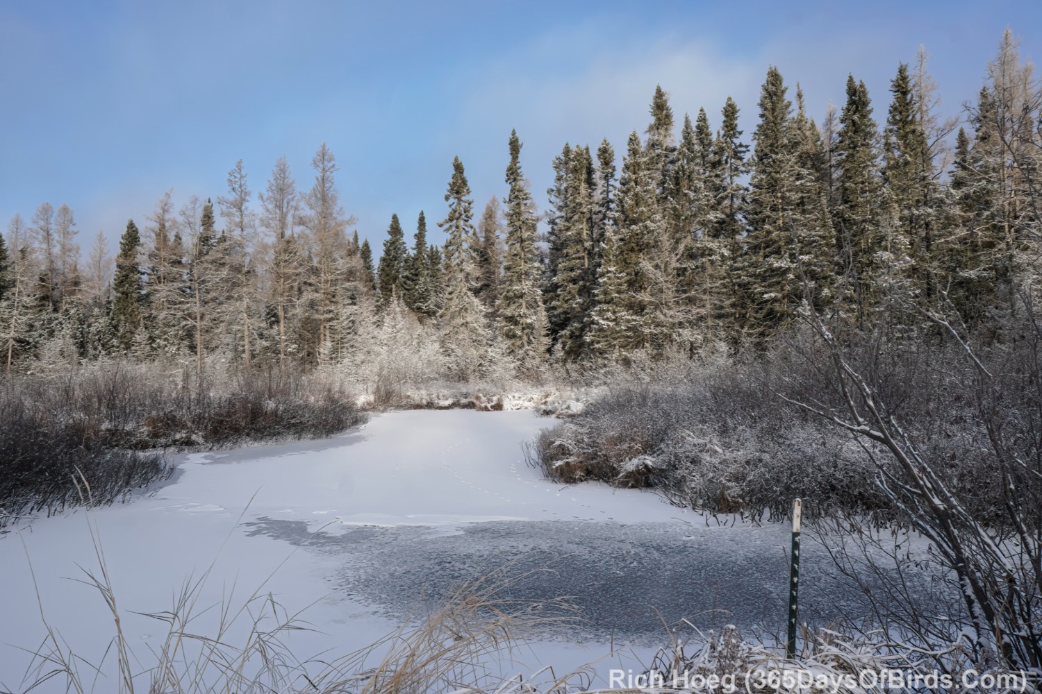
After some happy time with the Black-Backs I drove south to Greenwood Creek (GPS Location). As noted last year it would have been an almost impossible snowshoe into the Greenwood Creek Bog. This year it was a pleasant stroll along a dirt road / trail. If you want to take the same hike look for two small red flags a just south of Greenwood Creek near a highway bend. There actually is a parking area just off the highway. The roundtrip hike is two miles, and is very easy (sometimes very wet).
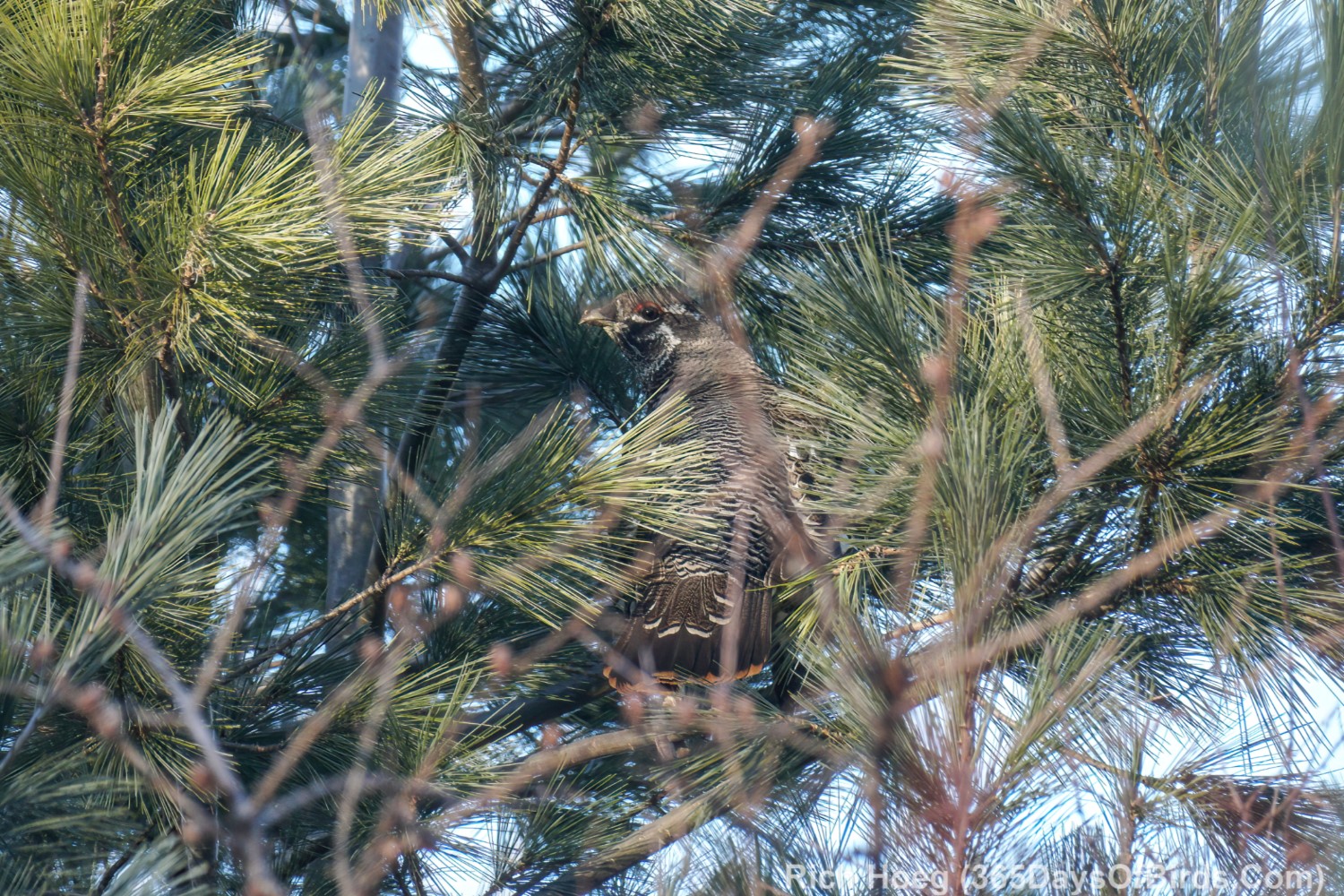
Here are a few images and a video of the bog from my hike
A Spruce Grouse in a Spruce!
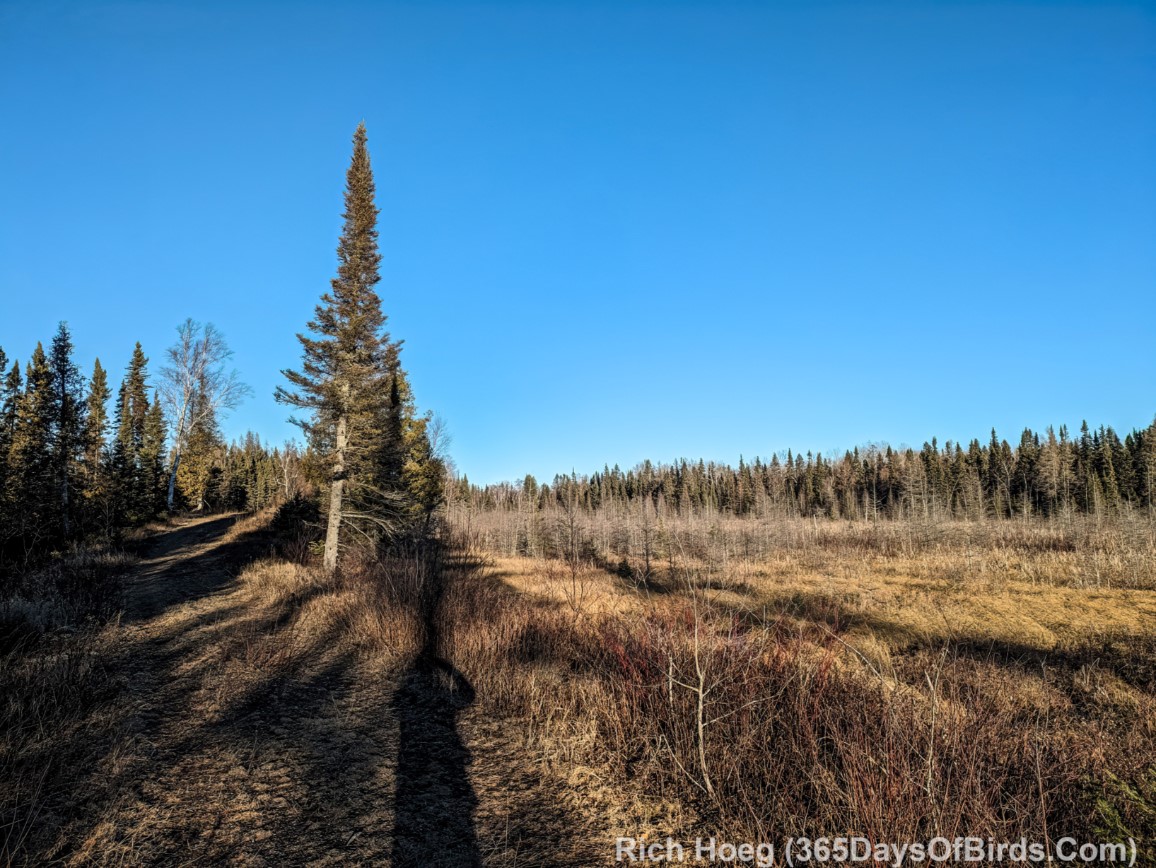
And some Greenwood Creek Bog images / videos from my mobile phone.
The Bog
Greenwood Creek Bog … The Movie! (video link for email subscribers)
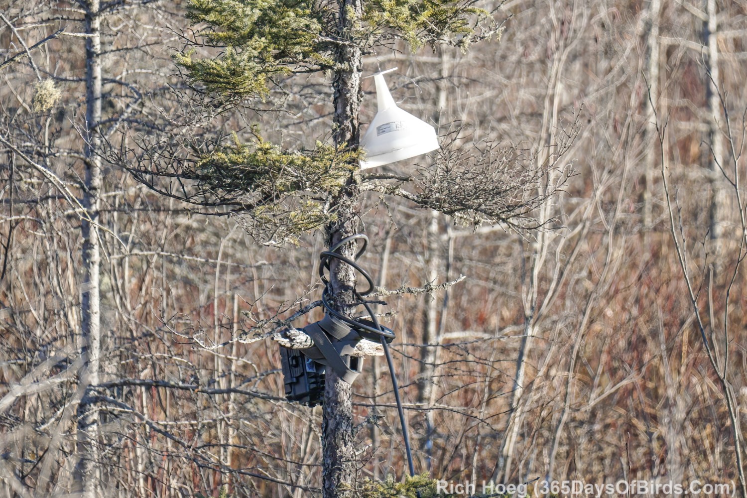
Someone else likes this Bog … a TrailCam setup
If you’ve stuck with me this long, here is a birding treat. Although I did not re-find the Northern Hawk Owl, my initial sighting was between 1.7 and 2.0 miles north of Sand River. The owl spent most of its time of the west side of Lake County #2. Good luck, and if you find the NHO, please let me know. Thank you.
This morning I had planned to return to the Greenwood Forest Fire Burn Area which is 40 miles north of Two Harbors. Before heading out on a birding outing, I always check the weather conditions, and sometimes the road reports. Optimal weather in the winter involves both safety, and understanding if I am likely to be successful. My check of the weather this morning put an end to my birding plans … icy roads and low visibility.
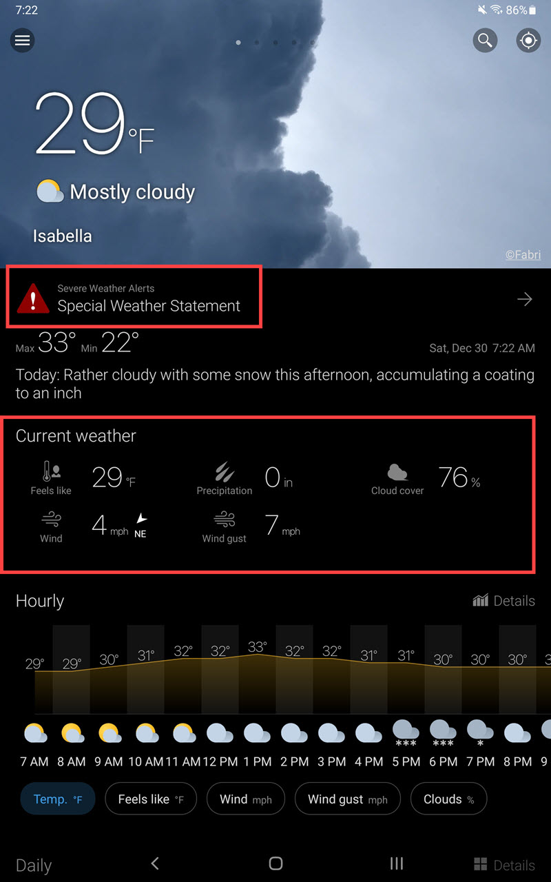
The number of weather apps available for either the Android or Apple platform is mind boggling. I will review the app I use, and indicate the aspects of the app I like and why. Obviously other apps may have similar features … the key is does your app provided you with the necessary data. My app is WeaWow (Google Play | Apple App Store). The basic app is free and has no advertisements, but for a small $2 donation you may unlock additional sources used for weather data input.
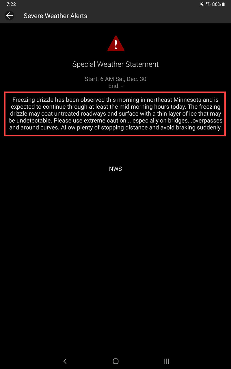
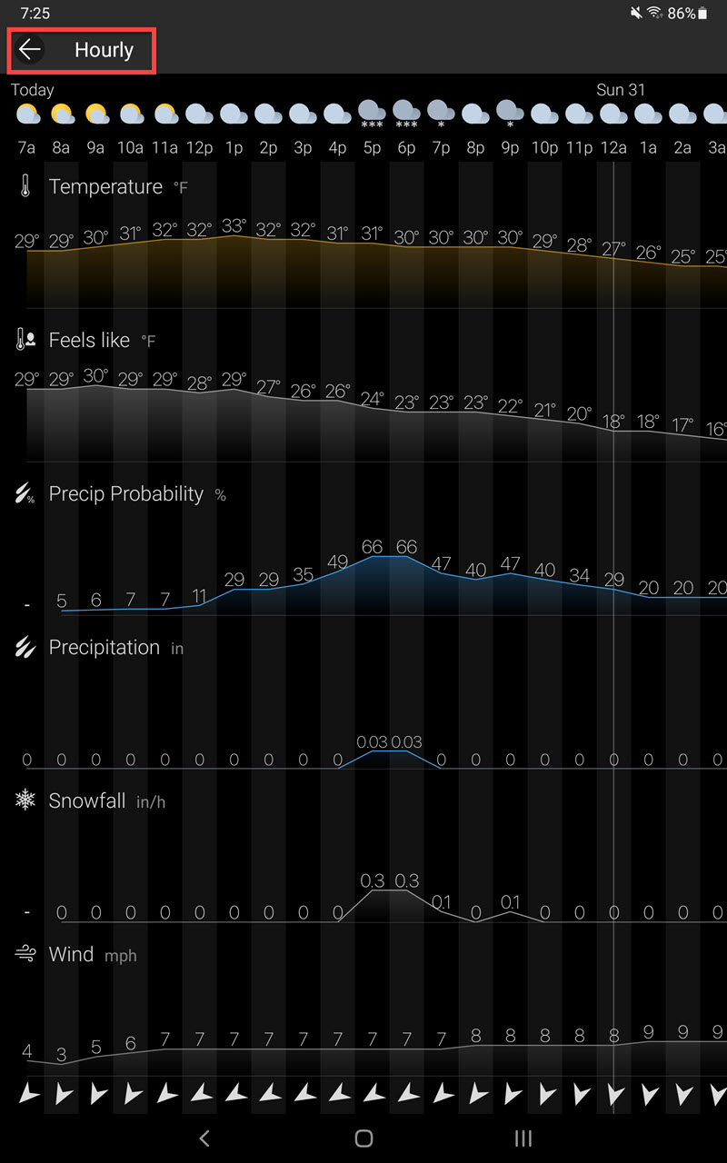
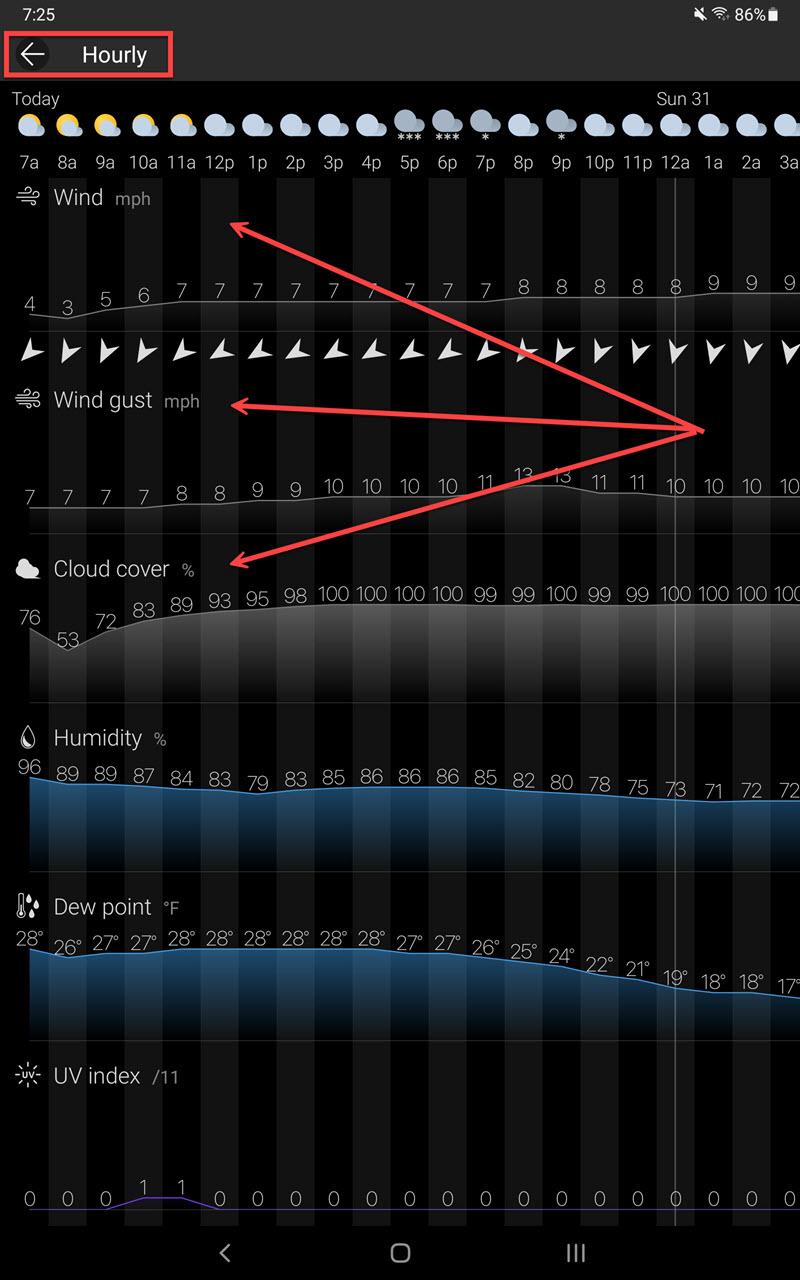
Click / Press Upon any Image to View at Full Size!
The StartUp Screen & Overview
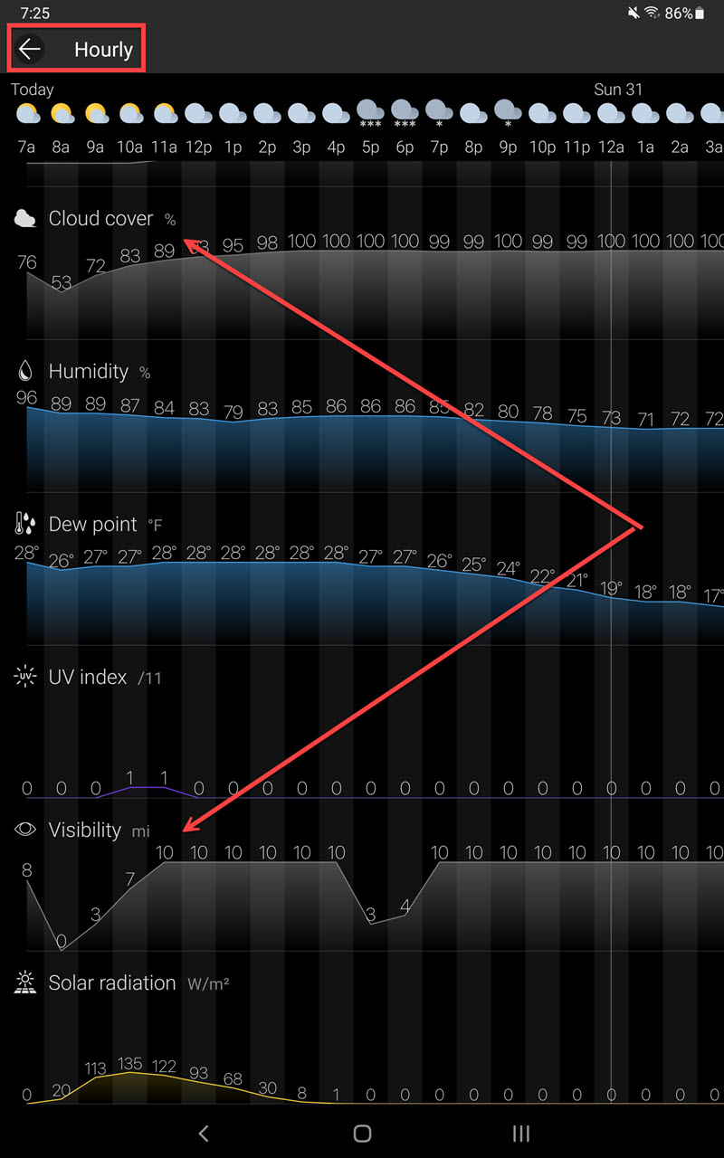
The Weather Warning from the US Weather Service (based upon this warning I did more research. Not too surprisingly I am very interested in wind speed / direction, cloud cover, and visibility)
Hour by Hour Forecasted Details (my arrows point to information in which I have most interest)
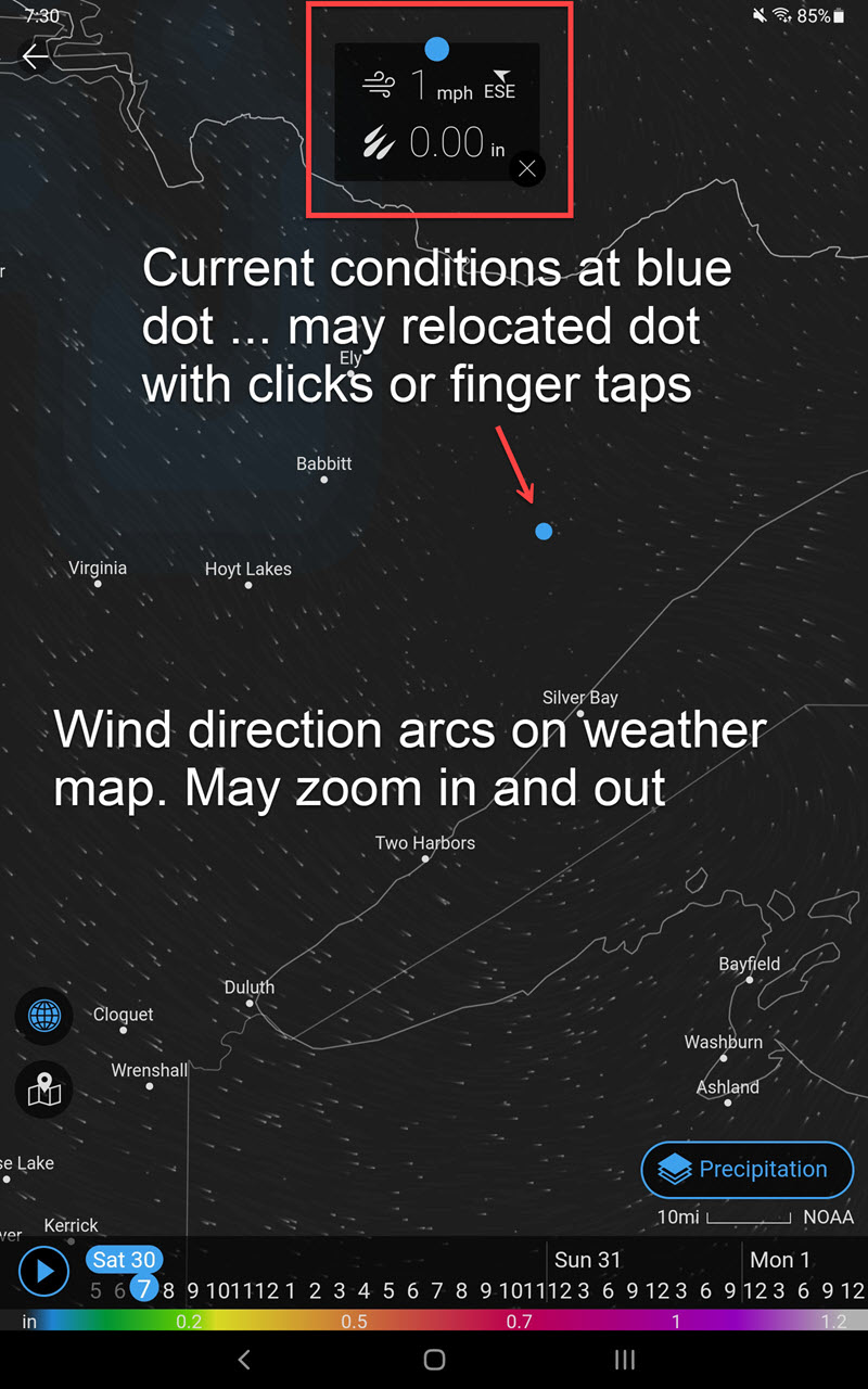
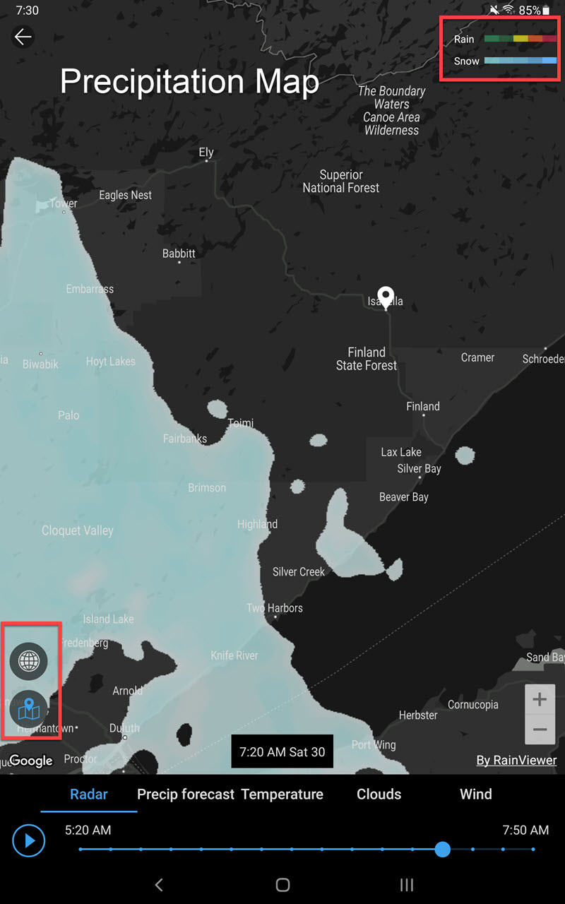
Weather Maps (what is happening right now … rain/ snow and wind are my primary interests)
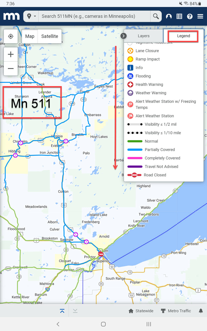
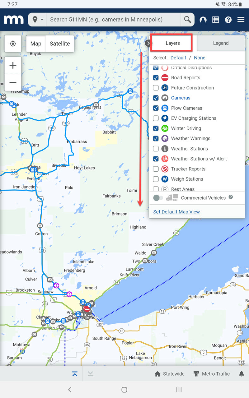
The weather data concerned me enough I then browsed to Mn511. This service of the State of Minnesota provides current road conditions. I can even look at pictures only minutes old from snow plow cameras (real cool). Most states have similar services.
Here are two screenshots taken earlier this morning when I decided to cancel my morning birding outing. In summation, use the weather apps / services. I doubt I would have seen anything, and already many car crashes were being reported.